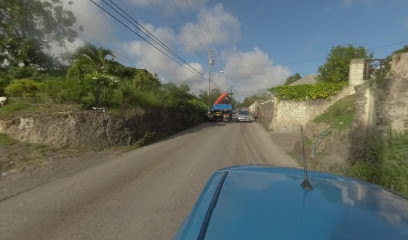
| Memorials | : | 0 |
| Location | : | Barbados |
| Coordinate | : | 13.1045160, -59.5790290 |
| Description | : | Saint Matthew's Church dates back to 1829 when Mr James Rogers donated three-quarters of an acre of land from Friendship Plantation, St Michael. On November 21, 1829 the cornerstone was laid by Governor Sir James Lyon, assisted by Bishop William Hart Coleridge. It was consecrated on March 18, 1830. The Church was totally destroyed by the hurricane of 1831 and rebuilt in 1832 with local funds and a subsidy from the Bishop. In 1841, Mr James Rogers donated another half acre of land to extend the burial ground. The ceiling of the Church is a masterpiece of art made... Read More |
frequently asked questions (FAQ):
-
Where is Saint Matthews Anglican Church Cemetery?
Saint Matthews Anglican Church Cemetery is located at Hothersal Turning Saint Michael ,Barbados.
-
Saint Matthews Anglican Church Cemetery cemetery's updated grave count on graveviews.com?
0 memorials
-
Where are the coordinates of the Saint Matthews Anglican Church Cemetery?
Latitude: 13.1045160
Longitude: -59.5790290
Nearby Cemetories:
1. Saint George Parish Church Cemetery
Barbados
Coordinate: 13.1311300, -59.5639400
2. Saint David's Churchyard
Barbados
Coordinate: 13.1311300, -59.5639400
3. Saint Mathias Church Memorial Garden
Barbados
Coordinate: 13.0761570, -59.5994940
4. Saint Leonards Anglican Church Cemetery
Barbados
Coordinate: 13.1059010, -59.6191760
5. Garrison Military Cemetery
Barbados
Coordinate: 13.0791530, -59.6098530
6. Coral Ridge Memorial Gardens
Barbados
Coordinate: 13.0973640, -59.5254600
7. Christ Church Parish Church
Barbados
Coordinate: 13.0651820, -59.5381840
8. Holy Innocents Church Graveyard
Barbados
Coordinate: 13.1826710, -59.5811000
9. Saint Thomas Parish Church Cemetery
Barbados
Coordinate: 13.1858900, -59.6129200
10. Saint Philip Parish Church Cemetery
Barbados
Coordinate: 13.1366770, -59.4887670
11. Saint James Parish Church and Cemetery
Barbados
Coordinate: 13.1908600, -59.6381500
12. Saint Joseph Parish Church Cemetery
Barbados
Coordinate: 13.2010490, -59.5393320
13. Newcastle Plantation Estate
Barbados
Coordinate: 13.1938400, -59.5001400
14. Saint Johns Parish Church Cemetery
Barbados
Coordinate: 13.1840296, -59.4721794
15. Mangrove Plantation Estate Cemetery
Barbados
Coordinate: 13.2349700, -59.6172900
16. Saint Andrew Parish Church Cemetery
Barbados
Coordinate: 13.2526700, -59.5678600
17. All Saints Chapel Burial Ground
Barbados
Coordinate: 13.2696800, -59.6125200
18. Saint Philip-the-Less Churchyard
Barbados
Coordinate: 13.2842700, -59.5821100
19. Saint Lucy Parish Church Cemetery
Barbados
Coordinate: 13.2919100, -59.6235800
20. Choc Bay War Cemetery
Saint Lucia
Coordinate: 14.0225200, -60.9861370
21. Castries City Cemetery
Saint Lucia
Coordinate: 14.0224370, -60.9869960
22. San Chez Cemetery
Grenada
Coordinate: 12.5247260, -61.3865720
23. Tibeau Cemetery
Grenada
Coordinate: 12.4973638, -61.4237995
24. Grand Bay Cemetery
Grenada
Coordinate: 12.4714613, -61.4349142

