
| Memorials | : | 117 |
| Location | : | Ray, Williams County, USA |
| Coordinate | : | 48.3431015, -103.1905975 |
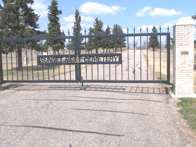
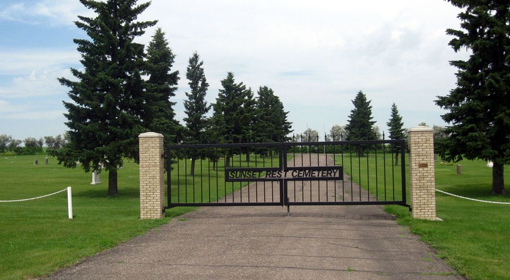
| Description | : | Township 156 - Range 97 - Section 8 of Equality Township Located on 5 acres of land purchased from N.P. Nelson with first burial in 1919. Today the cemetery is well maintained by board members, is fenced in and has a large wrought iron gate at its entrance. Trees were planted and more land was acquired in 1972 from Iver Solberg and Daniel Delaney. |
frequently asked questions (FAQ):
-
Where is Sunset Rest Cemetery?
Sunset Rest Cemetery is located at Ray, Williams County ,North Dakota ,USA.
-
Sunset Rest Cemetery cemetery's updated grave count on graveviews.com?
117 memorials
-
Where are the coordinates of the Sunset Rest Cemetery?
Latitude: 48.3431015
Longitude: -103.1905975
Nearby Cemetories:
1. Soine Family Cemetery
Ray, Williams County, USA
Coordinate: 48.3349990, -103.1952670
2. Saint Michaels Cemetery
Ray, Williams County, USA
Coordinate: 48.3483009, -103.1781006
3. Dunkard Church Cemetery
Wheelock, Williams County, USA
Coordinate: 48.3431620, -103.2371250
4. Hilltop Cemetery
Wheelock, Williams County, USA
Coordinate: 48.2915560, -103.1414530
5. Wheelock Cemetery
Wheelock, Williams County, USA
Coordinate: 48.2874985, -103.2596970
6. Emmanual Lutheran German Cemetery
Ray, Williams County, USA
Coordinate: 48.3278008, -103.0580978
7. Temple Cemetery
Temple, Williams County, USA
Coordinate: 48.3871994, -103.0475006
8. Saint Mary Catholic Cemetery
Epping, Williams County, USA
Coordinate: 48.2671380, -103.3453700
9. Epping Cemetery
Epping, Williams County, USA
Coordinate: 48.2602997, -103.3550034
10. Rainbow Valley Lutheran Cemetery
Wildrose, Williams County, USA
Coordinate: 48.4802361, -103.2330551
11. Bethany Valley Cemetery
Epping, Williams County, USA
Coordinate: 48.4056015, -103.3842010
12. Trinity Lutheran Cemetery
Tioga, Williams County, USA
Coordinate: 48.2980800, -102.9476700
13. Minton Cemetery
Williams County, USA
Coordinate: 48.3867760, -102.9412060
14. Zion Lutheran Cemetery
Tioga, Williams County, USA
Coordinate: 48.3911018, -102.9411011
15. Betaini Lutheran Cemetery
Tioga, Williams County, USA
Coordinate: 48.2691994, -102.9558029
16. United Cemetery
Tioga, Williams County, USA
Coordinate: 48.3885994, -102.9396973
17. Eastside Cemetery
Tioga, Williams County, USA
Coordinate: 48.3939018, -102.9235992
18. Saint Paul Lutheran Cemetery
Wildrose, Williams County, USA
Coordinate: 48.5321999, -103.1857986
19. Bakken Cemetery
Tioga, Williams County, USA
Coordinate: 48.4160995, -102.9216995
20. Saint Olaf Cemetery
Temple, Williams County, USA
Coordinate: 48.5069008, -103.0160980
21. Beaver Creek Cemetery
Tioga, Williams County, USA
Coordinate: 48.1751900, -103.0217650
22. Springbrook Cemetery #2
Spring Brook, Williams County, USA
Coordinate: 48.2556839, -103.4734116
23. Barstad Cemetery
Tioga, Williams County, USA
Coordinate: 48.1746560, -102.9990800
24. Stordahl Cemetery
Hamlet, Williams County, USA
Coordinate: 48.5614014, -103.1231003