
| Memorials | : | 205 |
| Location | : | Boone County, USA |
| Coordinate | : | 38.8500595, -84.6287766 |
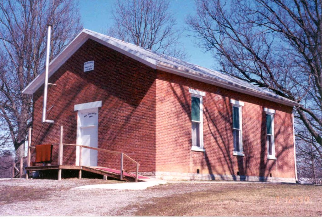
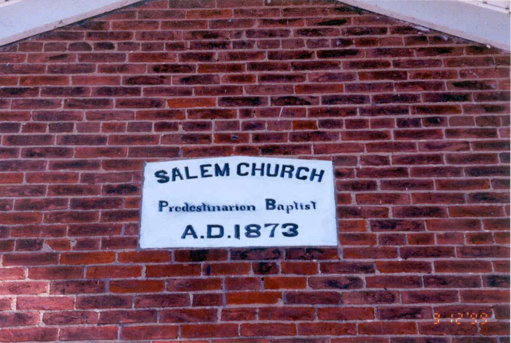
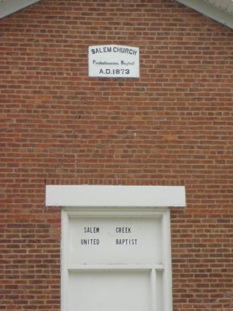
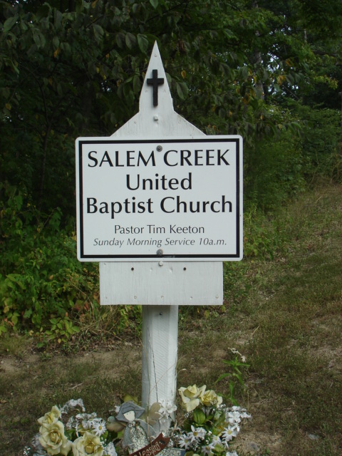
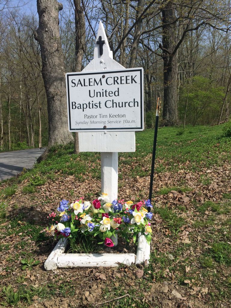
| Description | : | The cemetery is located on the east side of Oak Creek Drive about 750 feet north of its junction with Walton-Verona Road (Kentucky State Highway 14). The U.S. Geological Survey (USGS) Geographic Names Information System (GNIS) feature ID for the cemetery is 2569290 (Salem Church Cemetery). The Boone County GIS unique ID assigned to this cemetery is 121 (Old Salem Baptist Cemetery). The cemetery has an index number of 122 (Old Salem Baptist) on the Boone County Kentucky Cemetery Map published in 2005 by the Boone County Planning Commission in conjunction with Johnson-Wilson Cemetery Stewards Association. The cemetery is identified as Old... Read More |
frequently asked questions (FAQ):
-
Where is Salem Predestinarian Baptist Church Cemetery?
Salem Predestinarian Baptist Church Cemetery is located at 13320 Oak Creek Road Boone County ,Kentucky , 41092USA.
-
Salem Predestinarian Baptist Church Cemetery cemetery's updated grave count on graveviews.com?
1 memorials
-
Where are the coordinates of the Salem Predestinarian Baptist Church Cemetery?
Latitude: 38.8500595
Longitude: -84.6287766
Nearby Cemetories:
1. Roberts Family Cemetery
Walton, Boone County, USA
Coordinate: 38.8531970, -84.6457220
2. Finnell-Burton-Roberts Cemetery
Walton, Boone County, USA
Coordinate: 38.8665940, -84.6216130
3. Johnson-Noell Family Cemetery
Walton, Boone County, USA
Coordinate: 38.8611180, -84.6497140
4. Ross Cemetery
Walton, Boone County, USA
Coordinate: 38.8697230, -84.6033330
5. Powers Cemetery
Kenton County, USA
Coordinate: 38.8232994, -84.6082993
6. Webster Cemetery
Piner, Kenton County, USA
Coordinate: 38.8388890, -84.5877780
7. Senour Family Burying Ground
Walton, Boone County, USA
Coordinate: 38.8844770, -84.6396230
8. Byland Cemetery
Kenton County, USA
Coordinate: 38.8577995, -84.5824966
9. Hudson Cemetery
Walton, Boone County, USA
Coordinate: 38.8872220, -84.6375000
10. Allphin Cemetery
Kenton County, USA
Coordinate: 38.8117570, -84.6107770
11. Hughes Cemetery
Walton, Boone County, USA
Coordinate: 38.8897220, -84.6438890
12. Robinson Cemetery
Walton, Boone County, USA
Coordinate: 38.8888890, -84.6100000
13. Rebecca Stone Cemetery
Verona, Boone County, USA
Coordinate: 38.8558330, -84.6816670
14. New Bethel Cemetery
Verona, Boone County, USA
Coordinate: 38.8129300, -84.6542700
15. Saint Patricks Cemetery
Verona, Boone County, USA
Coordinate: 38.8252983, -84.6733017
16. Jones Cemetery
Piner, Kenton County, USA
Coordinate: 38.8400000, -84.5752780
17. Current Cemetery
Bracht, Kenton County, USA
Coordinate: 38.8205986, -84.5886002
18. Northcutt Cemetery
Kenton County, USA
Coordinate: 38.8493996, -84.5717010
19. Percival Cemetery
Bank Lick, Kenton County, USA
Coordinate: 38.8875000, -84.5913890
20. Sayers Cemetery
Bracht, Kenton County, USA
Coordinate: 38.8133011, -84.5886002
21. Powers Cemetery
Verona, Boone County, USA
Coordinate: 38.8328200, -84.6910900
22. Richwood Presbyterian Cemetery
Walton, Boone County, USA
Coordinate: 38.8994500, -84.6516300
23. Hume Cemetery
Verona, Boone County, USA
Coordinate: 38.8376200, -84.6947200
24. Carlisle Cemetery
Kenton County, USA
Coordinate: 38.8227770, -84.5691600