
| Memorials | : | 1 |
| Location | : | Walton, Boone County, USA |
| Coordinate | : | 38.8888890, -84.6100000 |
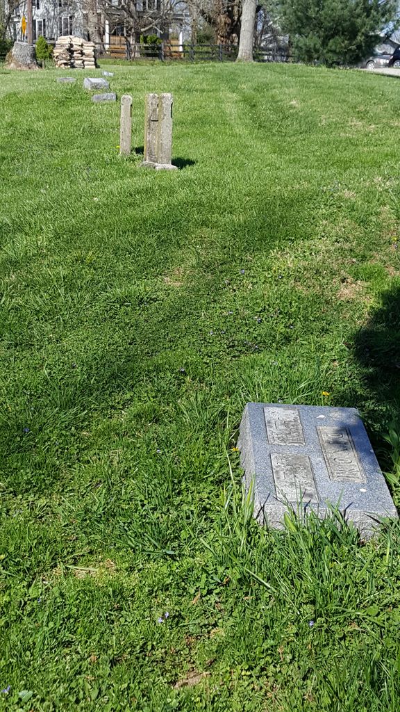
| Description | : | The cemetery is located on the south side of Chambers Road about 0.1 miles west of its intersection with Dixie Highway (US 25). The Boone County GIS unique ID assigned to this cemetery is 139 (Robinson Cemetery). The cemetery has an index number of 141 (Robinson) on the Boone County Kentucky Cemetery Map published in 2005 by the Boone County Planning Commission in conjunction with Johnson-Wilson Cemetery Stewards Association. The cemetery is identified as the Robinson Cemetery in the Boone County Family Cemetery Register, Volume 2, compiled by the Boone County Historic Preservation Review Board. The cemetery register sheet is dated April 17,... Read More |
frequently asked questions (FAQ):
-
Where is Robinson Cemetery?
Robinson Cemetery is located at Chambers Road Walton, Boone County ,Kentucky , 41094USA.
-
Robinson Cemetery cemetery's updated grave count on graveviews.com?
1 memorials
-
Where are the coordinates of the Robinson Cemetery?
Latitude: 38.8888890
Longitude: -84.6100000
Nearby Cemetories:
1. Percival Cemetery
Bank Lick, Kenton County, USA
Coordinate: 38.8875000, -84.5913890
2. Ross Cemetery
Walton, Boone County, USA
Coordinate: 38.8697230, -84.6033330
3. Hudson Cemetery
Walton, Boone County, USA
Coordinate: 38.8872220, -84.6375000
4. Lampton Family Cemetery
Richwood, Boone County, USA
Coordinate: 38.9104350, -84.6151260
5. Senour Family Burying Ground
Walton, Boone County, USA
Coordinate: 38.8844770, -84.6396230
6. Finnell-Burton-Roberts Cemetery
Walton, Boone County, USA
Coordinate: 38.8665940, -84.6216130
7. Hughes Cemetery
Walton, Boone County, USA
Coordinate: 38.8897220, -84.6438890
8. Glackin Family Cemetery
Richwood, Boone County, USA
Coordinate: 38.9130050, -84.6302180
9. Cruises Creek Baptist Church Cemetery
Kenton County, USA
Coordinate: 38.8788730, -84.5694070
10. Richwood Presbyterian Cemetery
Walton, Boone County, USA
Coordinate: 38.8994500, -84.6516300
11. Byland Cemetery
Kenton County, USA
Coordinate: 38.8577995, -84.5824966
12. Carpenter Cemetery
Boone County, USA
Coordinate: 38.9258070, -84.6281840
13. Salem Predestinarian Baptist Church Cemetery
Boone County, USA
Coordinate: 38.8500595, -84.6287766
14. Johnson-Noell Family Cemetery
Walton, Boone County, USA
Coordinate: 38.8611180, -84.6497140
15. Roberts Family Cemetery
Walton, Boone County, USA
Coordinate: 38.8531970, -84.6457220
16. Booth Family Cemetery
Union, Boone County, USA
Coordinate: 38.9265990, -84.6450410
17. Dewire Cemetery
Ricedale, Kenton County, USA
Coordinate: 38.9361110, -84.5963890
18. Grubbs Cemetery
Richwood, Boone County, USA
Coordinate: 38.9366260, -84.6262810
19. Northcutt Cemetery
Kenton County, USA
Coordinate: 38.8493996, -84.5717010
20. Butts-Snow-Loar Cemetery
Union, Boone County, USA
Coordinate: 38.9328660, -84.6396090
21. Webster Cemetery
Piner, Kenton County, USA
Coordinate: 38.8388890, -84.5877780
22. Lewis Rice Cemetery (Defunct)
Florence, Boone County, USA
Coordinate: 38.9427780, -84.6169440
23. Rector Cemetery
Independence, Kenton County, USA
Coordinate: 38.9433300, -84.6002800
24. Jones Cemetery
Piner, Kenton County, USA
Coordinate: 38.8400000, -84.5752780