
| Memorials | : | 123 |
| Location | : | Elmwood, Saline County, USA |
| Coordinate | : | 39.0636500, -93.3958100 |
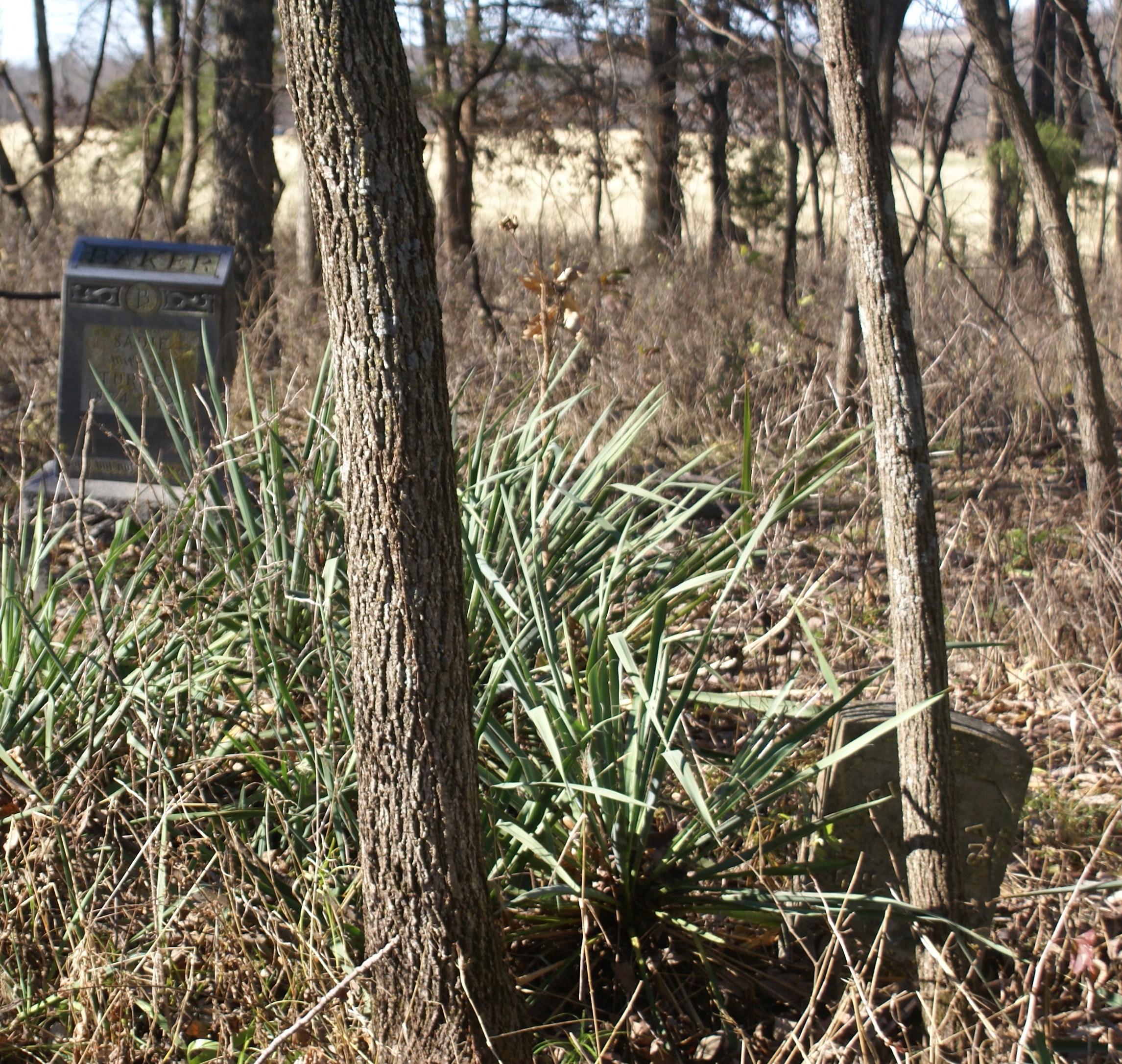
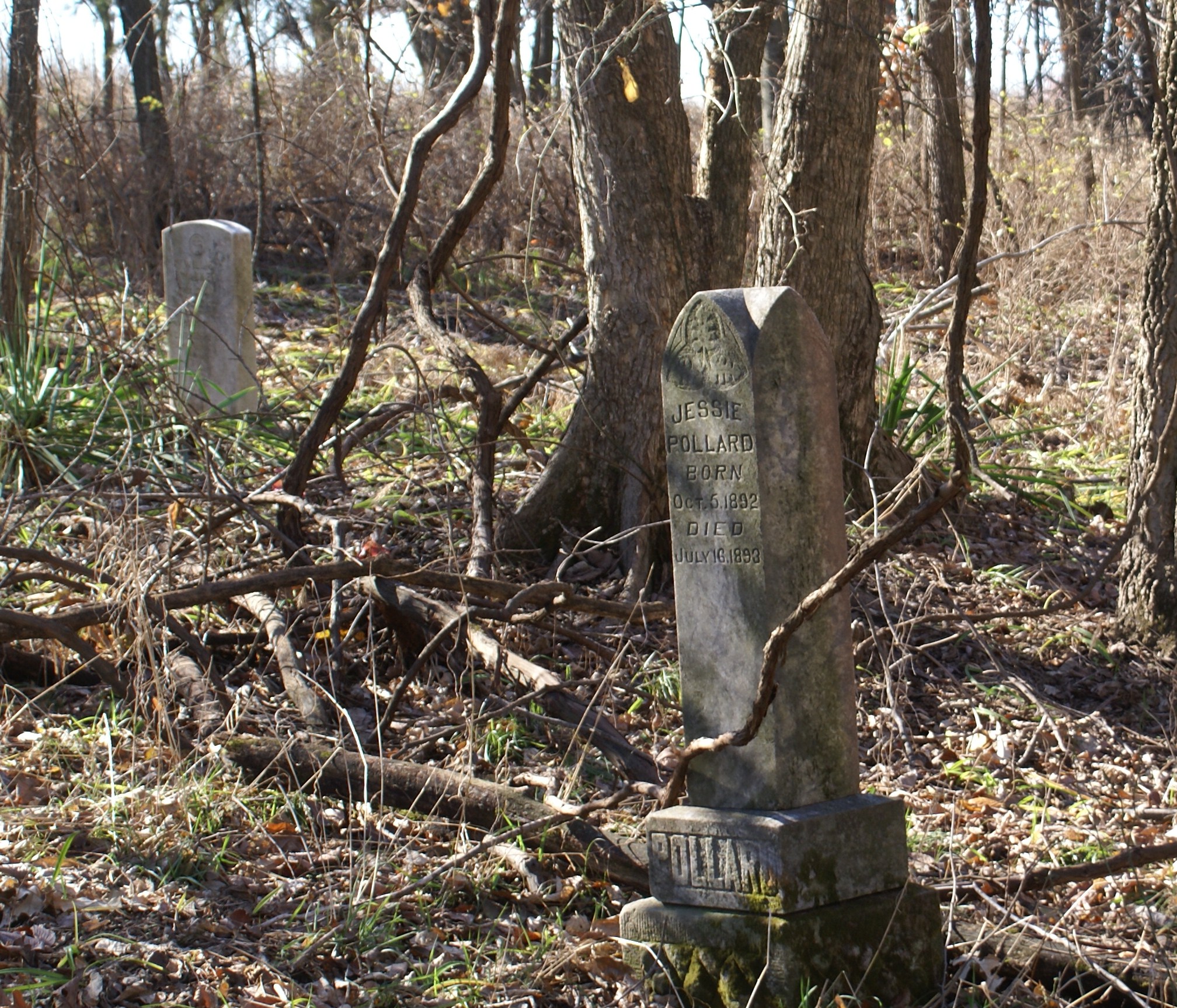
| Description | : | The church and cemetery were in Township 49N, Range 23W, Section 2. More specifically, the church and cemetery were located in the southeast corner of the Northeast 1/4 of Section 2. The cemetery area has grown up in trees since last burials. It is off the road a quarter mile down what was once a private lane and is now only the division line between two farmed fields. Bill Wealot who photographed the cemetery in November 2015 reports that the last burial in evidence appears to be from 1961. Both an African Methodist and African Baptist Church were located within approximately 1/4... Read More |
frequently asked questions (FAQ):
-
Where is Salt Pond African Baptist Church Cemetery?
Salt Pond African Baptist Church Cemetery is located at Elmwood, Saline County ,Missouri ,USA.
-
Salt Pond African Baptist Church Cemetery cemetery's updated grave count on graveviews.com?
11 memorials
-
Where are the coordinates of the Salt Pond African Baptist Church Cemetery?
Latitude: 39.0636500
Longitude: -93.3958100
Nearby Cemetories:
1. Salt Pond Methodist Cemetery
Sweet Springs, Saline County, USA
Coordinate: 39.0662660, -93.3913880
2. Mount Zion Cemetery
Sweet Springs, Saline County, USA
Coordinate: 39.0458860, -93.3821710
3. Pisgah Cemetery
Saline County, USA
Coordinate: 39.0722250, -93.4419240
4. Lynch Cemetery
Sweet Springs, Saline County, USA
Coordinate: 39.0262400, -93.4106200
5. Goshen Cemetery
Sweet Springs, Saline County, USA
Coordinate: 39.0656013, -93.3396988
6. Bailey Family Cemetery
Cretcher, Saline County, USA
Coordinate: 39.0386000, -93.3465100
7. Gross Cemetery
Sweet Springs, Saline County, USA
Coordinate: 39.0130997, -93.4085999
8. Providence Cemetery
Saline County, USA
Coordinate: 39.0461006, -93.3221970
9. Poe Cemetery
Sweet Springs, Saline County, USA
Coordinate: 39.0249200, -93.4641600
10. Salt Springs Cemetery
Saline County, USA
Coordinate: 39.1264000, -93.3460999
11. Antioch Cemetery
Saline County, USA
Coordinate: 39.0096510, -93.3205430
12. Blackburn Cemetery
Blackburn, Saline County, USA
Coordinate: 39.1178017, -93.4800034
13. Lewis Family Cemetery
Alma, Lafayette County, USA
Coordinate: 39.0610200, -93.5136300
14. Fairview Cemetery
Sweet Springs, Saline County, USA
Coordinate: 38.9714012, -93.4135971
15. Oak Grove Cemetery
Sweet Springs, Saline County, USA
Coordinate: 38.9710999, -93.3683014
16. Christ Lutheran Cemetery
Sweet Springs, Saline County, USA
Coordinate: 38.9817970, -93.3272270
17. Mount Saint Marys Cemetery
Shackleford, Saline County, USA
Coordinate: 39.1366997, -93.3058014
18. Maplewood Cemetery
Alma, Lafayette County, USA
Coordinate: 39.1046982, -93.5199966
19. Hazel Grove Cemetery
Herndon, Saline County, USA
Coordinate: 39.0079500, -93.2769660
20. Pleasant Grove Cemetery
Alma, Lafayette County, USA
Coordinate: 39.0525017, -93.5346985
21. Saint Peter's Memorial Cemetery
Davis Township, Lafayette County, USA
Coordinate: 39.0451300, -93.5350600
22. Little Grove Cemetery
Malta Bend, Saline County, USA
Coordinate: 39.1719017, -93.3685989
23. Holy Cross Lutheran Cemetery
Emma, Lafayette County, USA
Coordinate: 38.9828987, -93.4947662
24. Rose Valley Methodist Episcopal Cemetery
Sweet Springs, Saline County, USA
Coordinate: 38.9627991, -93.3277969