
| Memorials | : | 3 |
| Location | : | Sweet Springs, Saline County, USA |
| Coordinate | : | 38.9627991, -93.3277969 |
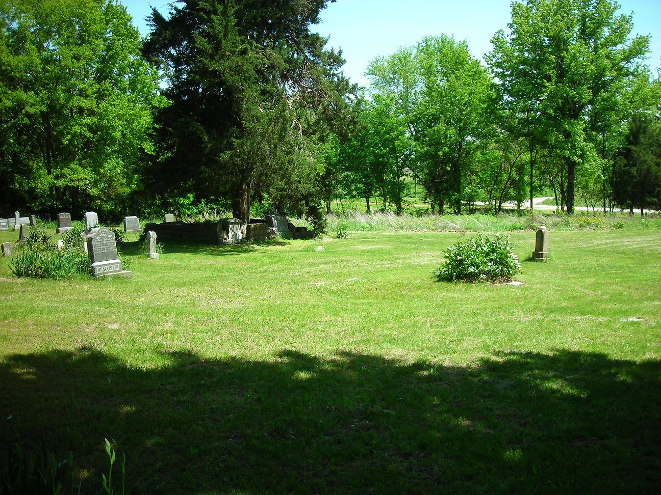
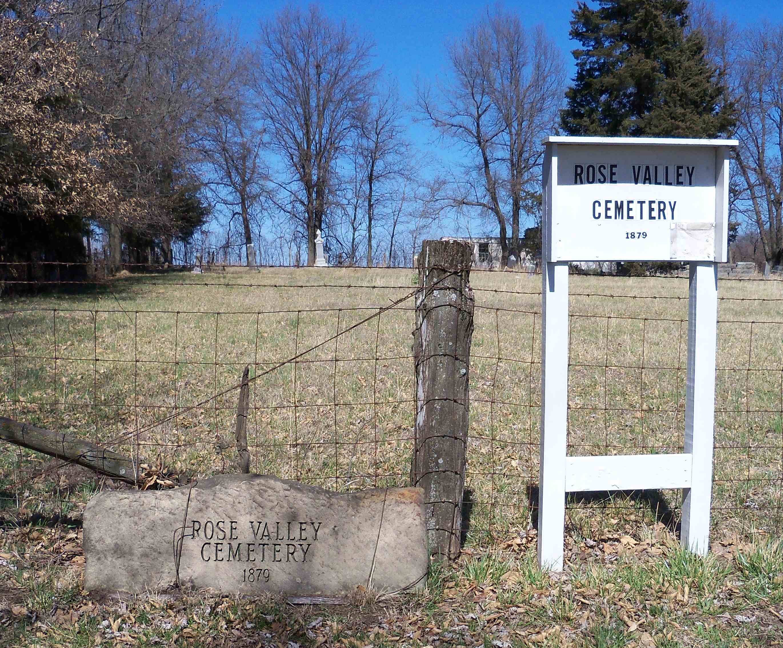
| Description | : | Rose Valley Methodist Episcopal Cemetery is located in the far northeast corner of Section 9, Township 48 N, Range 22 W. The Rose Valley School once stood immediately east of the church and cemetery in Section 10. Rose Valley Methodist Episcopal Cemetery lies between Sweet Springs to the west and Marshall Junction to the east and less than a mile south of Interstate 70. From Interstate 70, turn south on Route K. Proceed to the first intersection with a gravel road. Turn east on the gravel road and proceed east approximately 1000 feet. Cemetery will be on the north side... Read More |
frequently asked questions (FAQ):
-
Where is Rose Valley Methodist Episcopal Cemetery?
Rose Valley Methodist Episcopal Cemetery is located at Sweet Springs, Saline County ,Missouri ,USA.
-
Rose Valley Methodist Episcopal Cemetery cemetery's updated grave count on graveviews.com?
3 memorials
-
Where are the coordinates of the Rose Valley Methodist Episcopal Cemetery?
Latitude: 38.9627991
Longitude: -93.3277969
Nearby Cemetories:
1. Christ Lutheran Cemetery
Sweet Springs, Saline County, USA
Coordinate: 38.9817970, -93.3272270
2. Oak Grove Cemetery
Sweet Springs, Saline County, USA
Coordinate: 38.9710999, -93.3683014
3. Antioch Cemetery
Saline County, USA
Coordinate: 39.0096510, -93.3205430
4. Hazel Grove Cemetery
Herndon, Saline County, USA
Coordinate: 39.0079500, -93.2769660
5. Fairview Cemetery
Sweet Springs, Saline County, USA
Coordinate: 38.9714012, -93.4135971
6. Houstonia Cemetery
Houstonia, Pettis County, USA
Coordinate: 38.8941994, -93.3531036
7. Bailey Family Cemetery
Cretcher, Saline County, USA
Coordinate: 39.0386000, -93.3465100
8. Gross Cemetery
Sweet Springs, Saline County, USA
Coordinate: 39.0130997, -93.4085999
9. Providence Cemetery
Saline County, USA
Coordinate: 39.0461006, -93.3221970
10. South Fork Cemetery
Pettis County, USA
Coordinate: 38.9169006, -93.4227982
11. Lockney Cemetery
Marshall, Saline County, USA
Coordinate: 38.9834667, -93.2174667
12. Bethlehem Cemetery
Marshall Junction, Saline County, USA
Coordinate: 38.9369011, -93.2172012
13. Lynch Cemetery
Sweet Springs, Saline County, USA
Coordinate: 39.0262400, -93.4106200
14. Witcher Family Cemetery
Marshall Junction, Saline County, USA
Coordinate: 38.9553000, -93.2103000
15. Mount Zion Cemetery
Sweet Springs, Saline County, USA
Coordinate: 39.0458860, -93.3821710
16. Blue Lick Cemetery
Blue Lick, Saline County, USA
Coordinate: 39.0143220, -93.2142900
17. Goshen Cemetery
Sweet Springs, Saline County, USA
Coordinate: 39.0656013, -93.3396988
18. Finis Creek Negro Cemetery
Marshall, Saline County, USA
Coordinate: 39.0207800, -93.2142900
19. Clark Cemetery
Marshall, Saline County, USA
Coordinate: 38.9716590, -93.1876550
20. Salt Pond African Baptist Church Cemetery
Elmwood, Saline County, USA
Coordinate: 39.0636500, -93.3958100
21. Salt Pond Methodist Cemetery
Sweet Springs, Saline County, USA
Coordinate: 39.0662660, -93.3913880
22. Poe Cemetery
Sweet Springs, Saline County, USA
Coordinate: 39.0249200, -93.4641600
23. High Point Cemetery
Hughesville, Pettis County, USA
Coordinate: 38.8549995, -93.2506027
24. High Hill Cemetery
Pettis County, USA
Coordinate: 38.8544006, -93.2446976