
| Memorials | : | 0 |
| Location | : | Sweet Springs, Saline County, USA |
| Coordinate | : | 38.9817970, -93.3272270 |
| Description | : | Has also been referred to as Liberty Cemetery. |
frequently asked questions (FAQ):
-
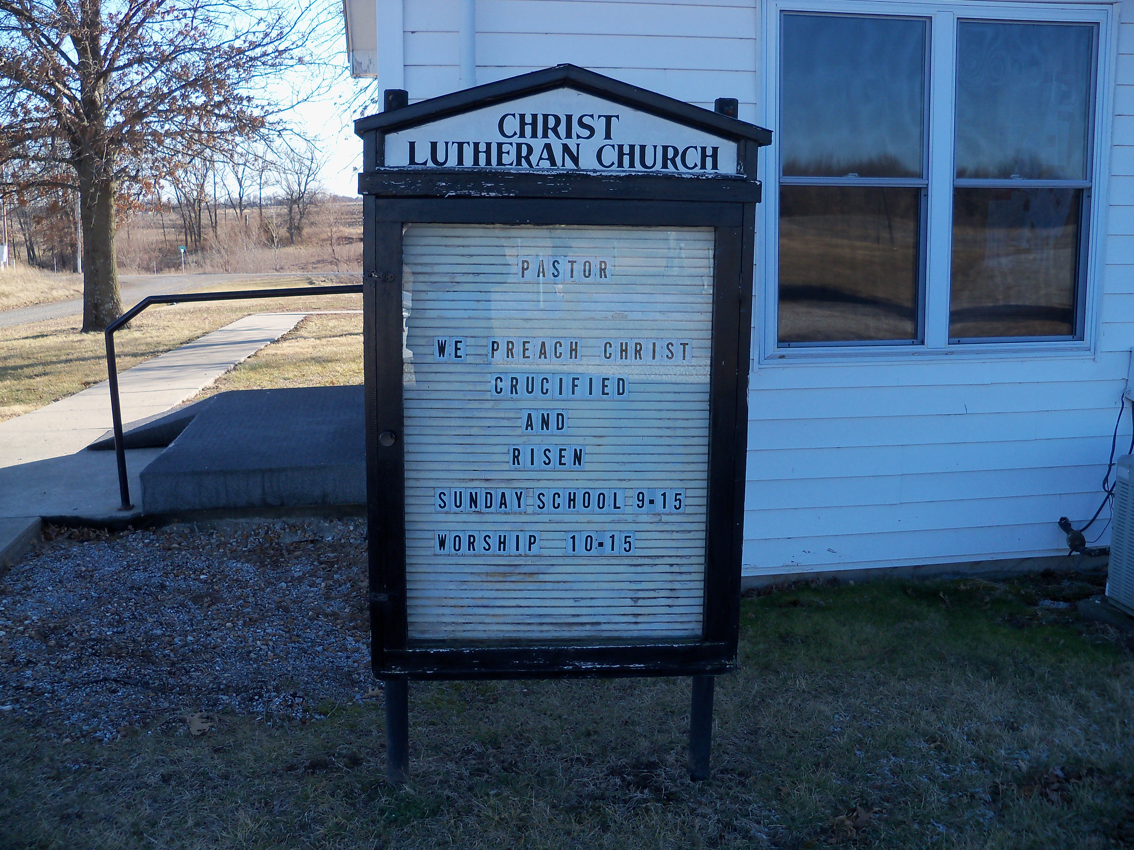
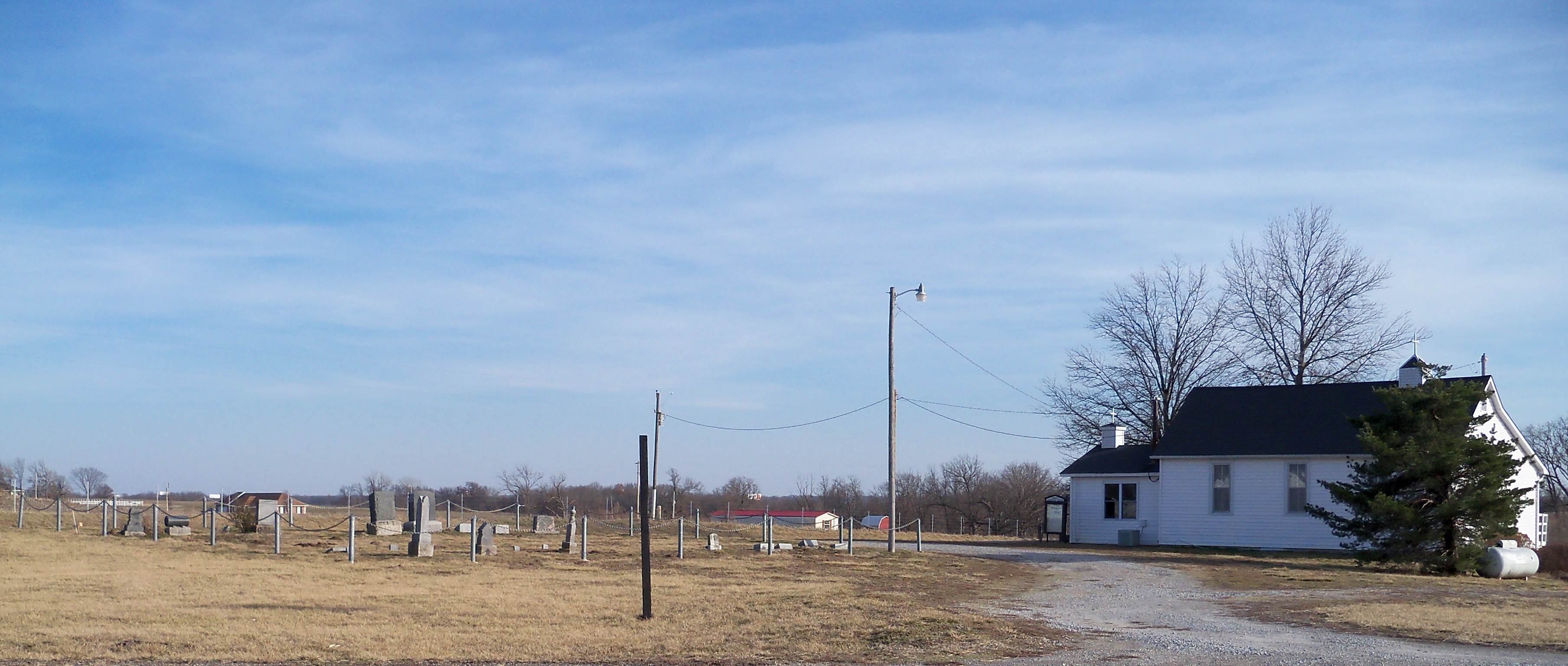
Where is Christ Lutheran Cemetery?
Christ Lutheran Cemetery is located at Located at the intersection of State EE and Fallow Rd. approximately 3/4 mile north of Interstate 70 Sweet Springs, Saline County ,Missouri ,USA.
-
Christ Lutheran Cemetery cemetery's updated grave count on graveviews.com?
0 memorials
-
Where are the coordinates of the Christ Lutheran Cemetery?
Latitude: 38.9817970
Longitude: -93.3272270
Nearby Cemetories:
1. Rose Valley Methodist Episcopal Cemetery
Sweet Springs, Saline County, USA
Coordinate: 38.9627991, -93.3277969
2. Antioch Cemetery
Saline County, USA
Coordinate: 39.0096510, -93.3205430
3. Oak Grove Cemetery
Sweet Springs, Saline County, USA
Coordinate: 38.9710999, -93.3683014
4. Hazel Grove Cemetery
Herndon, Saline County, USA
Coordinate: 39.0079500, -93.2769660
5. Bailey Family Cemetery
Cretcher, Saline County, USA
Coordinate: 39.0386000, -93.3465100
6. Providence Cemetery
Saline County, USA
Coordinate: 39.0461006, -93.3221970
7. Fairview Cemetery
Sweet Springs, Saline County, USA
Coordinate: 38.9714012, -93.4135971
8. Gross Cemetery
Sweet Springs, Saline County, USA
Coordinate: 39.0130997, -93.4085999
9. Mount Zion Cemetery
Sweet Springs, Saline County, USA
Coordinate: 39.0458860, -93.3821710
10. Lynch Cemetery
Sweet Springs, Saline County, USA
Coordinate: 39.0262400, -93.4106200
11. Goshen Cemetery
Sweet Springs, Saline County, USA
Coordinate: 39.0656013, -93.3396988
12. Lockney Cemetery
Marshall, Saline County, USA
Coordinate: 38.9834667, -93.2174667
13. Houstonia Cemetery
Houstonia, Pettis County, USA
Coordinate: 38.8941994, -93.3531036
14. Blue Lick Cemetery
Blue Lick, Saline County, USA
Coordinate: 39.0143220, -93.2142900
15. Witcher Family Cemetery
Marshall Junction, Saline County, USA
Coordinate: 38.9553000, -93.2103000
16. Finis Creek Negro Cemetery
Marshall, Saline County, USA
Coordinate: 39.0207800, -93.2142900
17. Bethlehem Cemetery
Marshall Junction, Saline County, USA
Coordinate: 38.9369011, -93.2172012
18. Salt Pond African Baptist Church Cemetery
Elmwood, Saline County, USA
Coordinate: 39.0636500, -93.3958100
19. Salt Pond Methodist Cemetery
Sweet Springs, Saline County, USA
Coordinate: 39.0662660, -93.3913880
20. South Fork Cemetery
Pettis County, USA
Coordinate: 38.9169006, -93.4227982
21. Clark Cemetery
Marshall, Saline County, USA
Coordinate: 38.9716590, -93.1876550
22. Poe Cemetery
Sweet Springs, Saline County, USA
Coordinate: 39.0249200, -93.4641600
23. Mount Olive Cemetery
Marshall, Saline County, USA
Coordinate: 39.0566310, -93.2100890
24. Pisgah Cemetery
Saline County, USA
Coordinate: 39.0722250, -93.4419240