
| Memorials | : | 0 |
| Location | : | Sandbach, Cheshire East Unitary Authority, England |
| Coordinate | : | 53.1410080, -2.3556550 |
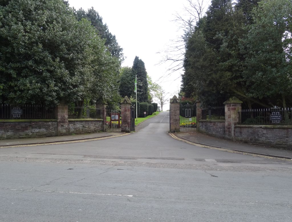
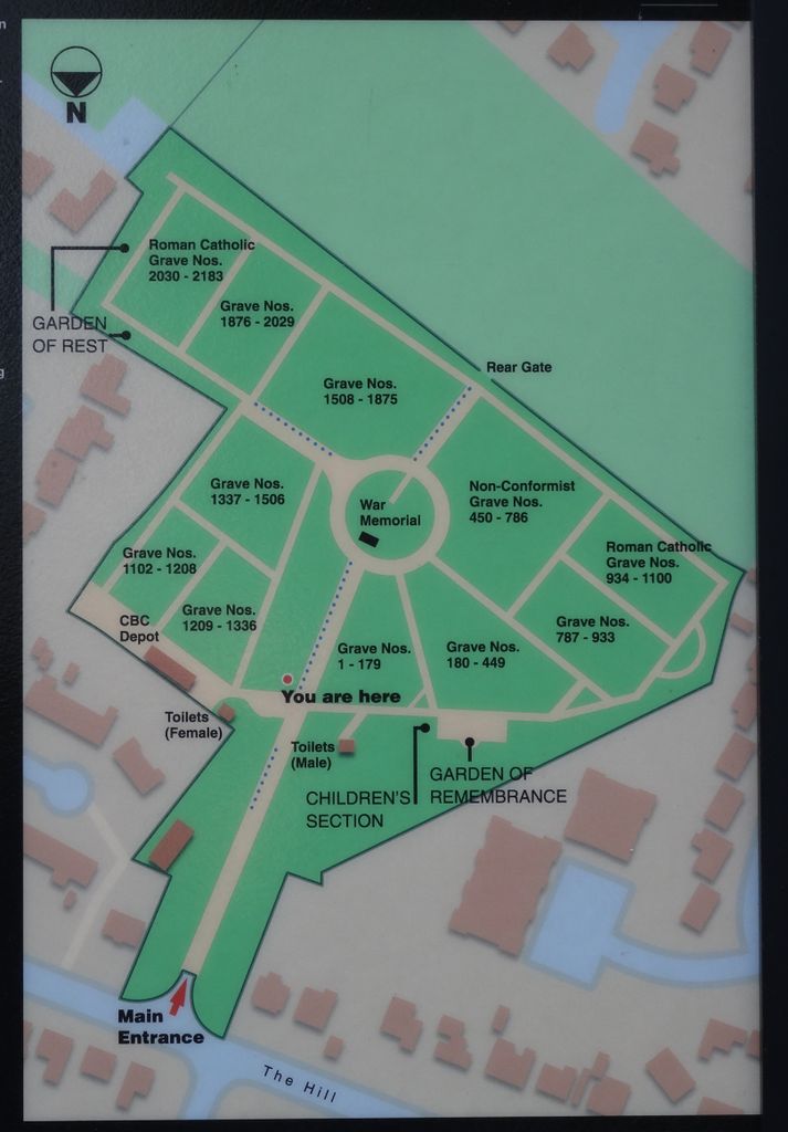
| Description | : | Opened in 1935, the first interment took place on the 30 March 1935. On average between 70 and 80 interments take place in Sandbach Cemetery each year. The cemetery provides the following sections: Fully consecrated with the rites of the Church of England Interdenominational Roman Catholic Full Memorial Children's Section Garden of Remembrance Garden of Rest Butterfly garden |
frequently asked questions (FAQ):
-
Where is Sandbach Cemetery?
Sandbach Cemetery is located at off The Hill Sandbach, Cheshire East Unitary Authority ,Cheshire , CW11 1JJEngland.
-
Sandbach Cemetery cemetery's updated grave count on graveviews.com?
0 memorials
-
Where are the coordinates of the Sandbach Cemetery?
Latitude: 53.1410080
Longitude: -2.3556550
Nearby Cemetories:
1. St Mary Churchyard
Sandbach, Cheshire East Unitary Authority, England
Coordinate: 53.1435380, -2.3610030
2. Hope Chapel
Sandbach, Cheshire East Unitary Authority, England
Coordinate: 53.1439600, -2.3643100
3. St. John's Churchyard
Sandbach Heath, Cheshire East Unitary Authority, England
Coordinate: 53.1506690, -2.3371800
4. Christ Church Churchyard
Wheelock, Cheshire East Unitary Authority, England
Coordinate: 53.1247500, -2.3768200
5. St Peter Churchyard
Elworth, Cheshire East Unitary Authority, England
Coordinate: 53.1485950, -2.3898080
6. The Church on Ettiley Heath
Ettiley Heath, Cheshire East Unitary Authority, England
Coordinate: 53.1387412, -2.3964267
7. Wheelock Heath Baptist Chapelyard
Sandbach, Cheshire East Unitary Authority, England
Coordinate: 53.1132940, -2.3730320
8. St John the Baptist Churchyard
Smallwood, Cheshire East Unitary Authority, England
Coordinate: 53.1381700, -2.2913100
9. St Oswald Churchyard
Brereton, Cheshire East Unitary Authority, England
Coordinate: 53.1797180, -2.3284870
10. St. Matthew's Churchyard
Haslington, Cheshire East Unitary Authority, England
Coordinate: 53.1011010, -2.3933740
11. St. Leonard's Churchyard
Warmingham, Cheshire East Unitary Authority, England
Coordinate: 53.1462213, -2.4367574
12. Christ Church Churchyard
Alsager, Cheshire East Unitary Authority, England
Coordinate: 53.0977630, -2.3166660
13. St Mary Magdalene Churchyard
Alsager, Cheshire East Unitary Authority, England
Coordinate: 53.0960640, -2.3071370
14. St Michael's
Haslington, Cheshire East Unitary Authority, England
Coordinate: 53.0946170, -2.4097820
15. All Saint's Churchyard
Somerford, Cheshire East Unitary Authority, England
Coordinate: 53.1803580, -2.2786350
16. All Saints Churchyard
Odd Rode, Cheshire East Unitary Authority, England
Coordinate: 53.1142100, -2.2644690
17. St. Luke Churchyard
Holmes Chapel, Cheshire East Unitary Authority, England
Coordinate: 53.2020350, -2.3575080
18. Crewe Cemetery & Crematorium
Crewe, Cheshire East Unitary Authority, England
Coordinate: 53.1030540, -2.4415159
19. St. Michael Churchyard
Crewe, Cheshire East Unitary Authority, England
Coordinate: 53.1058200, -2.4475200
20. All Saints Churchyard
Church Lawton, Cheshire East Unitary Authority, England
Coordinate: 53.0987050, -2.2679300
21. Swettenham Cemetery
Swettenham, Cheshire East Unitary Authority, England
Coordinate: 53.2013150, -2.2996470
22. St Bertoline's Churchyard
Barthomley, Cheshire East Unitary Authority, England
Coordinate: 53.0681360, -2.3483600
23. St Peter Churchyard
Minshull Vernon, Cheshire East Unitary Authority, England
Coordinate: 53.1308770, -2.4772320
24. St. Michael and All Angels Churchyard
Middlewich, Cheshire East Unitary Authority, England
Coordinate: 53.1926870, -2.4445600