
| Memorials | : | 15 |
| Location | : | Parsons, Decatur County, USA |
| Coordinate | : | 35.6274370, -88.0665750 |
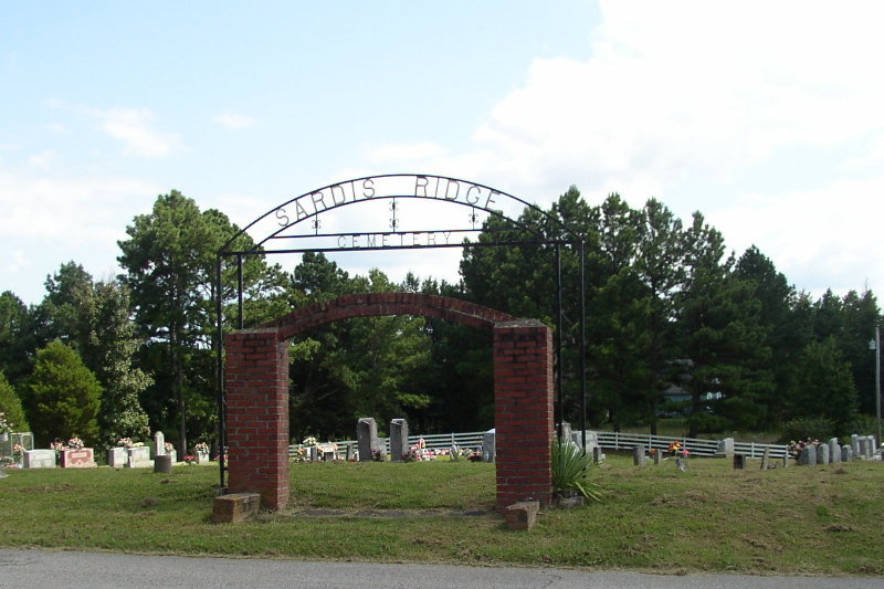
| Description | : | From the intersection of McKenzie Rd. & US-412 E, east of Parsons, travel south on McKenzie Rd. for about 60 yards; turning east (left) onto Sardis Ridge Rd., going 1.3 mi. to the cemetery on the south (right) side of the road, across the road from the Sardis Ridge Baptist Church. Sardis Ridge Cemetery is located about 5 miles east of Parsons on the old road between Parsons and Perryville, opposite Sardis Ridge Baptist Church. The cemetery is indicated on the U.S.G.S. Jeanette quadrangle (1986). The cemetery is maintained. About three dozen graves are marked with by thin... Read More |
frequently asked questions (FAQ):
-
Where is Sardis Ridge Cemetery?
Sardis Ridge Cemetery is located at Sardis Ridge Rd Parsons, Decatur County ,Tennessee , 38363USA.
-
Sardis Ridge Cemetery cemetery's updated grave count on graveviews.com?
13 memorials
-
Where are the coordinates of the Sardis Ridge Cemetery?
Latitude: 35.6274370
Longitude: -88.0665750
Nearby Cemetories:
1. Houston Cemetery
Decatur County, USA
Coordinate: 35.6268997, -88.0888977
2. Perryville Cemetery
Parsons, Decatur County, USA
Coordinate: 35.6229150, -88.0436520
3. Tolley Cemetery
Parsons, Decatur County, USA
Coordinate: 35.6090410, -88.0782990
4. Hopewell Cemetery
Parsons, Decatur County, USA
Coordinate: 35.6538890, -88.0653850
5. Southside Church Cemetery
Parsons, Decatur County, USA
Coordinate: 35.6282030, -88.1103900
6. Clay Cemetery
Parsons, Decatur County, USA
Coordinate: 35.6375510, -88.1126050
7. Houston Cemetery
Parsons, Decatur County, USA
Coordinate: 35.6171810, -88.1125870
8. Howard Cemetery
Perry County, USA
Coordinate: 35.6227989, -88.0180969
9. Mount Tabor Church Cemetery
Parsons, Decatur County, USA
Coordinate: 35.6242020, -88.1169180
10. White Cemetery
Decatur County, USA
Coordinate: 35.6068993, -88.1110992
11. Iron Hill Church Cemetery
Parsons, Decatur County, USA
Coordinate: 35.6638920, -88.0932450
12. Lunsford Cemetery
Parsons, Decatur County, USA
Coordinate: 35.6684530, -88.0829530
13. Wallace Cemetery
Decaturville, Decatur County, USA
Coordinate: 35.5817000, -88.0831000
14. Parsons Cemetery
Parsons, Decatur County, USA
Coordinate: 35.6472200, -88.1205000
15. Dixon Cemetery
Decatur County, USA
Coordinate: 35.5816994, -88.0481033
16. Herndon Cemetery
Parsons, Decatur County, USA
Coordinate: 35.6181970, -88.1255280
17. Howard Cemetery
Perry County, USA
Coordinate: 35.6180992, -88.0074997
18. Bunches Chapel Cemetery
Parsons, Decatur County, USA
Coordinate: 35.6743700, -88.0481870
19. Bussell Cemetery
Perry County, USA
Coordinate: 35.6166992, -88.0066986
20. Mount Lebanon Church Cemetery
Decaturville, Decatur County, USA
Coordinate: 35.5717910, -88.0555200
21. Kunkel Cemetery
Perry County, USA
Coordinate: 35.6183014, -87.9978027
22. Rosson Cemetery
Parsons, Decatur County, USA
Coordinate: 35.6243920, -88.1377210
23. Decaturville City Cemetery
Decaturville, Decatur County, USA
Coordinate: 35.5875240, -88.1200490
24. Fisher Cemetery
Decatur County, USA
Coordinate: 35.5667000, -88.0733032