
| Memorials | : | 0 |
| Location | : | Parsons, Decatur County, USA |
| Coordinate | : | 35.6472200, -88.1205000 |
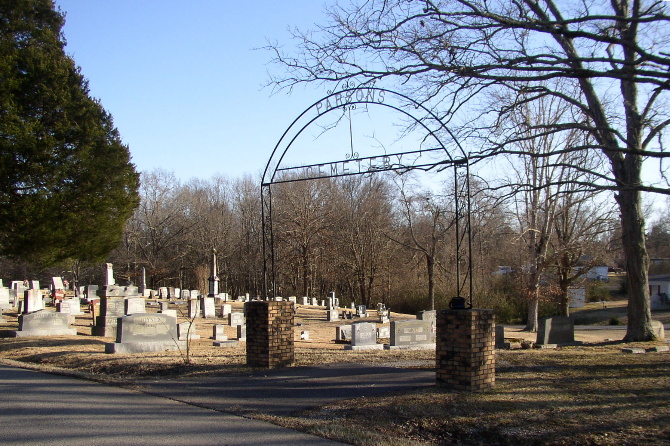
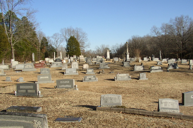
| Description | : | Parsons Cemetery, third or fourth largest cemetery in Decatur County, is bounded by Fourth Street, Perryville Road, Fifth Street, and Carolina Avenue. It is shown on the U.S.G.S. Jeanette quadrangle (1986) as the unnamed cemetery between the label "Water" and the label "Parsons." The cemetery designated on the quadrangle as "Parsons Cem" to the southeast is Clay Cemetery, the city's old negro cemetery. Parsons Cemetery is divided into two sections. The newer western section originally was to have been a memorial garden type cemetery with flush-to-the-ground markers for easy mowing. However, this plan has not been enforced. This... Read More |
frequently asked questions (FAQ):
-
Where is Parsons Cemetery?
Parsons Cemetery is located at 337 Old Perryville Road Parsons, Decatur County ,Tennessee ,USA.
-
Parsons Cemetery cemetery's updated grave count on graveviews.com?
0 memorials
-
Where are the coordinates of the Parsons Cemetery?
Latitude: 35.6472200
Longitude: -88.1205000
Nearby Cemetories:
1. Clay Cemetery
Parsons, Decatur County, USA
Coordinate: 35.6375510, -88.1126050
2. Southside Church Cemetery
Parsons, Decatur County, USA
Coordinate: 35.6282030, -88.1103900
3. Bear Creek Church Cemetery
Parsons, Decatur County, USA
Coordinate: 35.6491130, -88.1481300
4. Mount Tabor Church Cemetery
Parsons, Decatur County, USA
Coordinate: 35.6242020, -88.1169180
5. Graves Cemetery
Parsons, Decatur County, USA
Coordinate: 35.6274740, -88.1421470
6. Rosson Cemetery
Parsons, Decatur County, USA
Coordinate: 35.6243920, -88.1377210
7. Iron Hill Church Cemetery
Parsons, Decatur County, USA
Coordinate: 35.6638920, -88.0932450
8. Herndon Cemetery
Parsons, Decatur County, USA
Coordinate: 35.6181970, -88.1255280
9. Houston Cemetery
Parsons, Decatur County, USA
Coordinate: 35.6171810, -88.1125870
10. Barnett Cemetery
Parsons, Decatur County, USA
Coordinate: 35.6377790, -88.1581500
11. Houston Cemetery
Decatur County, USA
Coordinate: 35.6268997, -88.0888977
12. Cross Roads Church Cemetery
Parsons, Decatur County, USA
Coordinate: 35.6814030, -88.1150360
13. Lunsford Cemetery
Parsons, Decatur County, USA
Coordinate: 35.6684530, -88.0829530
14. Decatur County Memorial Gardens
Parsons, Decatur County, USA
Coordinate: 35.6838580, -88.1127480
15. Stills Cemetery
Parsons, Decatur County, USA
Coordinate: 35.6848660, -88.1269820
16. McMurry Cemetery
Parsons, Decatur County, USA
Coordinate: 35.6864650, -88.1294860
17. Apostolic Church of Jesus Christ Cemetery
Parsons, Decatur County, USA
Coordinate: 35.6871480, -88.1106520
18. White Cemetery
Decatur County, USA
Coordinate: 35.6068993, -88.1110992
19. Keen Cemetery
Parsons, Decatur County, USA
Coordinate: 35.6459090, -88.1715020
20. Hopewell Cemetery
Parsons, Decatur County, USA
Coordinate: 35.6538890, -88.0653850
21. Gabbard Cemetery
Parsons, Decatur County, USA
Coordinate: 35.6875340, -88.1507260
22. Sardis Ridge Cemetery
Parsons, Decatur County, USA
Coordinate: 35.6274370, -88.0665750
23. Hays Cemetery
Bible Hill, Decatur County, USA
Coordinate: 35.6914070, -88.1505910
24. Hill Cemetery
Parsons, Decatur County, USA
Coordinate: 35.6914190, -88.1505980