
| Memorials | : | 0 |
| Location | : | Send, Guildford Borough, England |
| Website | : | sendparishcouncil.gov.uk/send-cemetery/ |
| Coordinate | : | 51.2876880, -0.5273440 |
| Description | : | Send is located 23 miles (37 km) south-west from Hyde Park Corner and 6 miles (10 km) south-west of junction 10 of the M25 and lies north-west of the A3 trunk road. The parish is bounded to the west and north by the River Wey and the Wey Navigation. The nearest railway station is at West Clandon but Woking is not much further and offers a better service. Nearby villages include Send Marsh, Ripley, Ockham, Woking, Pyrford and West Clandon. Send village reputedly got its name as a corruption of the word sand, which was extracted until the 1990s for construction... Read More |
frequently asked questions (FAQ):
-
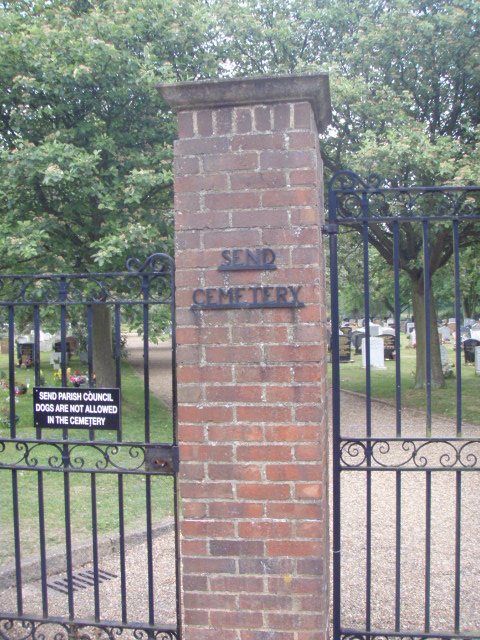
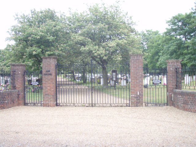
Where is Send Cemetery?
Send Cemetery is located at Send Hill Send, Guildford Borough ,Surrey ,England.
-
Send Cemetery cemetery's updated grave count on graveviews.com?
0 memorials
-
Where are the coordinates of the Send Cemetery?
Latitude: 51.2876880
Longitude: -0.5273440
Nearby Cemetories:
1. St Mary the Virgin Churchyard
Send, Guildford Borough, England
Coordinate: 51.2791230, -0.5408600
2. St Peter's Church
Old Woking, Woking Borough, England
Coordinate: 51.3017410, -0.5372560
3. Old Woking Burial Ground
Old Woking, Woking Borough, England
Coordinate: 51.3026230, -0.5351320
4. St Mary Magdalen Churchyard
Ripley, Guildford Borough, England
Coordinate: 51.2992230, -0.4936400
5. St Edward the Confessor Churchyard
Sutton Green, Woking Borough, England
Coordinate: 51.2741930, -0.5608230
6. St. Nicholas Church
Pyrford, Woking Borough, England
Coordinate: 51.3137910, -0.5094020
7. Burpham Churchyard
Guildford, Guildford Borough, England
Coordinate: 51.2622640, -0.5497350
8. All Saints Churchyard
Ockham, Guildford Borough, England
Coordinate: 51.2979900, -0.4710800
9. Ss Peter & Paul Church Cemetery
West Clandon, Guildford Borough, England
Coordinate: 51.2517500, -0.5045400
10. St. Peter & St. Paul's Churchyard
West Clandon, Guildford Borough, England
Coordinate: 51.2507990, -0.5053760
11. St John the Evangelist Churchyard
Merrow, Guildford Borough, England
Coordinate: 51.2459770, -0.5271350
12. St Mary the Virgin Churchyard
Horsell, Woking Borough, England
Coordinate: 51.3227460, -0.5703770
13. Wisley Church Churchyard
Wisley, Guildford Borough, England
Coordinate: 51.3257400, -0.4847130
14. St John the Baptist Churchyard
St Johns, Woking Borough, England
Coordinate: 51.3104700, -0.5929170
15. Stoke New Cemetery
Guildford, Guildford Borough, England
Coordinate: 51.2543900, -0.5824700
16. St. John's Churchyard
Stoke-next-Guildford, Guildford Borough, England
Coordinate: 51.2470280, -0.5711690
17. Stoke Old Cemetery
Guildford, Guildford Borough, England
Coordinate: 51.2522600, -0.5828500
18. St Mary the Virgin Churchyard
Worplesdon, Guildford Borough, England
Coordinate: 51.2730100, -0.6067360
19. Woking Crematorium
Woking, Woking Borough, England
Coordinate: 51.3122590, -0.6022630
20. St John the Baptist Church
West Byfleet, Woking Borough, England
Coordinate: 51.3383570, -0.5023990
21. St Mary Churchyard
Byfleet, Woking Borough, England
Coordinate: 51.3328210, -0.4757360
22. Society of Friends Burial Ground (Defunct)
Guildford, Guildford Borough, England
Coordinate: 51.2364500, -0.5703050
23. Holy Trinity Church
Guildford, Guildford Borough, England
Coordinate: 51.2357740, -0.5705540
24. St Mary Churchyard
West Horsley, Guildford Borough, England
Coordinate: 51.2622470, -0.4417370