
| Memorials | : | 1 |
| Location | : | Ockham, Guildford Borough, England |
| Coordinate | : | 51.2979900, -0.4710800 |
| Description | : | Ockham is a tiny English village near East Horsley, in Surrey, England. The village lies to the east of the A3 which runs between Cobham and Guildford. Other neighbouring villages include Ripley, Wisley and Effingham. |
frequently asked questions (FAQ):
-
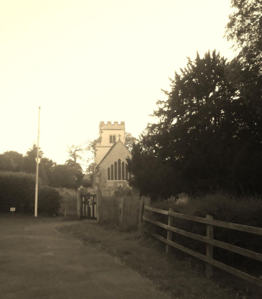
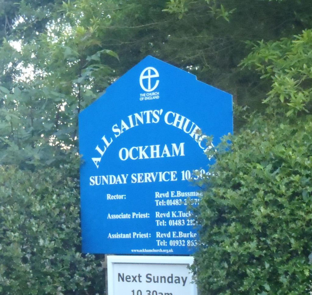
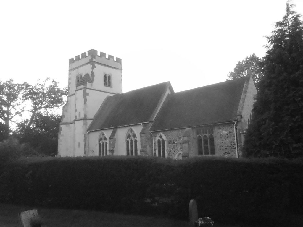
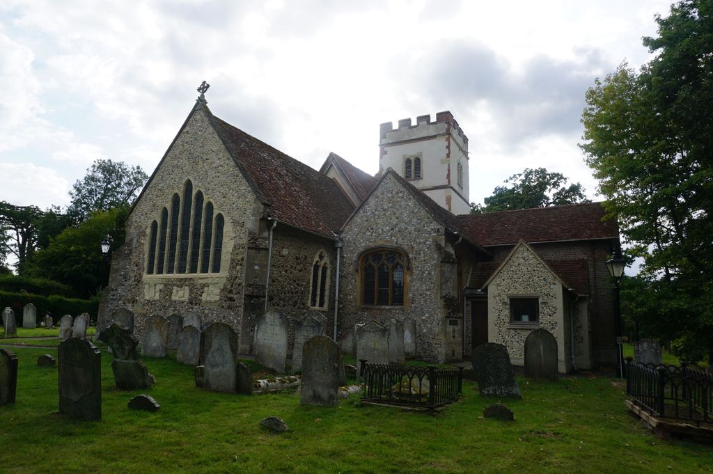
Where is All Saints Churchyard?
All Saints Churchyard is located at Ockham, Guildford Borough ,Surrey , GU23 6NLEngland.
-
All Saints Churchyard cemetery's updated grave count on graveviews.com?
1 memorials
-
Where are the coordinates of the All Saints Churchyard?
Latitude: 51.2979900
Longitude: -0.4710800
Nearby Cemetories:
1. St Mary Magdalen Churchyard
Ripley, Guildford Borough, England
Coordinate: 51.2992230, -0.4936400
2. St. Matthew's Churchyard
Cobham, Elmbridge Borough, England
Coordinate: 51.3098290, -0.4335730
3. St. Nicholas Church
Pyrford, Woking Borough, England
Coordinate: 51.3137910, -0.5094020
4. Wisley Church Churchyard
Wisley, Guildford Borough, England
Coordinate: 51.3257400, -0.4847130
5. St Mary Churchyard
Byfleet, Woking Borough, England
Coordinate: 51.3328210, -0.4757360
6. Send Cemetery
Send, Guildford Borough, England
Coordinate: 51.2876880, -0.5273440
7. St Mary Churchyard
West Horsley, Guildford Borough, England
Coordinate: 51.2622470, -0.4417370
8. Old Woking Burial Ground
Old Woking, Woking Borough, England
Coordinate: 51.3026230, -0.5351320
9. St Peter's Church
Old Woking, Woking Borough, England
Coordinate: 51.3017410, -0.5372560
10. St. Martin's Churchyard
East Horsley, Guildford Borough, England
Coordinate: 51.2638550, -0.4314040
11. St John the Baptist Church
West Byfleet, Woking Borough, England
Coordinate: 51.3383570, -0.5023990
12. St Andrew Churchyard
Cobham, Elmbridge Borough, England
Coordinate: 51.3259580, -0.4114970
13. St Mary the Virgin Churchyard
Send, Guildford Borough, England
Coordinate: 51.2791230, -0.5408600
14. Ss Peter & Paul Church Cemetery
West Clandon, Guildford Borough, England
Coordinate: 51.2517500, -0.5045400
15. St. Peter & St. Paul's Churchyard
West Clandon, Guildford Borough, England
Coordinate: 51.2507990, -0.5053760
16. Cobham Municipal Cemetery
Cobham, Elmbridge Borough, England
Coordinate: 51.3204240, -0.3954060
17. St Lawrence Churchyard
Effingham, Guildford Borough, England
Coordinate: 51.2712010, -0.3984180
18. All Saints Churchyard
Little Bookham, Mole Valley District, England
Coordinate: 51.2826900, -0.3864790
19. St Marys Churchyard
Stoke D'Abernon, Elmbridge Borough, England
Coordinate: 51.3139230, -0.3812710
20. Yehudi Menuhin International School
Stoke D'Abernon, Elmbridge Borough, England
Coordinate: 51.3059170, -0.3775720
21. Burpham Churchyard
Guildford, Guildford Borough, England
Coordinate: 51.2622640, -0.5497350
22. St Edward the Confessor Churchyard
Sutton Green, Woking Borough, England
Coordinate: 51.2741930, -0.5608230
23. St John the Evangelist Churchyard
Merrow, Guildford Borough, England
Coordinate: 51.2459770, -0.5271350
24. St Nicolas Parish Churchyard
Great Bookham, Mole Valley District, England
Coordinate: 51.2798220, -0.3739870