| Memorials | : | 1 |
| Location | : | Mount Gilead, Montgomery County, USA |
| Coordinate | : | 35.2156780, -80.0024410 |
| Description | : | Sharon Presbyterian Church This church/cemetery is located approximately 1 ¼ mile east of Mt. Gilead on the right side of SR # 731. The Sharon Presbyterian Church, for runner of Mt. Gilead Presbyterian Church, was organized in 1795, and on April 2. 1812 Sharon called Rev. William Peacock to be its pastor. The first church was a crude log building replaced by a framed structure, and both were located on the land of Charles McKinon about 1 1/2 miles southeast of Wadeville on Dyson's Creek. (Also called Denson's Creek) When William Peacock was about 21 years of age, he came to... Read More |
frequently asked questions (FAQ):
-
Where is Sharon Presbyterian Church?
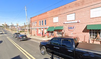
Sharon Presbyterian Church is located at N Main St Mount Gilead, Montgomery County ,North Carolina , 27306USA.
-
Sharon Presbyterian Church cemetery's updated grave count on graveviews.com?
1 memorials
-
Where are the coordinates of the Sharon Presbyterian Church?
Latitude: 35.2156780
Longitude: -80.0024410
Nearby Cemetories:
1. Sharon Cemetery
Mount Gilead, Montgomery County, USA
Coordinate: 35.2136002, -79.9796982
2. Pleasant Grove Church Cemetery
Mount Gilead, Montgomery County, USA
Coordinate: 35.1967010, -79.9944000
3. Bethel Baptist Church Cemetery
Mount Gilead, Montgomery County, USA
Coordinate: 35.2234300, -80.0391800
4. Galloway Cemetery
Mount Gilead, Montgomery County, USA
Coordinate: 35.1779210, -80.0155840
5. Frazier Family Cemetery
Mount Gilead, Montgomery County, USA
Coordinate: 35.1786400, -79.9854870
6. Ropers Grove Cemetery
Mount Gilead, Montgomery County, USA
Coordinate: 35.2566986, -79.9966965
7. Ingram Chapel Cemetery
Mount Gilead, Montgomery County, USA
Coordinate: 35.1971130, -79.9533320
8. Thomasville Missionary Baptist Church Cemetery
Mount Gilead, Montgomery County, USA
Coordinate: 35.1718180, -80.0203510
9. Melton Grove United Methodist Church Cemetery
Mount Gilead, Montgomery County, USA
Coordinate: 35.1698160, -80.0134250
10. Hamer Creek Baptist Church Cemetery
Mount Gilead, Montgomery County, USA
Coordinate: 35.1593370, -80.0138730
11. McRae Cemetery
Pee Dee, Montgomery County, USA
Coordinate: 35.2736015, -79.9946976
12. Stoney Fork Baptist Church Cemetery
Mount Gilead, Montgomery County, USA
Coordinate: 35.2755380, -80.0118270
13. Zion Methodist Cemetery
Mount Gilead, Montgomery County, USA
Coordinate: 35.2725670, -80.0368520
14. Watkins Cemetery
Norwood, Stanly County, USA
Coordinate: 35.1860940, -80.0738730
15. Wadeville United Methodist Church Cemetery
Wadeville, Montgomery County, USA
Coordinate: 35.2796790, -79.9707540
16. Parsons Family Cemetery
Wadeville, Montgomery County, USA
Coordinate: 35.2819620, -79.9737970
17. Calvary Baptist Church Cemetery
Mount Gilead, Montgomery County, USA
Coordinate: 35.2544310, -79.9284410
18. Wadeville Baptist Church Cemetery
Wadeville, Montgomery County, USA
Coordinate: 35.2824250, -79.9683770
19. Wall-Almond Cemetery
Norwood, Stanly County, USA
Coordinate: 35.1718150, -80.0760200
20. Cochran Cemetery
Norwood, Stanly County, USA
Coordinate: 35.2292167, -80.0934167
21. Saint Stephen AME Church Cemetery
Mount Gilead, Montgomery County, USA
Coordinate: 35.1479550, -80.0447190
22. Little River United Methodist Church Cemetery
Mount Gilead, Montgomery County, USA
Coordinate: 35.2035280, -79.9015600
23. Mount Airy AME Zion Church Cemetery
Mangum, Richmond County, USA
Coordinate: 35.1319500, -79.9971600
24. Moore Family Cemetery
Montgomery County, USA
Coordinate: 35.2864200, -80.0581700

