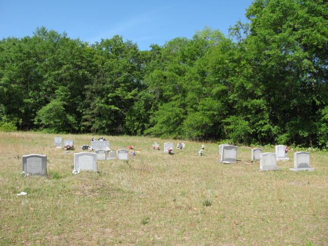
| Memorials | : | 0 |
| Location | : | Cash, Chesterfield County, USA |
| Coordinate | : | 34.6157180, -79.8753370 |
| Description | : | From Cheraw, South Carolina take Highway 52 South to the Cash Community. Cemetery will be on the right. |
frequently asked questions (FAQ):
-
Where is Shields Cemetery?
Shields Cemetery is located at Highway 52 South Cash, Chesterfield County ,South Carolina ,USA.
-
Shields Cemetery cemetery's updated grave count on graveviews.com?
0 memorials
-
Where are the coordinates of the Shields Cemetery?
Latitude: 34.6157180
Longitude: -79.8753370
Nearby Cemetories:
1. Shield Cemetery
Cheraw, Chesterfield County, USA
Coordinate: 34.6156196, -79.8752721
2. Howard Family Cemetery
Cheraw, Chesterfield County, USA
Coordinate: 34.6089410, -79.8780040
3. Cash Family Cemetery
Cash, Chesterfield County, USA
Coordinate: 34.6067210, -79.8742290
4. Montrose Cemetery
Chesterfield County, USA
Coordinate: 34.6255989, -79.8842010
5. Bethel Baptist Church Cemetery
Cash, Chesterfield County, USA
Coordinate: 34.5823110, -79.8823280
6. Living Hope Church Cemetery
Cheraw, Chesterfield County, USA
Coordinate: 34.5808500, -79.9112300
7. Chatham Hill Memorial Gardens
Cheraw, Chesterfield County, USA
Coordinate: 34.6719017, -79.9019012
8. Forest Pine Freewill Independent Church Cemetery
Cheraw, Chesterfield County, USA
Coordinate: 34.6324050, -79.9585820
9. Fisher Hill Community Cemetery
Cheraw, Chesterfield County, USA
Coordinate: 34.6738360, -79.9319040
10. J. C. Broome Memorial Garden
Cheraw, Chesterfield County, USA
Coordinate: 34.6753830, -79.9346970
11. Pleasant Hill Baptist Church Cemetery
Cheraw, Chesterfield County, USA
Coordinate: 34.6372990, -79.9684310
12. Old Saint Davids Episcopal Church Cemetery
Cheraw, Chesterfield County, USA
Coordinate: 34.6956140, -79.8794250
13. Piney Grove Baptist Church Cemetery
Patrick, Chesterfield County, USA
Coordinate: 34.6144500, -79.9728500
14. Faith Freewill Baptist Church Cemetery
Cheraw, Chesterfield County, USA
Coordinate: 34.6717450, -79.9451980
15. Pee Dee Union Baptist Church Cemetery
Cheraw, Chesterfield County, USA
Coordinate: 34.6968440, -79.8775160
16. Foundry Hill Cemetery
Cheraw, Chesterfield County, USA
Coordinate: 34.6957350, -79.8998800
17. Sawmill Baptist Church Cemetery
Bennettsville, Marlboro County, USA
Coordinate: 34.6268200, -79.7742300
18. Piney Grove Cemetery
Cheraw, Chesterfield County, USA
Coordinate: 34.5825000, -79.9705600
19. Colonel Kolbs Tomb
Marlboro County, USA
Coordinate: 34.5367012, -79.8272018
20. Erasmus Powe Family Cemetery
Cheraw, Chesterfield County, USA
Coordinate: 34.7041400, -79.8822950
21. Nolan Family Cemetery
Cash, Chesterfield County, USA
Coordinate: 34.5268160, -79.8575860
22. Lemon Memorial Garden
Wallace, Marlboro County, USA
Coordinate: 34.6722720, -79.7900100
23. Coachman Cemetery
Wallace, Marlboro County, USA
Coordinate: 34.6727760, -79.7890770
24. Progressive Church of Our Lord Jesus Christ Cemete
Cheraw, Chesterfield County, USA
Coordinate: 34.6910300, -79.9387430

