
| Memorials | : | 13 |
| Location | : | Archbold, Fulton County, USA |
| Coordinate | : | 41.5140110, -84.2771370 |
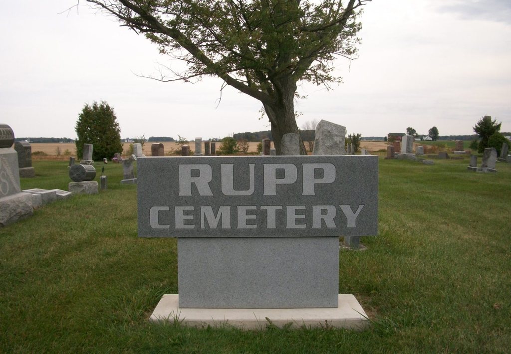
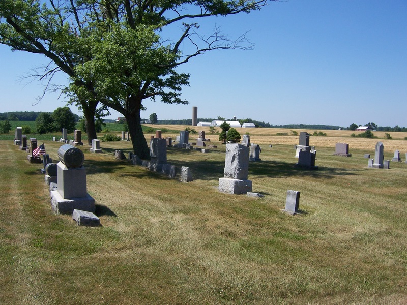
| Description | : | The Rupp Cemetery is located east of Archbold, along the south side of County Road C and east of Township Road 21-3. The Rupp Cemetery is located on land settled by Christian Rupp. In 1880 the Defenseless, Mennonite Congregation built a brick church on land purchased from Jacob Rupp on the north side of the road. At about the same time land was obtained from Christian Rupp on the south side of the road to be used as a cemetery. The cemetery is located in German Township, Fulton County, Ohio, and is # 3767 (Rupp Cemetery / Archbold Defenseless... Read More |
frequently asked questions (FAQ):
-
Where is Rupp Cemetery?
Rupp Cemetery is located at County Road C Archbold, Fulton County ,Ohio , 43502USA.
-
Rupp Cemetery cemetery's updated grave count on graveviews.com?
13 memorials
-
Where are the coordinates of the Rupp Cemetery?
Latitude: 41.5140110
Longitude: -84.2771370
Nearby Cemetories:
1. Reform Cemetery
Archbold, Fulton County, USA
Coordinate: 41.5039790, -84.3061070
2. Archbold Cemetery
Archbold, Fulton County, USA
Coordinate: 41.5028000, -84.3058014
3. Saint Peters Cemetery
Archbold, Fulton County, USA
Coordinate: 41.5428009, -84.2882996
4. Saint James Lutheran Cemetery
Burlington, Fulton County, USA
Coordinate: 41.5428009, -84.2630997
5. Pettisville Union Cemetery
Pettisville, Fulton County, USA
Coordinate: 41.5294190, -84.2258910
6. Pettisville Cemetery
Pettisville, Fulton County, USA
Coordinate: 41.5302620, -84.2258690
7. Aeschliman Cemetery
Pettisville, Fulton County, USA
Coordinate: 41.5147018, -84.2192001
8. Pettisville Lutheran Cemetery
Pettisville, Fulton County, USA
Coordinate: 41.5321900, -84.2237400
9. Wyse Cemetery
Fulton County, USA
Coordinate: 41.5647820, -84.2686700
10. Beck Cemetery
Fulton County, USA
Coordinate: 41.5648620, -84.2682880
11. Eckley Cemetery
Eckley, Fulton County, USA
Coordinate: 41.5641600, -84.2491200
12. Lauber Hill Cemetery
Fulton County, USA
Coordinate: 41.5742410, -84.2681490
13. Freedom Township Cemetery
Freedom Township, Henry County, USA
Coordinate: 41.4752970, -84.2069960
14. North Pettisville Cemetery
Wauseon, Fulton County, USA
Coordinate: 41.5728190, -84.2200180
15. Saint John Lutheran Church Cemetery
Ridgeville Township, Henry County, USA
Coordinate: 41.4425410, -84.3084650
16. Zion Lutheran Church Cemetery
Napoleon, Henry County, USA
Coordinate: 41.4414170, -84.2495930
17. Johnson Cemetery
Burlington, Fulton County, USA
Coordinate: 41.5791230, -84.3308020
18. Locust Grove Cemetery
Ridgeville Corners, Henry County, USA
Coordinate: 41.4389650, -84.2558060
19. Saint Peter Lutheran Cemetery
Ridgeville Township, Henry County, USA
Coordinate: 41.4389000, -84.2549973
20. Lena Cemetery
Fulton County, USA
Coordinate: 41.5175018, -84.1731033
21. Goll Cemetery
Archbold, Fulton County, USA
Coordinate: 41.5558014, -84.3677979
22. Smith Cemetery
Franklin Township, Fulton County, USA
Coordinate: 41.5957985, -84.2316971
23. Ayers Cemetery
Fulton County, USA
Coordinate: 41.5960999, -84.2296982
24. Bayes Cemetery
Wauseon, Fulton County, USA
Coordinate: 41.5581017, -84.1706009