
| Memorials | : | 0 |
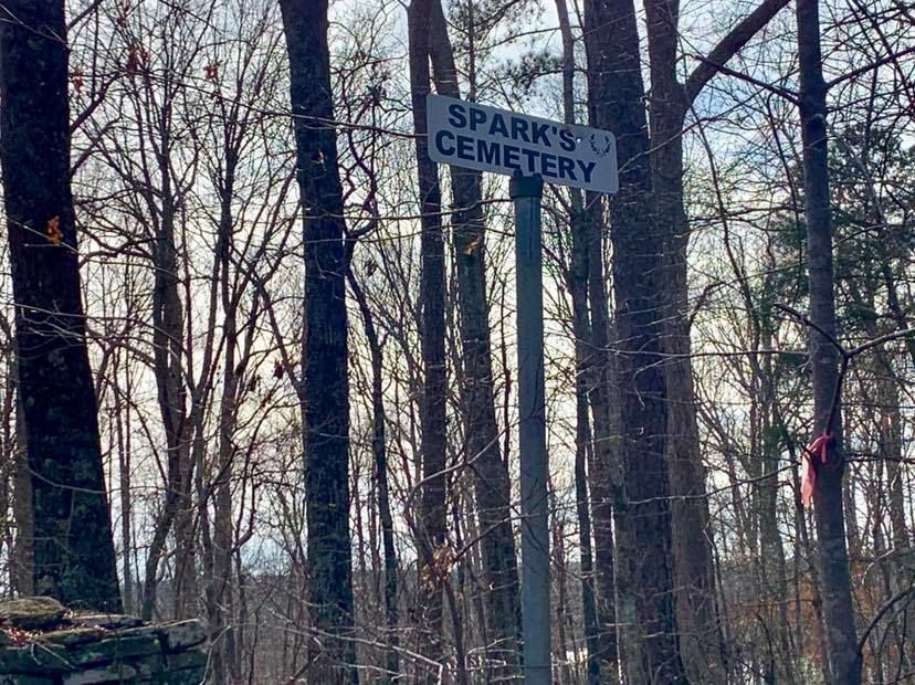
| Location | : | Dingler Crossroads, Carroll County, USA |
| Coordinate | : | 33.5429840, -84.9445500 |
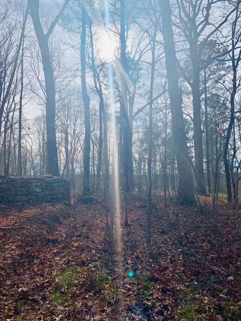
| Description | : | This cemetery started out as the BAILEY family burying ground. In 1855, a 1-acre family graveyard was excepted in a deed of sale for the BAILEY plantation, which encompassed all of Land Lot #61, the north half of Lot #36 and the north half of Lot #29 in the Fifth Land District of Carroll County, Georgia. This plantation was said to be on the road from Palmetto to Carrollton. Dingler Crossroads lies just about at the center of Lot #29. The burying ground was near the residence of Robert S. & Elizabeth "Betsey" (COPLAND) BAILEY, according... Read More |
frequently asked questions (FAQ):
-
Where is Sparks Cemetery?
Sparks Cemetery is located at Dingler Crossroads, Carroll County ,Georgia ,USA.
-
Sparks Cemetery cemetery's updated grave count on graveviews.com?
0 memorials
-
Where are the coordinates of the Sparks Cemetery?
Latitude: 33.5429840
Longitude: -84.9445500
Nearby Cemetories:
1. Driver-Boon-Bearden Family Cemetery
Carrollton, Carroll County, USA
Coordinate: 33.5353710, -84.9556820
2. Wilson Cemetery
Carroll County, USA
Coordinate: 33.5567017, -84.9655991
3. Wilson Chapel Cemetery
Cross Plains, Carroll County, USA
Coordinate: 33.5582760, -84.9677470
4. Hinesley Cemetery
Cross Plains, Carroll County, USA
Coordinate: 33.5675011, -84.9514008
5. Corinth Baptist Church Cemetery
Whitesburg, Carroll County, USA
Coordinate: 33.5231018, -84.9233017
6. Antioch Primitive Baptist Church Cemetery
Banning, Carroll County, USA
Coordinate: 33.5181007, -84.9321976
7. Gilley Cemetery
Cross Plains, Carroll County, USA
Coordinate: 33.5459200, -84.9777460
8. Cross Plains Baptist Church Cemetery
Cross Plains, Carroll County, USA
Coordinate: 33.5583000, -84.9756012
9. Saint Paul Methodist Church Cemetery
Whitesburg, Carroll County, USA
Coordinate: 33.5503006, -84.9094009
10. Cross Plains Christian Church Cemetery
Carrollton, Carroll County, USA
Coordinate: 33.5600014, -84.9775009
11. Kiser Cemetery
Carroll County, USA
Coordinate: 33.5692000, -84.9737660
12. Banning Church of God Cemetery
Whitesburg, Carroll County, USA
Coordinate: 33.5088340, -84.9296410
13. Consolation Baptist Church Cemetery
Whitesburg, Carroll County, USA
Coordinate: 33.5731010, -84.9171982
14. Mount Calvary Cemetery
Carroll County, USA
Coordinate: 33.5085983, -84.9246979
15. Jones Mill Cemetery
Whitesburg, Carroll County, USA
Coordinate: 33.5139008, -84.9116974
16. Mount Carmel Church Cemetery
Cross Plains, Carroll County, USA
Coordinate: 33.5746994, -84.9744034
17. Mount Avery Missionary Baptist Memory Gardens
Whitesburg, Carroll County, USA
Coordinate: 33.5317001, -84.8966980
18. Bushby Church Cemetery
Carrollton, Carroll County, USA
Coordinate: 33.5843290, -84.9204109
19. Whitesburg Cemetery
Whitesburg, Carroll County, USA
Coordinate: 33.5005989, -84.9180984
20. Ayers Cemetery
Whitesburg, Carroll County, USA
Coordinate: 33.5029340, -84.9100470
21. Stovall Cemetery
Whitesburg, Carroll County, USA
Coordinate: 33.5726510, -84.8971080
22. Harper Cemetery
Clem, Carroll County, USA
Coordinate: 33.5132490, -84.9936250
23. Antioch Missionary Baptist Church Cemetery
Carrollton, Carroll County, USA
Coordinate: 33.5311012, -85.0036011
24. Gray Family Cemetery
Carrollton, Carroll County, USA
Coordinate: 33.5025160, -84.9822250