
| Memorials | : | 9 |
| Location | : | Minterne Magna, West Dorset District, England |
| Coordinate | : | 50.8375700, -2.4848100 |
frequently asked questions (FAQ):
-
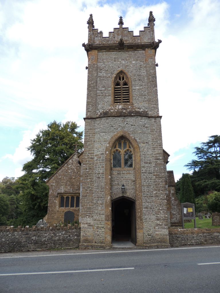
Where is St. Andrew's Churchyard?
St. Andrew's Churchyard is located at Minterne Magna, West Dorset District ,Dorset ,England.
-
St. Andrew's Churchyard cemetery's updated grave count on graveviews.com?
1 memorials
-
Where are the coordinates of the St. Andrew's Churchyard?
Latitude: 50.8375700
Longitude: -2.4848100
Nearby Cemetories:
1. Hilfield Chapel
Hilfield, West Dorset District, England
Coordinate: 50.8442800, -2.5199520
2. Hilfield Friary (Society of St. Francis)
Hilfield, West Dorset District, England
Coordinate: 50.8385230, -2.5252120
3. Holy Rood Churchyard
Buckland Newton, West Dorset District, England
Coordinate: 50.8461660, -2.4453910
4. Cerne Abbey
Cerne Abbas, West Dorset District, England
Coordinate: 50.8106000, -2.4754000
5. St Mary Churchyard
Cerne Abbas, West Dorset District, England
Coordinate: 50.8095040, -2.4756200
6. St. Mary's Churchyard
Glanvilles Wootton, North Dorset District, England
Coordinate: 50.8717800, -2.4558510
7. Alton Pancras Cemetery
Alton Pancras, West Dorset District, England
Coordinate: 50.8203710, -2.4289390
8. Holnest Churchyard
Holnest, West Dorset District, England
Coordinate: 50.8870090, -2.4895200
9. All Saints Churchyard
Piddletrenthide, West Dorset District, England
Coordinate: 50.8053720, -2.4242110
10. St. Andrew's Churchyard
Leigh, West Dorset District, England
Coordinate: 50.8761580, -2.5443780
11. St John The Baptist
Piddletrenthide, West Dorset District, England
Coordinate: 50.8192530, -2.4021230
12. All Saints
Nether Cerne, West Dorset District, England
Coordinate: 50.7824394, -2.4695370
13. St. Thomas A' Beckett Churchyard
Pulham, North Dorset District, England
Coordinate: 50.8753720, -2.4111670
14. St. Mary the Virgin
Melbury Bubb, West Dorset District, England
Coordinate: 50.8571090, -2.5751350
15. St. Peter’s Churchyard
Chetnole, West Dorset District, England
Coordinate: 50.8718521, -2.5666604
16. Holy Trinity Churchyard
Godmanstone, West Dorset District, England
Coordinate: 50.7748310, -2.4750600
17. St Peter and St Paul Churchyard
Mappowder, North Dorset District, England
Coordinate: 50.8527740, -2.3773230
18. Long Burton Methodist Churchyard
Longburton, West Dorset District, England
Coordinate: 50.9074120, -2.4988250
19. St. Peter and St. Paul Churchyard
Cattistock, West Dorset District, England
Coordinate: 50.7939600, -2.5810920
20. St Mary's Chapel
Melbury Sampford, West Dorset District, England
Coordinate: 50.8515000, -2.6022600
21. St. James The Great Churchyard
Longburton, West Dorset District, England
Coordinate: 50.9130390, -2.5010040
22. Saint Laurence Churchyard
Holwell, West Dorset District, England
Coordinate: 50.9063460, -2.4288180
23. St. Osmund's Churchyard
Evershot, West Dorset District, England
Coordinate: 50.8383970, -2.6082280
24. Holy Trinity Churchyard
Chilfrome, West Dorset District, England
Coordinate: 50.7874620, -2.5823870