| Memorials | : | 0 |
| Location | : | Holwell, West Dorset District, England |
| Coordinate | : | 50.9063460, -2.4288180 |
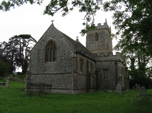
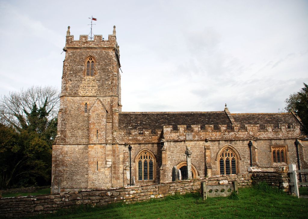
| Description | : | Church of Saint Laurence, Holwell, West Dorset on Sherborne DT9 5LB. Holwell is a parish and scattered village sited on Oxford Clay in the Blackmore Vale 6 miles south east of Sherborne. It was formerly a detached part of Somerset, until it was transferred to Dorset in October 1844. Caundle Brook, a small stream, the principle tributary of the River Lydden, flows through the northern part of the parish and here was located the original medieval settlement. It contains the church, a large early 18th century rectory and a few stone cottages, a thatched store, and an inn on... Read More |
frequently asked questions (FAQ):
-
Where is Saint Laurence Churchyard?
Saint Laurence Churchyard is located at Sherborne Holwell, West Dorset District ,Dorset , DT 9 5LBEngland.
-
Saint Laurence Churchyard cemetery's updated grave count on graveviews.com?
0 memorials
-
Where are the coordinates of the Saint Laurence Churchyard?
Latitude: 50.9063460
Longitude: -2.4288180
Nearby Cemetories:
1. Bishop's Caundle Extension Cemetery
Bishops Caundle, West Dorset District, England
Coordinate: 50.9169370, -2.4343580
2. Bishops Caundle
Bishops Caundle, West Dorset District, England
Coordinate: 50.9171310, -2.4336400
3. St Barnabas Church
Stock Gaylard, North Dorset District, England
Coordinate: 50.9148900, -2.3968200
4. St. Peter and St. Paul's Churchyard
Caundle Marsh, West Dorset District, England
Coordinate: 50.9176840, -2.4596680
5. Saint Barnabas Churchyard
Lydlinch, North Dorset District, England
Coordinate: 50.9157030, -2.3961520
6. Stourton Caundle Civic Cemetery
Stourton Caundle, North Dorset District, England
Coordinate: 50.9349030, -2.4065510
7. St. Peter's Churchyard
Stourton Caundle, North Dorset District, England
Coordinate: 50.9354210, -2.4080470
8. St. Thomas A' Beckett Churchyard
Pulham, North Dorset District, England
Coordinate: 50.8753720, -2.4111670
9. St Lawrence Churchyard
Folke, West Dorset District, England
Coordinate: 50.9179430, -2.4854020
10. St. Mary's Churchyard
Glanvilles Wootton, North Dorset District, England
Coordinate: 50.8717800, -2.4558510
11. St. Thomas A. Beckett Churchyard
Lydlinch, North Dorset District, England
Coordinate: 50.9190370, -2.3675640
12. Holnest Churchyard
Holnest, West Dorset District, England
Coordinate: 50.8870090, -2.4895200
13. St. Catherine's Churchyard
Haydon, West Dorset District, England
Coordinate: 50.9404290, -2.4702910
14. St. Mary Magdalene Churchyard
North Wootton, West Dorset District, England
Coordinate: 50.9281260, -2.4895320
15. Long Burton Methodist Churchyard
Longburton, West Dorset District, England
Coordinate: 50.9074120, -2.4988250
16. St. James The Great Churchyard
Longburton, West Dorset District, England
Coordinate: 50.9130390, -2.5010040
17. Purse Caundle Civic Cemetery
Purse Caundle, West Dorset District, England
Coordinate: 50.9553680, -2.4327770
18. St. Peter's Churchyard
Purse Caundle, West Dorset District, England
Coordinate: 50.9569440, -2.4342330
19. St. Peter's Churchyard
Goathill, West Dorset District, England
Coordinate: 50.9534230, -2.4628960
20. St. Mary and St. James Churchyard
Hazelbury Bryan, North Dorset District, England
Coordinate: 50.8736000, -2.3520000
21. Holy Rood Churchyard
Buckland Newton, West Dorset District, England
Coordinate: 50.8461660, -2.4453910
22. All Saints Church, Fifehead Neville
Fifehead Neville, North Dorset District, England
Coordinate: 50.8980180, -2.3312380
23. All Saints
Fifehead Neville, North Dorset District, England
Coordinate: 50.8980320, -2.3311970
24. St Peter and St Paul Churchyard
Mappowder, North Dorset District, England
Coordinate: 50.8527740, -2.3773230


