
| Memorials | : | 3 |
| Location | : | Harringworth, East Northamptonshire Borough, England |
| Coordinate | : | 52.5671000, -0.6491000 |
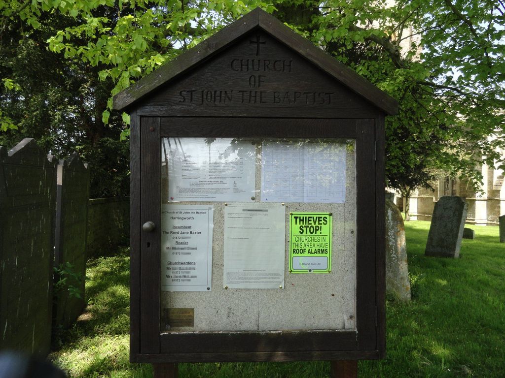
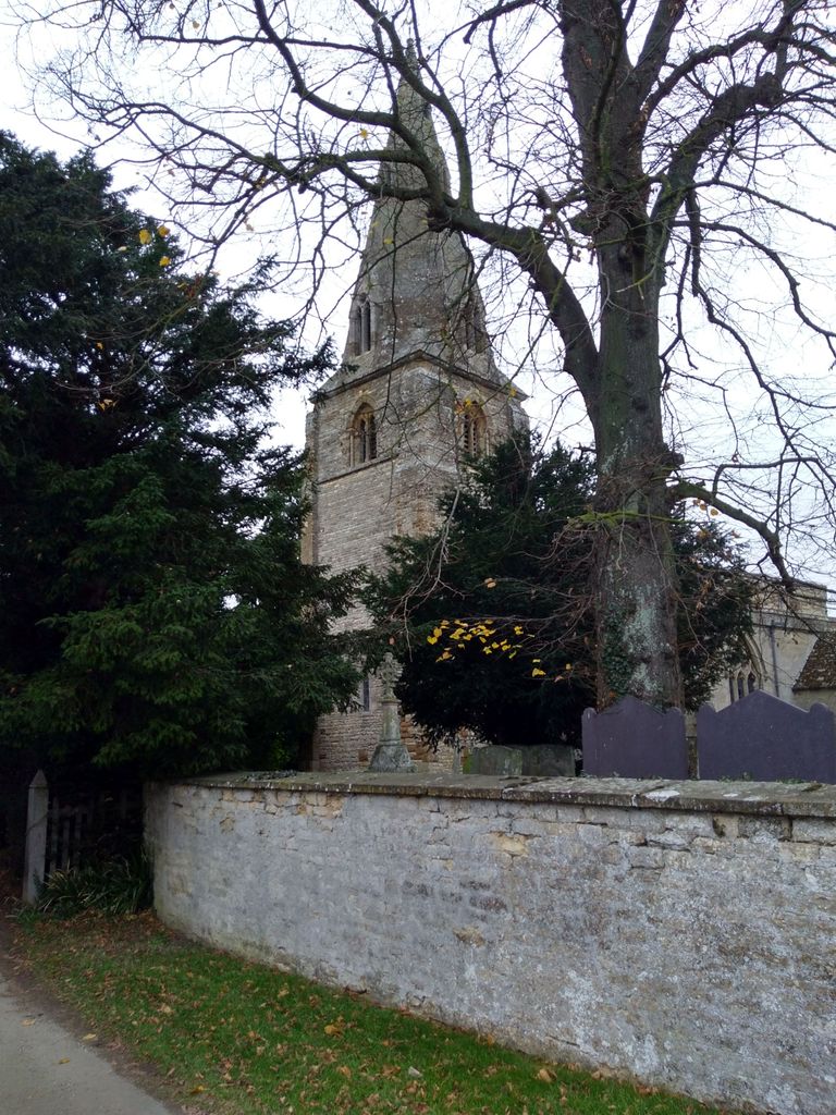
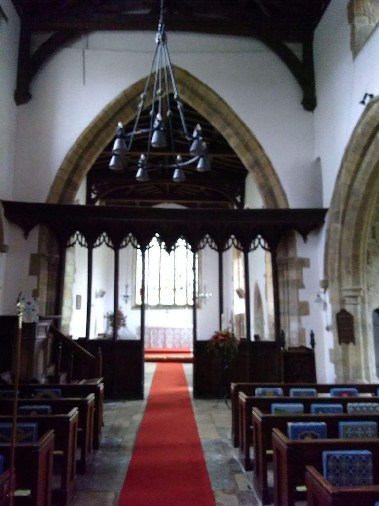
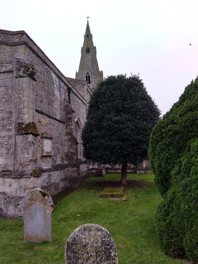
| Description | : | St. John The Baptist church dates back to the 12th Century but underwent a thorough restoration during the 19th century which was completed by 1892. The inside of the church contains mural tablets dedicated to the Blaydes family while the North Aisle contains a vault for members of the Tryon family. A quick survey of the churchyard would reveal many weather worn headstones the bulk of which bear the surnames; Bradshaw, Cant, Clarke, Dams, Hackett, Ward and Wyman. This is by no means a comprehensive list and it should be possible, using the right kind of light, to read most... Read More |
frequently asked questions (FAQ):
-
Where is Saint John The Baptist Churchyard?
Saint John The Baptist Churchyard is located at Seaton Road Harringworth, East Northamptonshire Borough ,Northamptonshire , NN17 3AFEngland.
-
Saint John The Baptist Churchyard cemetery's updated grave count on graveviews.com?
3 memorials
-
Where are the coordinates of the Saint John The Baptist Churchyard?
Latitude: 52.5671000
Longitude: -0.6491000


Nearby Cemetories:
1. All Hallows Churchyard
Seaton, Rutland Unitary Authority, England
Coordinate: 52.5745730, -0.6670810
2. St Mary the Virgin Churchyard
Morcott, Rutland Unitary Authority, England
Coordinate: 52.5967800, -0.6366200
3. St. James Churchyard
Gretton, Corby Borough, England
Coordinate: 52.5403000, -0.6763400
4. All Saints Churchyard
Laxton, East Northamptonshire Borough, England
Coordinate: 52.5535760, -0.5992450
5. St. Andrew's Churchyard
Glaston, Rutland Unitary Authority, England
Coordinate: 52.5953628, -0.6781534
6. St. Peter's Churchyard
Barrowden, Rutland Unitary Authority, England
Coordinate: 52.5888800, -0.6063600
7. Church of Saint John the Baptist
Wakerley, East Northamptonshire Borough, England
Coordinate: 52.5817323, -0.5929850
8. St Mary the Virgin Churchyard
South Luffenham, Rutland Unitary Authority, England
Coordinate: 52.6067200, -0.6114100
9. Uppingham Lawn Cemetery
Uppingham, Rutland Unitary Authority, England
Coordinate: 52.5855800, -0.7229700
10. St. Peter and St. Paul's Churchyard
Uppingham, Rutland Unitary Authority, England
Coordinate: 52.5873820, -0.7221660
11. St Nicholas Churchyard
Pilton, Rutland Unitary Authority, England
Coordinate: 52.6165200, -0.6504100
12. St. Nicholas' Churchyard
Bulwick, East Northamptonshire Borough, England
Coordinate: 52.5376000, -0.5818000
13. Deene Park
Deene, East Northamptonshire Borough, England
Coordinate: 52.5242960, -0.6010350
14. Saint Peter's Churchyard
Deene, East Northamptonshire Borough, England
Coordinate: 52.5242490, -0.5984740
15. Holy Trinity Churchyard
Blatherwycke, East Northamptonshire Borough, England
Coordinate: 52.5514375, -0.5646654
16. St. Peter and St. Paul's Churchyard
Wing, Rutland Unitary Authority, England
Coordinate: 52.6172140, -0.6814150
17. St. John The Baptist Church
North Luffenham, Rutland Unitary Authority, England
Coordinate: 52.6186570, -0.6211140
18. St. John the Evangelist Churchyard
Caldecott, Rutland Unitary Authority, England
Coordinate: 52.5341600, -0.7213400
19. St Andrew Churchyard
Stoke Dry, Rutland Unitary Authority, England
Coordinate: 52.5620632, -0.7394099
20. St. Mary the Virgin Churchyard
Uppingham, Rutland Unitary Authority, England
Coordinate: 52.5996800, -0.7324400
21. St Peter & Paul Churchyard
Preston, Rutland Unitary Authority, England
Coordinate: 52.6122600, -0.7162560
22. Leicester Road Cemetery
Uppingham, Rutland Unitary Authority, England
Coordinate: 52.5975766, -0.7413414
23. Shire Lodge Cemetery
Corby, Corby Borough, England
Coordinate: 52.5073610, -0.7084990
24. Church of St Mary
Duddington, East Northamptonshire Borough, England
Coordinate: 52.5969190, -0.5432540