
| Memorials | : | 2 |
| Location | : | Gretton, Corby Borough, England |
| Coordinate | : | 52.5403000, -0.6763400 |
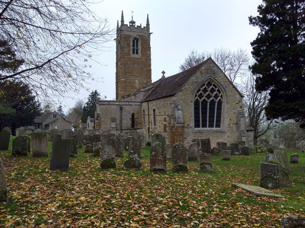
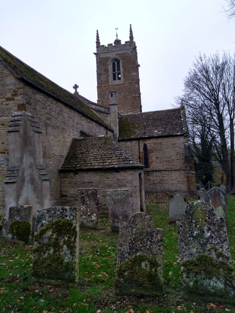
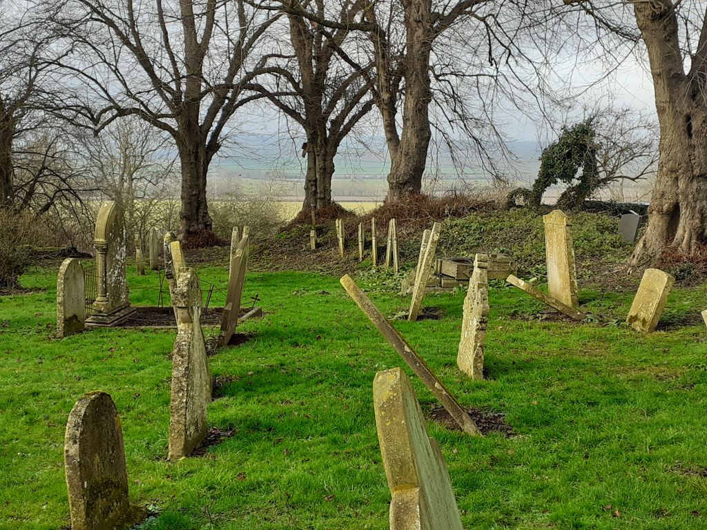
| Description | : | The main building of the church dates to the 11th century, and the surrounding churchyard has gravestones dating back to the 17th century. The 15th century church tower has unusual Norman arches, round pillars, and highly unusual irregular shaped east window. Several tombs and tombstones are of note. The burial vaults of the Hatton family of nearby Kirby Hall are located on the east end of the church, and required that the chancel floor be raised in the 18th century in order to accommodate the tombs. Another tomb, located in the churchyard to the east of the porch, remembers a... Read More |
frequently asked questions (FAQ):
-
Where is St. James Churchyard?
St. James Churchyard is located at Station Road Gretton, Corby Borough ,Northamptonshire , NN17 3BUEngland.
-
St. James Churchyard cemetery's updated grave count on graveviews.com?
2 memorials
-
Where are the coordinates of the St. James Churchyard?
Latitude: 52.5403000
Longitude: -0.6763400


Nearby Cemetories:
1. St. John the Evangelist Churchyard
Caldecott, Rutland Unitary Authority, England
Coordinate: 52.5341600, -0.7213400
2. Saint John The Baptist Churchyard
Harringworth, East Northamptonshire Borough, England
Coordinate: 52.5671000, -0.6491000
3. All Hallows Churchyard
Seaton, Rutland Unitary Authority, England
Coordinate: 52.5745730, -0.6670810
4. Shire Lodge Cemetery
Corby, Corby Borough, England
Coordinate: 52.5073610, -0.7084990
5. St Andrew Churchyard
Stoke Dry, Rutland Unitary Authority, England
Coordinate: 52.5620632, -0.7394099
6. Independant Chapel Cemetery
Great Easton, Harborough District, England
Coordinate: 52.5268820, -0.7472440
7. St. Andrew Churchyard Extension
Hallaton, Harborough District, England
Coordinate: 52.5308470, -0.7505850
8. St. Andrew's Churchyard
Great Easton, Harborough District, England
Coordinate: 52.5288590, -0.7525630
9. Deene Park
Deene, East Northamptonshire Borough, England
Coordinate: 52.5242960, -0.6010350
10. All Saints Churchyard
Laxton, East Northamptonshire Borough, England
Coordinate: 52.5535760, -0.5992450
11. Saint Peter's Churchyard
Deene, East Northamptonshire Borough, England
Coordinate: 52.5242490, -0.5984740
12. Uppingham Lawn Cemetery
Uppingham, Rutland Unitary Authority, England
Coordinate: 52.5855800, -0.7229700
13. St. Peter and St. Paul's Churchyard
Uppingham, Rutland Unitary Authority, England
Coordinate: 52.5873820, -0.7221660
14. Saint Nicholas Cemetery
Bringhurst, Harborough District, England
Coordinate: 52.5216700, -0.7614220
15. St. Andrew's Churchyard
Glaston, Rutland Unitary Authority, England
Coordinate: 52.5953628, -0.6781534
16. Saint Nicholas Churchyard
Bringhurst, Harborough District, England
Coordinate: 52.5208900, -0.7613600
17. St. Nicholas' Churchyard
Bulwick, East Northamptonshire Borough, England
Coordinate: 52.5376000, -0.5818000
18. St Mary the Virgin Churchyard
Morcott, Rutland Unitary Authority, England
Coordinate: 52.5967800, -0.6366200
19. St Mary Magdalene
Cottingham, Corby Borough, England
Coordinate: 52.5008296, -0.7551008
20. St. Peter's Churchyard
Stockerston, Harborough District, England
Coordinate: 52.5687800, -0.7706600
21. St. Peter's Churchyard
Barrowden, Rutland Unitary Authority, England
Coordinate: 52.5888800, -0.6063600
22. Church of Saint John the Baptist
Wakerley, East Northamptonshire Borough, England
Coordinate: 52.5817323, -0.5929850
23. St. Mary the Virgin Churchyard
Uppingham, Rutland Unitary Authority, England
Coordinate: 52.5996800, -0.7324400
24. Holy Trinity Churchyard
Blatherwycke, East Northamptonshire Borough, England
Coordinate: 52.5514375, -0.5646654