
| Memorials | : | 0 |
| Location | : | West Dean, Chichester District, England |
| Coordinate | : | 50.9065650, -0.7762740 |
| Description | : | This village is not to be confused with the West Dean in East Sussex. West Dean is a village and civil parish in the District of Chichester in West Sussex, England located 7.5 kilometres (4.7 mi) north of Chichester on the A286 road just west of Singleton. The parish includes the hamlets of Binderton and Chilgrove. |
frequently asked questions (FAQ):
-
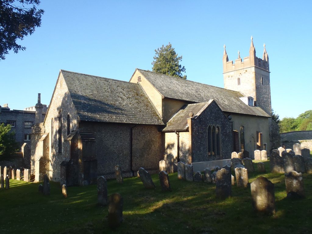
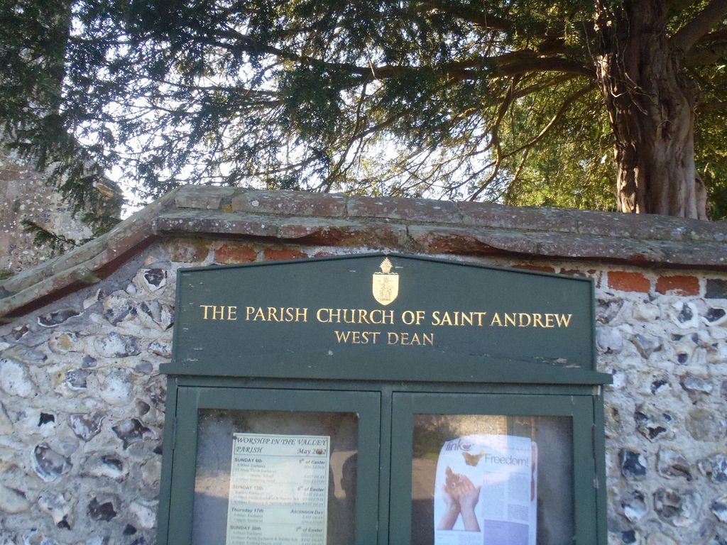
Where is St Andrews Churchyard?
St Andrews Churchyard is located at West Dean, Chichester District ,West Sussex ,England.
-
St Andrews Churchyard cemetery's updated grave count on graveviews.com?
0 memorials
-
Where are the coordinates of the St Andrews Churchyard?
Latitude: 50.9065650
Longitude: -0.7762740

Nearby Cemetories:
1. West Dean Cemetery
West Dean, Chichester District, England
Coordinate: 50.9060300, -0.7796100
2. Saint Mary's Churchyard
Lavant, Chichester District, England
Coordinate: 50.8694800, -0.7764350
3. All Saints Churchyard
East Dean, Chichester District, England
Coordinate: 50.9111110, -0.7136340
4. Goodwood House
Chichester, Chichester District, England
Coordinate: 50.8723110, -0.7394830
5. St Andrews Churchyard
Funtington, Chichester District, England
Coordinate: 50.8721430, -0.8268280
6. Goodwood Motor Circuit Cemetery
Chichester, Chichester District, England
Coordinate: 50.8579000, -0.7538800
7. St Mary Churchyard
Bepton, Chichester District, England
Coordinate: 50.9576460, -0.7837500
8. St. Andrew's Churchyard
Didling, Chichester District, England
Coordinate: 50.9564810, -0.8126515
9. St Marys Churchyard
Funtington, Chichester District, England
Coordinate: 50.8576010, -0.8168180
10. St James Churchyard
Heyshott, Chichester District, England
Coordinate: 50.9556210, -0.7238880
11. St Peter Churchyard
Westhampnett, Chichester District, England
Coordinate: 50.8483570, -0.7501950
12. St Mary and St Blaise Church
Boxgrove, Chichester District, England
Coordinate: 50.8599300, -0.7110320
13. Chichester Crematorium and Garden of Remembrance
Chichester, Chichester District, England
Coordinate: 50.8438740, -0.7593710
14. Portfield Cemetery
Chichester, Chichester District, England
Coordinate: 50.8408650, -0.7581440
15. St Mary Churchyard
Funtington, Chichester District, England
Coordinate: 50.8673510, -0.8634900
16. St Andrew Churchyard
Tangmere, Chichester District, England
Coordinate: 50.8479850, -0.7207170
17. St Andrew Oxmarket Churchyard
Chichester, Chichester District, England
Coordinate: 50.8366000, -0.7769000
18. Chichester Cathedral
Chichester, Chichester District, England
Coordinate: 50.8362579, -0.7806380
19. St Mary the Virgin
Upwaltham, Chichester District, England
Coordinate: 50.9164000, -0.6600810
20. St Mary Magdelene Churchyard
West Lavington, Chichester District, England
Coordinate: 50.9773640, -0.7311840
21. St Andrew Churchyard and Extension
Oving, Chichester District, England
Coordinate: 50.8379190, -0.7219220
22. St. Mary's Churchyard
Chichester, Chichester District, England
Coordinate: 50.8300340, -0.7659220
23. St. Paul's Churchyard
Elsted, Chichester District, England
Coordinate: 50.9720678, -0.8403674
24. St Peter's Church Raction
Bosham, Chichester District, England
Coordinate: 50.8771050, -0.8931000