
| Memorials | : | 0 |
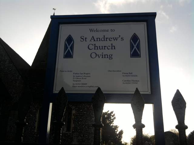
| Location | : | Oving, Chichester District, England |
| Coordinate | : | 50.8379190, -0.7219220 |
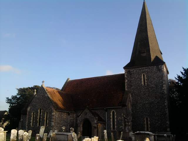
| Description | : | Oving Church has alot of per 1870s graves in some dating back to 1700s Oving church Extension was Consecrated in 1872, is 110 yards East of the Churchyard, across the lane From the Church. |
frequently asked questions (FAQ):
-
Where is St Andrew Churchyard and Extension?
St Andrew Churchyard and Extension is located at Church Lane Oving, Chichester District ,West Sussex ,England.
-
St Andrew Churchyard and Extension cemetery's updated grave count on graveviews.com?
0 memorials
-
Where are the coordinates of the St Andrew Churchyard and Extension?
Latitude: 50.8379190
Longitude: -0.7219220

Nearby Cemetories:
1. St Andrew Churchyard
Tangmere, Chichester District, England
Coordinate: 50.8479850, -0.7207170
2. St Mary Churchyard
Aldingbourne, Arun District, England
Coordinate: 50.8436400, -0.6935500
3. St Peter Churchyard
Westhampnett, Chichester District, England
Coordinate: 50.8483570, -0.7501950
4. St Mary and St Blaise Church
Boxgrove, Chichester District, England
Coordinate: 50.8599300, -0.7110320
5. Portfield Cemetery
Chichester, Chichester District, England
Coordinate: 50.8408650, -0.7581440
6. Chichester Crematorium and Garden of Remembrance
Chichester, Chichester District, England
Coordinate: 50.8438740, -0.7593710
7. Goodwood Motor Circuit Cemetery
Chichester, Chichester District, England
Coordinate: 50.8579000, -0.7538800
8. St. Mary's Churchyard
Chichester, Chichester District, England
Coordinate: 50.8300340, -0.7659220
9. St Andrew Oxmarket Churchyard
Chichester, Chichester District, England
Coordinate: 50.8366000, -0.7769000
10. St. Stephen Churchyard
North Mundham, Chichester District, England
Coordinate: 50.8122060, -0.7603850
11. Goodwood House
Chichester, Chichester District, England
Coordinate: 50.8723110, -0.7394830
12. Chichester Cathedral
Chichester, Chichester District, England
Coordinate: 50.8362579, -0.7806380
13. Saint George's Churchyard
Eastergate, Arun District, England
Coordinate: 50.8379600, -0.6592400
14. Chalcraft Lane Cemetery
Bersted, Arun District, England
Coordinate: 50.7960950, -0.7002410
15. Saint Mary's Churchyard
Lavant, Chichester District, England
Coordinate: 50.8694800, -0.7764350
16. St Mary The Virgin Churchyard
Barnham, Arun District, England
Coordinate: 50.8236310, -0.6436550
17. St Mary Magdalene Churchyard
South Bersted, Arun District, England
Coordinate: 50.7940070, -0.6751900
18. Bognor Regis Old Cemetery
Bognor Regis, Arun District, England
Coordinate: 50.7907867, -0.6811950
19. St Mary Churchyard
Slindon, Arun District, England
Coordinate: 50.8666480, -0.6355800
20. St Richards Catholic Churchyard
Slindon, Arun District, England
Coordinate: 50.8680000, -0.6359000
21. St Marys Churchyard
Funtington, Chichester District, England
Coordinate: 50.8576010, -0.8168180
22. St Mary Churchyard
Walberton, Arun District, England
Coordinate: 50.8436840, -0.6186680
23. All Saints Churchyard
East Dean, Chichester District, England
Coordinate: 50.9111110, -0.7136340
24. St. Mary the Virgin
Yapton, Arun District, England
Coordinate: 50.8230000, -0.6076000