
| Memorials | : | 0 |
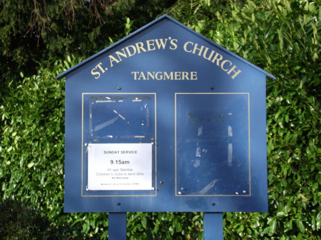
| Location | : | Tangmere, Chichester District, England |
| Coordinate | : | 50.8479850, -0.7207170 |
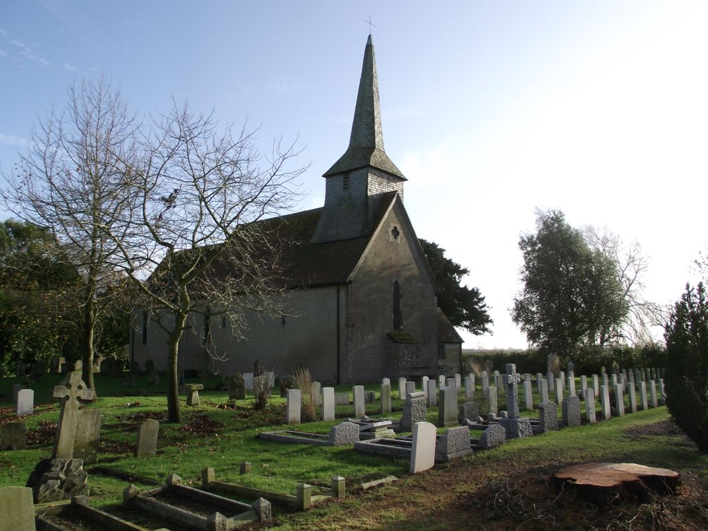
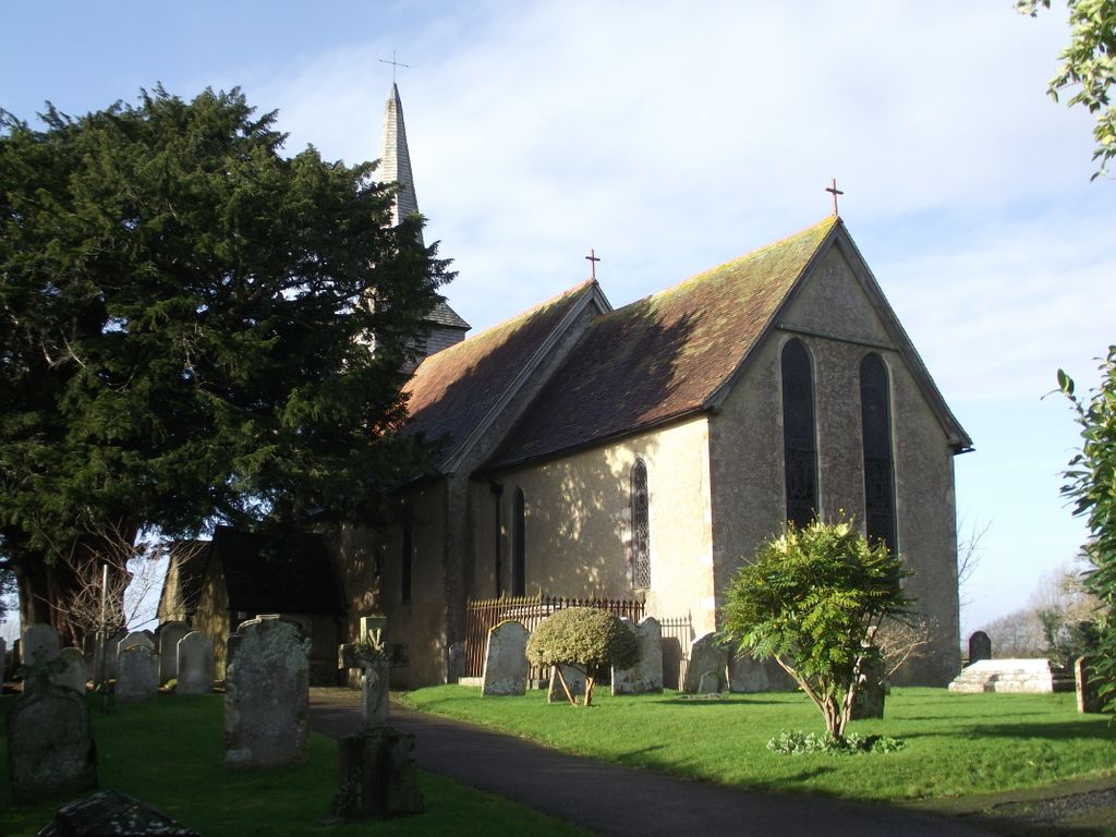
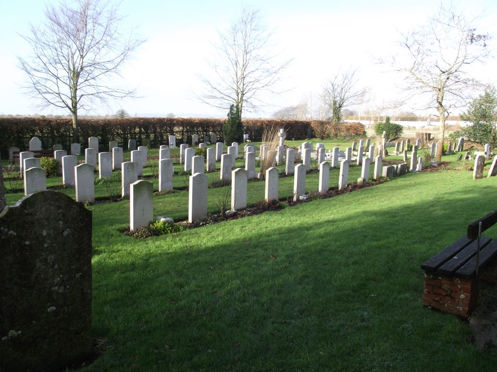
| Description | : | Tangmere is a small village and parish in the Rural District of Chichester, 66 miles south-west of London. It is 3 miles north-east of the city of Chichester. The Churchyard of St. Andrew, which belongs to the ecclesiastical authorities, adjoins the R.A.F. Aerodrome at Tangmere and the Rector is the Station Chaplain. It has been used for the burial of airmen from this station both before and since the 1939-1945 War. There are 39 Commonwealth burials of the 1939-1945 War, all airmen, 1 of whom is unidentified. There are 13 German Air Force burials here, 1 of whom is unidentified.... Read More |
frequently asked questions (FAQ):
-
Where is St Andrew Churchyard?
St Andrew Churchyard is located at Tangmere, Chichester District ,West Sussex ,England.
-
St Andrew Churchyard cemetery's updated grave count on graveviews.com?
0 memorials
-
Where are the coordinates of the St Andrew Churchyard?
Latitude: 50.8479850
Longitude: -0.7207170
Nearby Cemetories:
1. St Andrew Churchyard and Extension
Oving, Chichester District, England
Coordinate: 50.8379190, -0.7219220
2. St Mary and St Blaise Church
Boxgrove, Chichester District, England
Coordinate: 50.8599300, -0.7110320
3. St Mary Churchyard
Aldingbourne, Arun District, England
Coordinate: 50.8436400, -0.6935500
4. St Peter Churchyard
Westhampnett, Chichester District, England
Coordinate: 50.8483570, -0.7501950
5. Goodwood Motor Circuit Cemetery
Chichester, Chichester District, England
Coordinate: 50.8579000, -0.7538800
6. Portfield Cemetery
Chichester, Chichester District, England
Coordinate: 50.8408650, -0.7581440
7. Chichester Crematorium and Garden of Remembrance
Chichester, Chichester District, England
Coordinate: 50.8438740, -0.7593710
8. Goodwood House
Chichester, Chichester District, England
Coordinate: 50.8723110, -0.7394830
9. St. Mary's Churchyard
Chichester, Chichester District, England
Coordinate: 50.8300340, -0.7659220
10. St Andrew Oxmarket Churchyard
Chichester, Chichester District, England
Coordinate: 50.8366000, -0.7769000
11. Chichester Cathedral
Chichester, Chichester District, England
Coordinate: 50.8362579, -0.7806380
12. Saint George's Churchyard
Eastergate, Arun District, England
Coordinate: 50.8379600, -0.6592400
13. Saint Mary's Churchyard
Lavant, Chichester District, England
Coordinate: 50.8694800, -0.7764350
14. St. Stephen Churchyard
North Mundham, Chichester District, England
Coordinate: 50.8122060, -0.7603850
15. Chalcraft Lane Cemetery
Bersted, Arun District, England
Coordinate: 50.7960950, -0.7002410
16. St Mary The Virgin Churchyard
Barnham, Arun District, England
Coordinate: 50.8236310, -0.6436550
17. St Mary Churchyard
Slindon, Arun District, England
Coordinate: 50.8666480, -0.6355800
18. St Richards Catholic Churchyard
Slindon, Arun District, England
Coordinate: 50.8680000, -0.6359000
19. St Mary Magdalene Churchyard
South Bersted, Arun District, England
Coordinate: 50.7940070, -0.6751900
20. St Marys Churchyard
Funtington, Chichester District, England
Coordinate: 50.8576010, -0.8168180
21. Bognor Regis Old Cemetery
Bognor Regis, Arun District, England
Coordinate: 50.7907867, -0.6811950
22. All Saints Churchyard
East Dean, Chichester District, England
Coordinate: 50.9111110, -0.7136340
23. St Mary Churchyard
Walberton, Arun District, England
Coordinate: 50.8436840, -0.6186680
24. St Andrews Churchyard
West Dean, Chichester District, England
Coordinate: 50.9065650, -0.7762740