
| Memorials | : | 0 |
| Location | : | Boxgrove, Chichester District, England |
| Coordinate | : | 50.8599300, -0.7110320 |
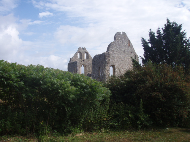
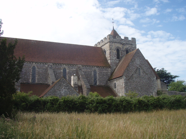
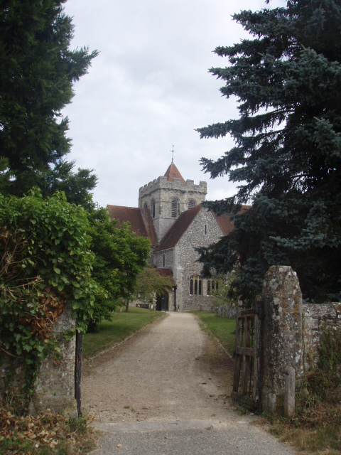
| Description | : | Description: Founded about 1066 by Robert de Haye, who in 1105 bestowed the church of St. Mary of Boxgrove upon the Benedictine Abbey of Lessay. The church and priory were granted to Sir Thomas West, Baron de la Warr and dissolved in 1536. The surviving remains of the priory church is still in use as the parish church of the Church of St Mary and St Blaise. |
frequently asked questions (FAQ):
-
Where is St Mary and St Blaise Church?
St Mary and St Blaise Church is located at Boxgrove, Chichester District ,West Sussex ,England.
-
St Mary and St Blaise Church cemetery's updated grave count on graveviews.com?
0 memorials
-
Where are the coordinates of the St Mary and St Blaise Church?
Latitude: 50.8599300
Longitude: -0.7110320

Nearby Cemetories:
1. St Andrew Churchyard
Tangmere, Chichester District, England
Coordinate: 50.8479850, -0.7207170
2. St Mary Churchyard
Aldingbourne, Arun District, England
Coordinate: 50.8436400, -0.6935500
3. Goodwood House
Chichester, Chichester District, England
Coordinate: 50.8723110, -0.7394830
4. St Andrew Churchyard and Extension
Oving, Chichester District, England
Coordinate: 50.8379190, -0.7219220
5. Goodwood Motor Circuit Cemetery
Chichester, Chichester District, England
Coordinate: 50.8579000, -0.7538800
6. St Peter Churchyard
Westhampnett, Chichester District, England
Coordinate: 50.8483570, -0.7501950
7. Chichester Crematorium and Garden of Remembrance
Chichester, Chichester District, England
Coordinate: 50.8438740, -0.7593710
8. Portfield Cemetery
Chichester, Chichester District, England
Coordinate: 50.8408650, -0.7581440
9. Saint George's Churchyard
Eastergate, Arun District, England
Coordinate: 50.8379600, -0.6592400
10. Saint Mary's Churchyard
Lavant, Chichester District, England
Coordinate: 50.8694800, -0.7764350
11. St. Mary's Churchyard
Chichester, Chichester District, England
Coordinate: 50.8300340, -0.7659220
12. St Andrew Oxmarket Churchyard
Chichester, Chichester District, England
Coordinate: 50.8366000, -0.7769000
13. St Mary Churchyard
Slindon, Arun District, England
Coordinate: 50.8666480, -0.6355800
14. St Richards Catholic Churchyard
Slindon, Arun District, England
Coordinate: 50.8680000, -0.6359000
15. Chichester Cathedral
Chichester, Chichester District, England
Coordinate: 50.8362579, -0.7806380
16. All Saints Churchyard
East Dean, Chichester District, England
Coordinate: 50.9111110, -0.7136340
17. St Mary The Virgin Churchyard
Barnham, Arun District, England
Coordinate: 50.8236310, -0.6436550
18. St. Stephen Churchyard
North Mundham, Chichester District, England
Coordinate: 50.8122060, -0.7603850
19. St Mary Churchyard
Walberton, Arun District, England
Coordinate: 50.8436840, -0.6186680
20. St Andrews Churchyard
West Dean, Chichester District, England
Coordinate: 50.9065650, -0.7762740
21. West Dean Cemetery
West Dean, Chichester District, England
Coordinate: 50.9060300, -0.7796100
22. Chalcraft Lane Cemetery
Bersted, Arun District, England
Coordinate: 50.7960950, -0.7002410
23. St Mary the Virgin
Upwaltham, Chichester District, England
Coordinate: 50.9164000, -0.6600810
24. St Marys Churchyard
Funtington, Chichester District, England
Coordinate: 50.8576010, -0.8168180