
| Memorials | : | 0 |
| Location | : | Ranmore Common, Mole Valley District, England |
| Website | : | ranmorewarmemorial.info/st-barnabas-church/ |
| Coordinate | : | 51.2419730, -0.3602730 |
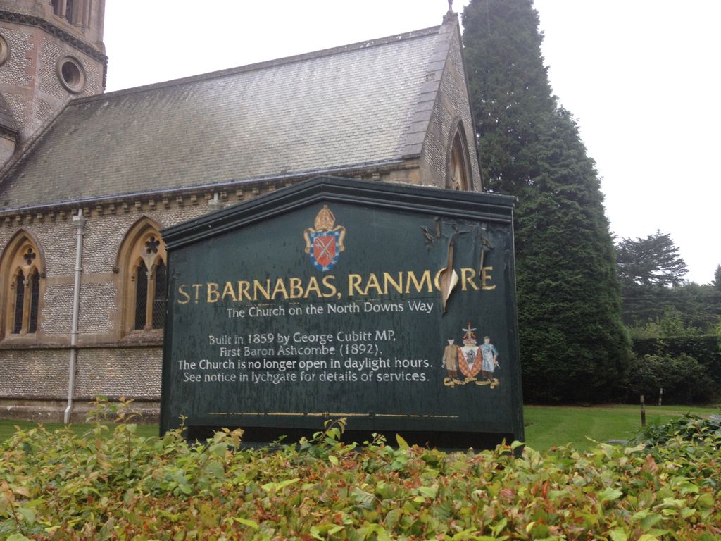
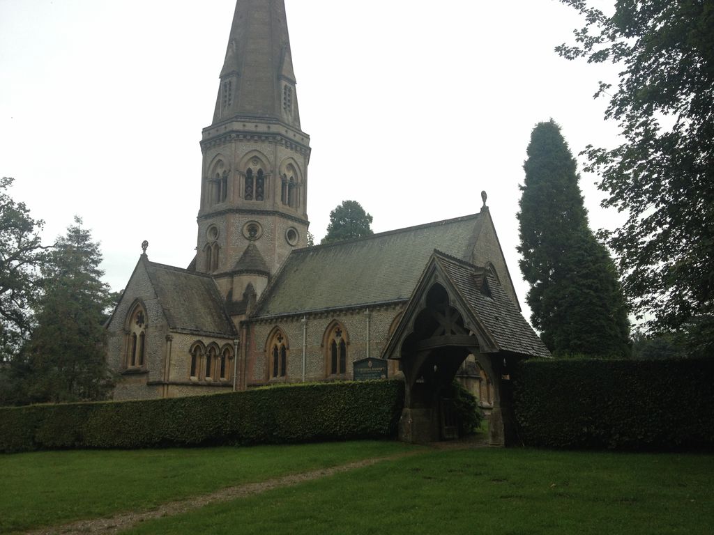
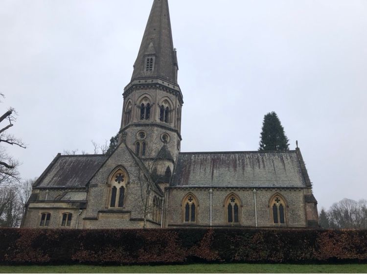
| Description | : | Ranmore Common is a village and an area of wooded common land on the North Downs, to the northwest of Dorking in the English county of Surrey. It is located within the civil parish of Wotton and is also within the Surrey Hills Area of Outstanding Natural Beauty. It is also a Site of Special Scientific Interest. St Barnabas Church has several notable burials including Sir Harry Hylton-Foster. |
frequently asked questions (FAQ):
-
Where is St. Barnabas Churchyard?
St. Barnabas Churchyard is located at N Downs Way Ranmore Common, Mole Valley District ,Surrey ,England.
-
St. Barnabas Churchyard cemetery's updated grave count on graveviews.com?
0 memorials
-
Where are the coordinates of the St. Barnabas Churchyard?
Latitude: 51.2419730
Longitude: -0.3602730
Nearby Cemetories:
1. Polesden Lacey Estate
Great Bookham, Mole Valley District, England
Coordinate: 51.2591310, -0.3718630
2. Polesden Lacey Estate Pet Cemetery
Great Bookham, Mole Valley District, England
Coordinate: 51.2592260, -0.3718640
3. Holy Trinity Churchyard, Westcott
Dorking, Mole Valley District, England
Coordinate: 51.2236075, -0.3694870
4. St Martin Churchyard
Dorking, Mole Valley District, England
Coordinate: 51.2326360, -0.3320140
5. Dorking Cemetery
Dorking, Mole Valley District, England
Coordinate: 51.2365646, -0.3189580
6. Deepdene Mausoleum
Dorking, Mole Valley District, England
Coordinate: 51.2307590, -0.3206630
7. St John the Evangelist Churchyard
Wotton, Mole Valley District, England
Coordinate: 51.2198770, -0.3895890
8. St Michael Churchyard
Mickleham, Mole Valley District, England
Coordinate: 51.2675150, -0.3233720
9. St Lawrence Churchyard
Effingham, Guildford Borough, England
Coordinate: 51.2712010, -0.3984180
10. St Nicolas Parish Churchyard
Great Bookham, Mole Valley District, England
Coordinate: 51.2798220, -0.3739870
11. All Saints Churchyard
Little Bookham, Mole Valley District, England
Coordinate: 51.2826900, -0.3864790
12. St Mary Churchyard
Fetcham, Mole Valley District, England
Coordinate: 51.2881290, -0.3525500
13. St James Churchyard
Abinger, Mole Valley District, England
Coordinate: 51.2017820, -0.4056060
14. St. Martin's Churchyard
East Horsley, Guildford Borough, England
Coordinate: 51.2638550, -0.4314040
15. St Mary and St Nicholas Churchyard
Leatherhead, Mole Valley District, England
Coordinate: 51.2925810, -0.3269850
16. St Mary Churchyard
West Horsley, Guildford Borough, England
Coordinate: 51.2622470, -0.4417370
17. St Mary Magdalene Churchyard
South Holmwood, Mole Valley District, England
Coordinate: 51.1904660, -0.3243540
18. Betchworth Parish Council Burial Ground
Betchworth, Mole Valley District, England
Coordinate: 51.2349245, -0.2695398
19. St. Michael's Churchyard
Betchworth, Mole Valley District, England
Coordinate: 51.2336480, -0.2673300
20. Christ Church Churchyard
Coldharbour, Mole Valley District, England
Coordinate: 51.1807050, -0.3576190
21. Felday Chapel
Holmbury St Mary, Mole Valley District, England
Coordinate: 51.1900360, -0.4129370
22. Randalls Park Cemetery and Crematorium
Leatherhead, Mole Valley District, England
Coordinate: 51.3035290, -0.3469730
23. St Mary the Virgin Churchyard
Holmbury St Mary, Mole Valley District, England
Coordinate: 51.1882600, -0.4130600
24. Yehudi Menuhin International School
Stoke D'Abernon, Elmbridge Borough, England
Coordinate: 51.3059170, -0.3775720