
| Memorials | : | 0 |
| Location | : | Dorking, Mole Valley District, England |
| Coordinate | : | 51.2365646, -0.3189580 |
frequently asked questions (FAQ):
-
Where is Dorking Cemetery?
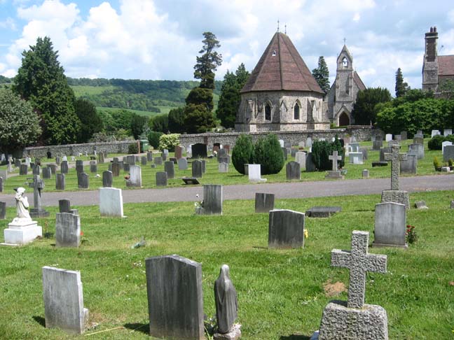
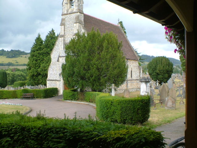
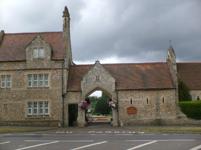
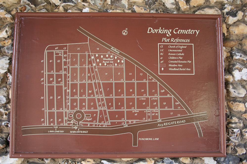
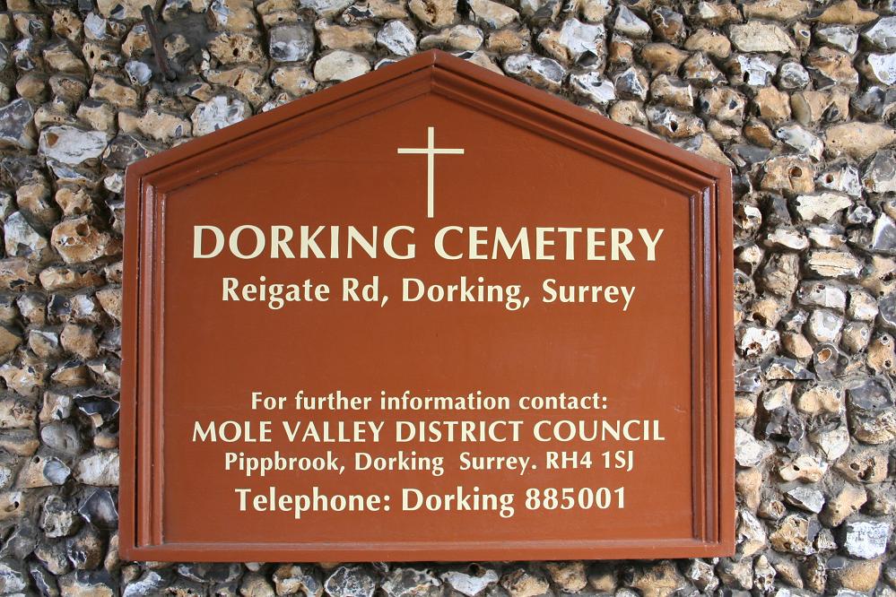
Dorking Cemetery is located at Reigate Road Dorking, Mole Valley District ,Surrey , RH4 1QFEngland.
-
Dorking Cemetery cemetery's updated grave count on graveviews.com?
0 memorials
-
Where are the coordinates of the Dorking Cemetery?
Latitude: 51.2365646
Longitude: -0.3189580
Nearby Cemetories:
1. Deepdene Mausoleum
Dorking, Mole Valley District, England
Coordinate: 51.2307590, -0.3206630
2. St Martin Churchyard
Dorking, Mole Valley District, England
Coordinate: 51.2326360, -0.3320140
3. St. Barnabas Churchyard
Ranmore Common, Mole Valley District, England
Coordinate: 51.2419730, -0.3602730
4. Betchworth Parish Council Burial Ground
Betchworth, Mole Valley District, England
Coordinate: 51.2349245, -0.2695398
5. St Michael Churchyard
Mickleham, Mole Valley District, England
Coordinate: 51.2675150, -0.3233720
6. St. Michael's Churchyard
Betchworth, Mole Valley District, England
Coordinate: 51.2336480, -0.2673300
7. Holy Trinity Churchyard, Westcott
Dorking, Mole Valley District, England
Coordinate: 51.2236075, -0.3694870
8. Polesden Lacey Estate
Great Bookham, Mole Valley District, England
Coordinate: 51.2591310, -0.3718630
9. Polesden Lacey Estate Pet Cemetery
Great Bookham, Mole Valley District, England
Coordinate: 51.2592260, -0.3718640
10. St. Mary the Virgin Churchyard
Buckland, Mole Valley District, England
Coordinate: 51.2435590, -0.2511510
11. St Mary Magdalene Churchyard
South Holmwood, Mole Valley District, England
Coordinate: 51.1904660, -0.3243540
12. St John the Evangelist Churchyard
Wotton, Mole Valley District, England
Coordinate: 51.2198770, -0.3895890
13. St Marys Churchyard
Headley, Mole Valley District, England
Coordinate: 51.2799700, -0.2736100
14. St. Bartholomew's Churchyard
Leigh, Mole Valley District, England
Coordinate: 51.2085790, -0.2483520
15. St Nicolas Parish Churchyard
Great Bookham, Mole Valley District, England
Coordinate: 51.2798220, -0.3739870
16. St Mary Churchyard
Fetcham, Mole Valley District, England
Coordinate: 51.2881290, -0.3525500
17. St Mary and St Nicholas Churchyard
Leatherhead, Mole Valley District, England
Coordinate: 51.2925810, -0.3269850
18. St Lawrence Churchyard
Effingham, Guildford Borough, England
Coordinate: 51.2712010, -0.3984180
19. Christ Church Churchyard
Coldharbour, Mole Valley District, England
Coordinate: 51.1807050, -0.3576190
20. All Saints Churchyard
Little Bookham, Mole Valley District, England
Coordinate: 51.2826900, -0.3864790
21. Saint Peter's Church
Walton-on-the-Hill, Reigate and Banstead Borough, England
Coordinate: 51.2817810, -0.2467230
22. St James Churchyard
Abinger, Mole Valley District, England
Coordinate: 51.2017820, -0.4056060
23. Randalls Park Cemetery and Crematorium
Leatherhead, Mole Valley District, England
Coordinate: 51.3035290, -0.3469730
24. St Peter Churchyard
Newdigate, Mole Valley District, England
Coordinate: 51.1652200, -0.2884860