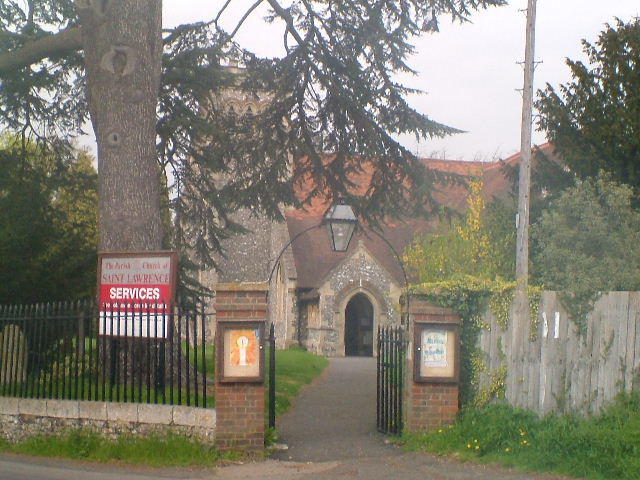
| Memorials | : | 0 |
| Location | : | Effingham, Guildford Borough, England |
| Coordinate | : | 51.2712010, -0.3984180 |
| Description | : | Famous Effingham villagers include Sir Barnes Wallis, inventor of the bouncing bomb which breached the Eder and Moehne dams in the Second World War. He also designed airships including the R100 and invented the geodetic construction of aeroplanes.Wallis lived with his wife Molly in the village for 49 years, and they rest together in the churchyard. |
frequently asked questions (FAQ):
-
Where is St Lawrence Churchyard?
St Lawrence Churchyard is located at Church Street Effingham, Guildford Borough ,Surrey , KT24 5LXEngland.
-
St Lawrence Churchyard cemetery's updated grave count on graveviews.com?
0 memorials
-
Where are the coordinates of the St Lawrence Churchyard?
Latitude: 51.2712010
Longitude: -0.3984180
Nearby Cemetories:
1. All Saints Churchyard
Little Bookham, Mole Valley District, England
Coordinate: 51.2826900, -0.3864790
2. St Nicolas Parish Churchyard
Great Bookham, Mole Valley District, England
Coordinate: 51.2798220, -0.3739870
3. Polesden Lacey Estate Pet Cemetery
Great Bookham, Mole Valley District, England
Coordinate: 51.2592260, -0.3718640
4. Polesden Lacey Estate
Great Bookham, Mole Valley District, England
Coordinate: 51.2591310, -0.3718630
5. St. Martin's Churchyard
East Horsley, Guildford Borough, England
Coordinate: 51.2638550, -0.4314040
6. St Mary Churchyard
West Horsley, Guildford Borough, England
Coordinate: 51.2622470, -0.4417370
7. St Mary Churchyard
Fetcham, Mole Valley District, England
Coordinate: 51.2881290, -0.3525500
8. Yehudi Menuhin International School
Stoke D'Abernon, Elmbridge Borough, England
Coordinate: 51.3059170, -0.3775720
9. St. Barnabas Churchyard
Ranmore Common, Mole Valley District, England
Coordinate: 51.2419730, -0.3602730
10. St Marys Churchyard
Stoke D'Abernon, Elmbridge Borough, England
Coordinate: 51.3139230, -0.3812710
11. St. Matthew's Churchyard
Cobham, Elmbridge Borough, England
Coordinate: 51.3098290, -0.4335730
12. Randalls Park Cemetery and Crematorium
Leatherhead, Mole Valley District, England
Coordinate: 51.3035290, -0.3469730
13. St Michael Churchyard
Mickleham, Mole Valley District, England
Coordinate: 51.2675150, -0.3233720
14. Cobham Municipal Cemetery
Cobham, Elmbridge Borough, England
Coordinate: 51.3204240, -0.3954060
15. St Mary and St Nicholas Churchyard
Leatherhead, Mole Valley District, England
Coordinate: 51.2925810, -0.3269850
16. Holy Trinity Churchyard, Westcott
Dorking, Mole Valley District, England
Coordinate: 51.2236075, -0.3694870
17. St John the Evangelist Churchyard
Wotton, Mole Valley District, England
Coordinate: 51.2198770, -0.3895890
18. All Saints Churchyard
Ockham, Guildford Borough, England
Coordinate: 51.2979900, -0.4710800
19. St Andrew Churchyard
Cobham, Elmbridge Borough, England
Coordinate: 51.3259580, -0.4114970
20. St Martin Churchyard
Dorking, Mole Valley District, England
Coordinate: 51.2326360, -0.3320140
21. Dorking Cemetery
Dorking, Mole Valley District, England
Coordinate: 51.2365646, -0.3189580
22. Deepdene Mausoleum
Dorking, Mole Valley District, England
Coordinate: 51.2307590, -0.3206630
23. St Mary Magdalen Churchyard
Ripley, Guildford Borough, England
Coordinate: 51.2992230, -0.4936400
24. St. James' Churchyard
Shere, Guildford Borough, England
Coordinate: 51.2191210, -0.4634830

