
| Memorials | : | 0 |
| Location | : | Newington, South Oxfordshire District, England |
| Coordinate | : | 51.6638800, -1.1207600 |
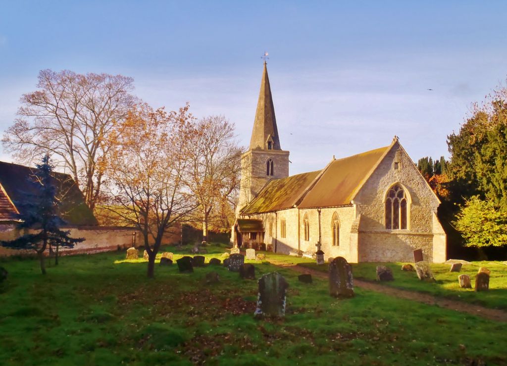
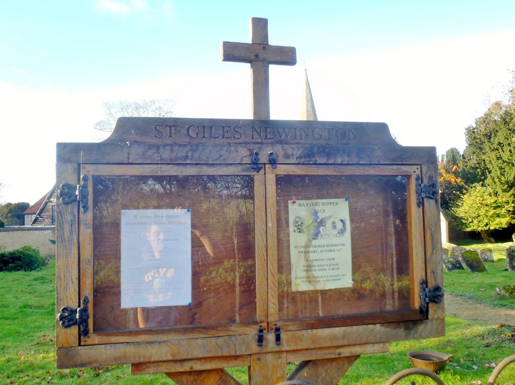
| Description | : | Newington is a village and civil parish in South Oxfordshire, about 4.5 miles (7 km) north of Wallingford. The Church of England parish church of Saint Giles was built in the 12th century, its transepts were added about 1200 and the west tower and spire were added early in the 14th century |
frequently asked questions (FAQ):
-
Where is St Giles Churchyard?
St Giles Churchyard is located at A329 Newington, South Oxfordshire District ,Oxfordshire , OX10 7AGEngland.
-
St Giles Churchyard cemetery's updated grave count on graveviews.com?
0 memorials
-
Where are the coordinates of the St Giles Churchyard?
Latitude: 51.6638800
Longitude: -1.1207600
Nearby Cemetories:
1. St Leonard and St Catherine
Drayton St Leonard, South Oxfordshire District, England
Coordinate: 51.6640020, -1.1387005
2. St John the Baptist Churchyard
Stadhampton, South Oxfordshire District, England
Coordinate: 51.6848390, -1.1279600
3. St Mary's Church Cemetery
Chalgrove, South Oxfordshire District, England
Coordinate: 51.6641000, -1.0802000
4. St Laurence Churchyard
Warborough, South Oxfordshire District, England
Coordinate: 51.6383330, -1.1358310
5. Friends Burying Ground
Warborough, South Oxfordshire District, England
Coordinate: 51.6374080, -1.1354510
6. Dorchester Cemetery
Dorchester, South Oxfordshire District, England
Coordinate: 51.6478130, -1.1649480
7. Dorchester Abbey
Dorchester, South Oxfordshire District, England
Coordinate: 51.6436250, -1.1644290
8. Saint Birinus Catholic Churchyard
Dorchester, South Oxfordshire District, England
Coordinate: 51.6412600, -1.1649100
9. St James Churchyard
Little Milton, South Oxfordshire District, England
Coordinate: 51.7019280, -1.1072800
10. Brightwell Baldwin St Bartholomews Churchyard
Brightwell Baldwin, South Oxfordshire District, England
Coordinate: 51.6500670, -1.0569610
11. Benson War Memorial
Benson, South Oxfordshire District, England
Coordinate: 51.6207890, -1.1108700
12. St. Helen Churchyard Extension
Benson, South Oxfordshire District, England
Coordinate: 51.6201400, -1.1121200
13. St. Helen's Churchyard
Benson, South Oxfordshire District, England
Coordinate: 51.6200200, -1.1127400
14. St. Peter's Churchyard
Little Wittenham, South Oxfordshire District, England
Coordinate: 51.6369880, -1.1830625
15. St Peter Churchyard
Easington, South Oxfordshire District, England
Coordinate: 51.6684300, -1.0443070
16. St Peter Churchyard
Marsh Baldon, South Oxfordshire District, England
Coordinate: 51.6941870, -1.1884550
17. Holy Rood Churchyard
Cuxham, South Oxfordshire District, England
Coordinate: 51.6516250, -1.0376070
18. St Lawrence Churchyard
Toot Baldon, South Oxfordshire District, England
Coordinate: 51.7051720, -1.1750220
19. Saint Mary's Churchyard
Garsington, South Oxfordshire District, England
Coordinate: 51.7140100, -1.1600700
20. Saint James Churchyard
Brightwell cum Sotwell, South Oxfordshire District, England
Coordinate: 51.6120200, -1.1549800
21. St Mary the Virgin Churchyard
Great Milton, South Oxfordshire District, England
Coordinate: 51.7170320, -1.0921100
22. St Michael Churchyard
Clifton Hampden, South Oxfordshire District, England
Coordinate: 51.6558680, -1.2103840
23. St Peter Churchyard
Great Haseley, South Oxfordshire District, England
Coordinate: 51.7102600, -1.0693200
24. St. Mary the Virgin Churchyard
Ewelme, South Oxfordshire District, England
Coordinate: 51.6177310, -1.0674850