
| Memorials | : | 0 |
| Location | : | Stadhampton, South Oxfordshire District, England |
| Coordinate | : | 51.6848390, -1.1279600 |
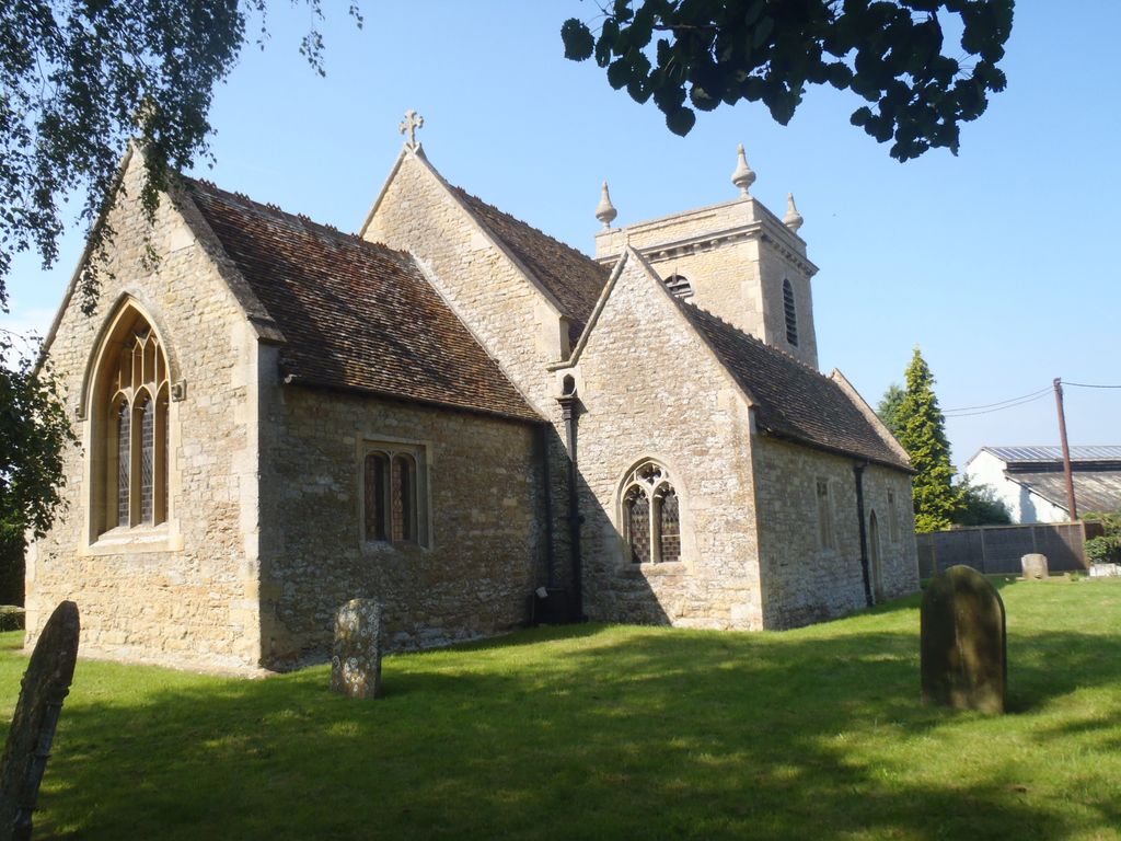
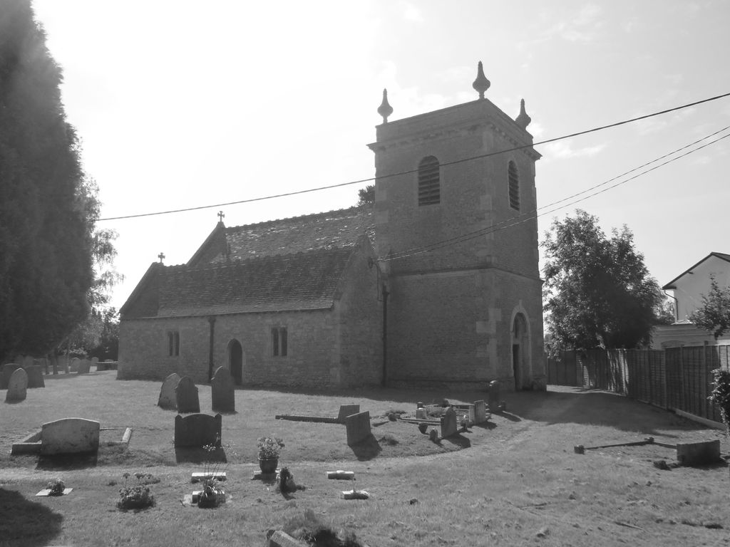
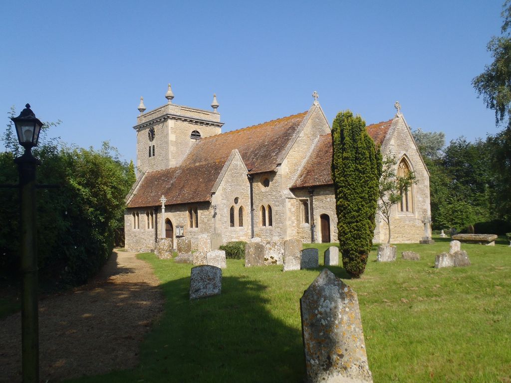
| Description | : | Stadhampton is a village and civil parish about 5 miles (8 km) north of Wallingford, in South Oxfordshire, England. Stadhampton village is on the A329 road and close to the River Thame. The Church of England parish church of Saint John the Baptist dates from the 13th century and was rebuilt and enlarged by the Gothic Revival architect E.G. Bruton in 1875. Since the Reformation St. John's has always had the same parish clergy as St. Mary's, Chiselhampton. The Welsh clergyman and writer John Roberts was priest of both parishes 1798–1803. The tower has a ring of four bells. Henry I Knight... Read More |
frequently asked questions (FAQ):
-
Where is St John the Baptist Churchyard?
St John the Baptist Churchyard is located at Milton Road Stadhampton, South Oxfordshire District ,Oxfordshire ,England.
-
St John the Baptist Churchyard cemetery's updated grave count on graveviews.com?
0 memorials
-
Where are the coordinates of the St John the Baptist Churchyard?
Latitude: 51.6848390
Longitude: -1.1279600
Nearby Cemetories:
1. St James Churchyard
Little Milton, South Oxfordshire District, England
Coordinate: 51.7019280, -1.1072800
2. St Giles Churchyard
Newington, South Oxfordshire District, England
Coordinate: 51.6638800, -1.1207600
3. St Leonard and St Catherine
Drayton St Leonard, South Oxfordshire District, England
Coordinate: 51.6640020, -1.1387005
4. Saint Mary's Churchyard
Garsington, South Oxfordshire District, England
Coordinate: 51.7140100, -1.1600700
5. St Lawrence Churchyard
Toot Baldon, South Oxfordshire District, England
Coordinate: 51.7051720, -1.1750220
6. St Mary's Church Cemetery
Chalgrove, South Oxfordshire District, England
Coordinate: 51.6641000, -1.0802000
7. All Saints Churchyard
Cuddesdon, South Oxfordshire District, England
Coordinate: 51.7230140, -1.1316130
8. St Peter Churchyard
Marsh Baldon, South Oxfordshire District, England
Coordinate: 51.6941870, -1.1884550
9. St Mary the Virgin Churchyard
Great Milton, South Oxfordshire District, England
Coordinate: 51.7170320, -1.0921100
10. Dorchester Cemetery
Dorchester, South Oxfordshire District, England
Coordinate: 51.6478130, -1.1649480
11. St Peter Churchyard
Great Haseley, South Oxfordshire District, England
Coordinate: 51.7102600, -1.0693200
12. St Laurence Churchyard
Warborough, South Oxfordshire District, England
Coordinate: 51.6383330, -1.1358310
13. Dorchester Abbey
Dorchester, South Oxfordshire District, England
Coordinate: 51.6436250, -1.1644290
14. Friends Burying Ground
Warborough, South Oxfordshire District, England
Coordinate: 51.6374080, -1.1354510
15. All Saints Parish Churchyard
Nuneham Courtenay, South Oxfordshire District, England
Coordinate: 51.6882380, -1.2057616
16. Saint Birinus Catholic Churchyard
Dorchester, South Oxfordshire District, England
Coordinate: 51.6412600, -1.1649100
17. St Peter Churchyard
Easington, South Oxfordshire District, England
Coordinate: 51.6684300, -1.0443070
18. Old All Saints Church
Nuneham Courtenay, South Oxfordshire District, England
Coordinate: 51.6805300, -1.2181300
19. Brightwell Baldwin St Bartholomews Churchyard
Brightwell Baldwin, South Oxfordshire District, England
Coordinate: 51.6500670, -1.0569610
20. St Michael Churchyard
Clifton Hampden, South Oxfordshire District, England
Coordinate: 51.6558680, -1.2103840
21. St. Peter's Churchyard
Little Wittenham, South Oxfordshire District, England
Coordinate: 51.6369880, -1.1830625
22. St. Giles' Churchyard
Horspath, South Oxfordshire District, England
Coordinate: 51.7397190, -1.1738770
23. Wheatley War Memorial
Wheatley, South Oxfordshire District, England
Coordinate: 51.7468630, -1.1388780
24. St Mary the Virgin Churchyard
Wheatley, South Oxfordshire District, England
Coordinate: 51.7476020, -1.1366080