
| Memorials | : | 4 |
| Location | : | Clifton Hampden, South Oxfordshire District, England |
| Coordinate | : | 51.6558680, -1.2103840 |
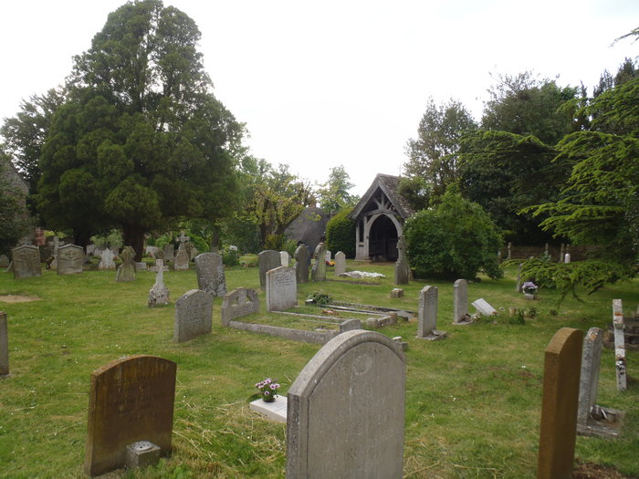
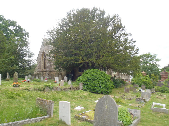
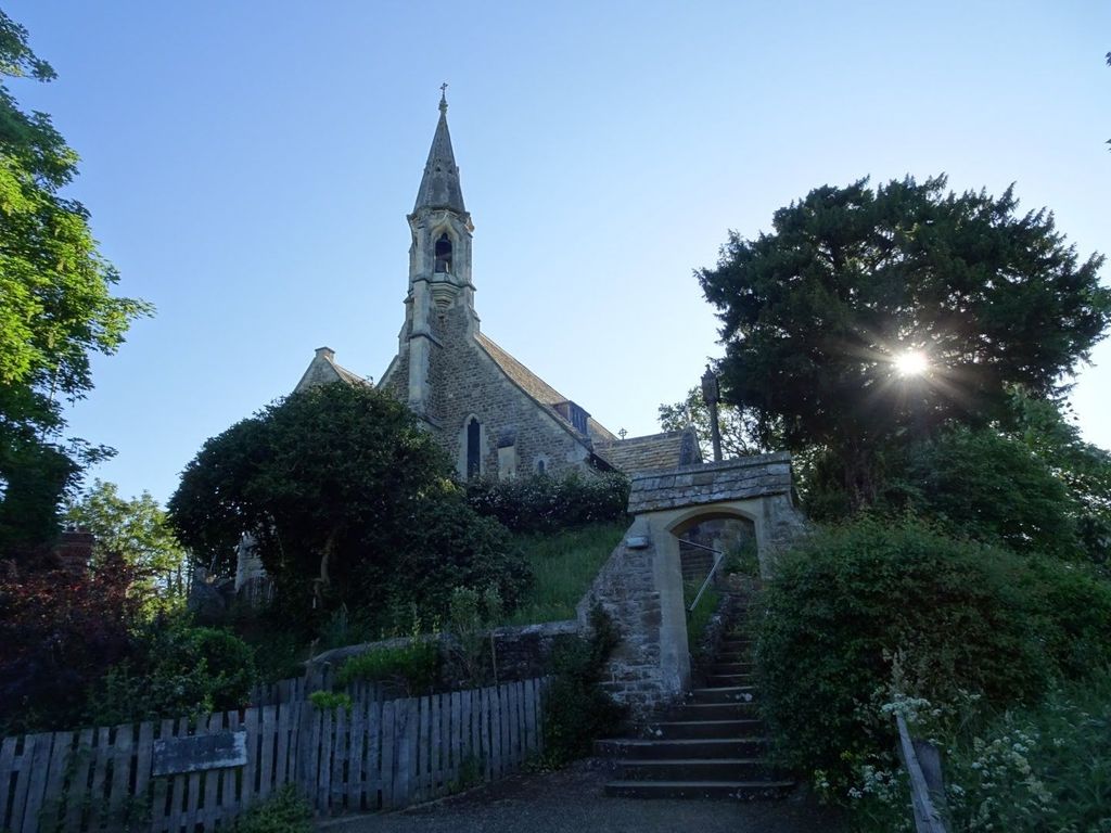
| Description | : | Clifton Hampden is a village and civil parish on the north bank of the River Thames, just over 3 miles east of Abingdon in Oxfordshire. Since 1932 the civil parish has included the village of Burcot, 1 mile east of Clifton Hampden. The Church of England parish church of St. Michael and All Angels was a chapel of Dorchester parish until the 19th century. The oldest parts of the church include the arcade of the south aisle, which was built in about 1180. Elsewhere in the church are three lancet windows from the 13th century in the Early English style. The... Read More |
frequently asked questions (FAQ):
-
Where is St Michael Churchyard?
St Michael Churchyard is located at High Street Clifton Hampden, South Oxfordshire District ,Oxfordshire , OX14 3EEEngland.
-
St Michael Churchyard cemetery's updated grave count on graveviews.com?
3 memorials
-
Where are the coordinates of the St Michael Churchyard?
Latitude: 51.6558680
Longitude: -1.2103840
Nearby Cemetories:
1. St Mary the Virgin Churchyard
Long Wittenham, South Oxfordshire District, England
Coordinate: 51.6423650, -1.2092860
2. Ss. Peter and Paul Churchyard
Appleford, Vale of White Horse District, England
Coordinate: 51.6396800, -1.2356090
3. Old All Saints Church
Nuneham Courtenay, South Oxfordshire District, England
Coordinate: 51.6805300, -1.2181300
4. St. Peter's Churchyard
Little Wittenham, South Oxfordshire District, England
Coordinate: 51.6369880, -1.1830625
5. Dorchester Cemetery
Dorchester, South Oxfordshire District, England
Coordinate: 51.6478130, -1.1649480
6. Dorchester Abbey
Dorchester, South Oxfordshire District, England
Coordinate: 51.6436250, -1.1644290
7. Saint Birinus Catholic Churchyard
Dorchester, South Oxfordshire District, England
Coordinate: 51.6412600, -1.1649100
8. All Saints Parish Churchyard
Nuneham Courtenay, South Oxfordshire District, England
Coordinate: 51.6882380, -1.2057616
9. Radley Cemetery
Radley, Vale of White Horse District, England
Coordinate: 51.6893900, -1.2446800
10. All Saints Churchyard
Sutton Courtenay, Vale of White Horse District, England
Coordinate: 51.6442680, -1.2718070
11. St Peter Churchyard
Marsh Baldon, South Oxfordshire District, England
Coordinate: 51.6941870, -1.1884550
12. St. Paul's Churchyard
Culham, South Oxfordshire District, England
Coordinate: 51.6512320, -1.2762060
13. St. James the Great Churchyard
Radley, Vale of White Horse District, England
Coordinate: 51.6907270, -1.2462510
14. Sutton Courtenay Village Cemetery
Sutton Courtenay, Vale of White Horse District, England
Coordinate: 51.6394000, -1.2746000
15. Abingdon Abbey (Defunct)
Abingdon, Vale of White Horse District, England
Coordinate: 51.6704790, -1.2783620
16. St Leonard and St Catherine
Drayton St Leonard, South Oxfordshire District, England
Coordinate: 51.6640020, -1.1387005
17. Our Lady and St Edmund of Abingdon Roman Catholic
Abingdon, Vale of White Horse District, England
Coordinate: 51.6747940, -1.2776270
18. St Nicholas Church
Abingdon, Vale of White Horse District, England
Coordinate: 51.6702720, -1.2808640
19. St. Helen's Churchyard
Abingdon, Vale of White Horse District, England
Coordinate: 51.6672868, -1.2830793
20. Abingdon War Memorial
Abingdon, Vale of White Horse District, England
Coordinate: 51.6702940, -1.2839070
21. St Laurence Churchyard
Warborough, South Oxfordshire District, England
Coordinate: 51.6383330, -1.1358310
22. Abingdon Baptist Church Burial Ground
Abingdon, Vale of White Horse District, England
Coordinate: 51.6700100, -1.2870810
23. Friends Burying Ground
Warborough, South Oxfordshire District, England
Coordinate: 51.6374080, -1.1354510
24. St. Agatha New Churchyard
Brightwell cum Sotwell, South Oxfordshire District, England
Coordinate: 51.6131480, -1.1665480