
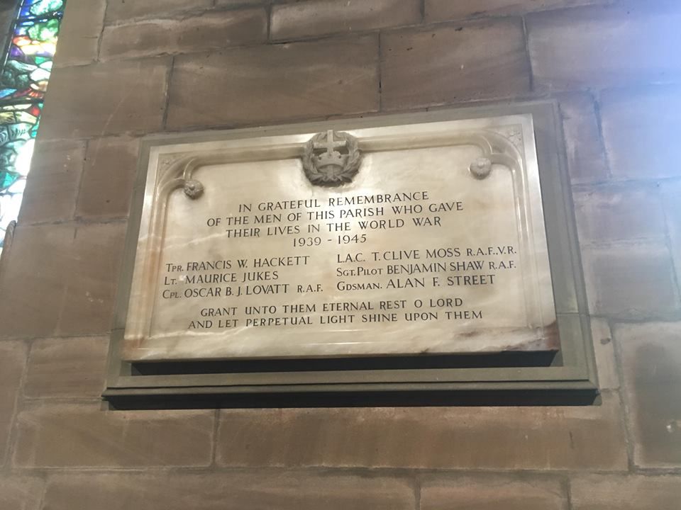
| Memorials | : | 13 |
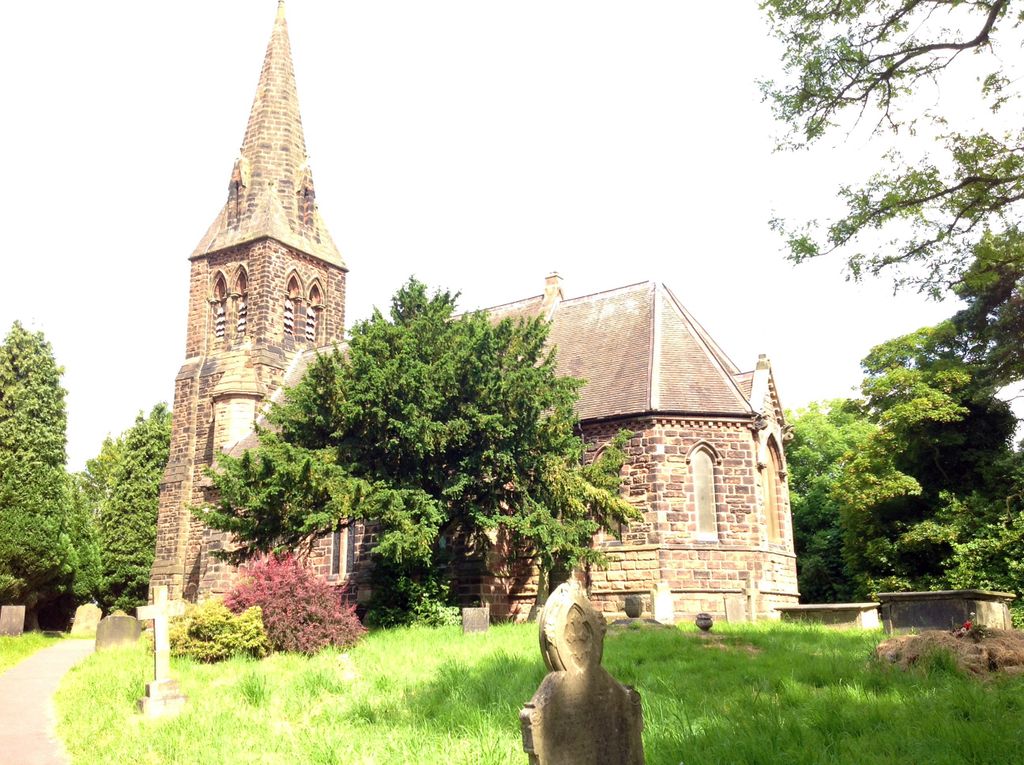
| Location | : | Hammerwich, Lichfield District, England |
| Description | : | The church is set on a hill overlooking the village of Hammerwich and is about 3 miles from Lichfield. |
frequently asked questions (FAQ):
-
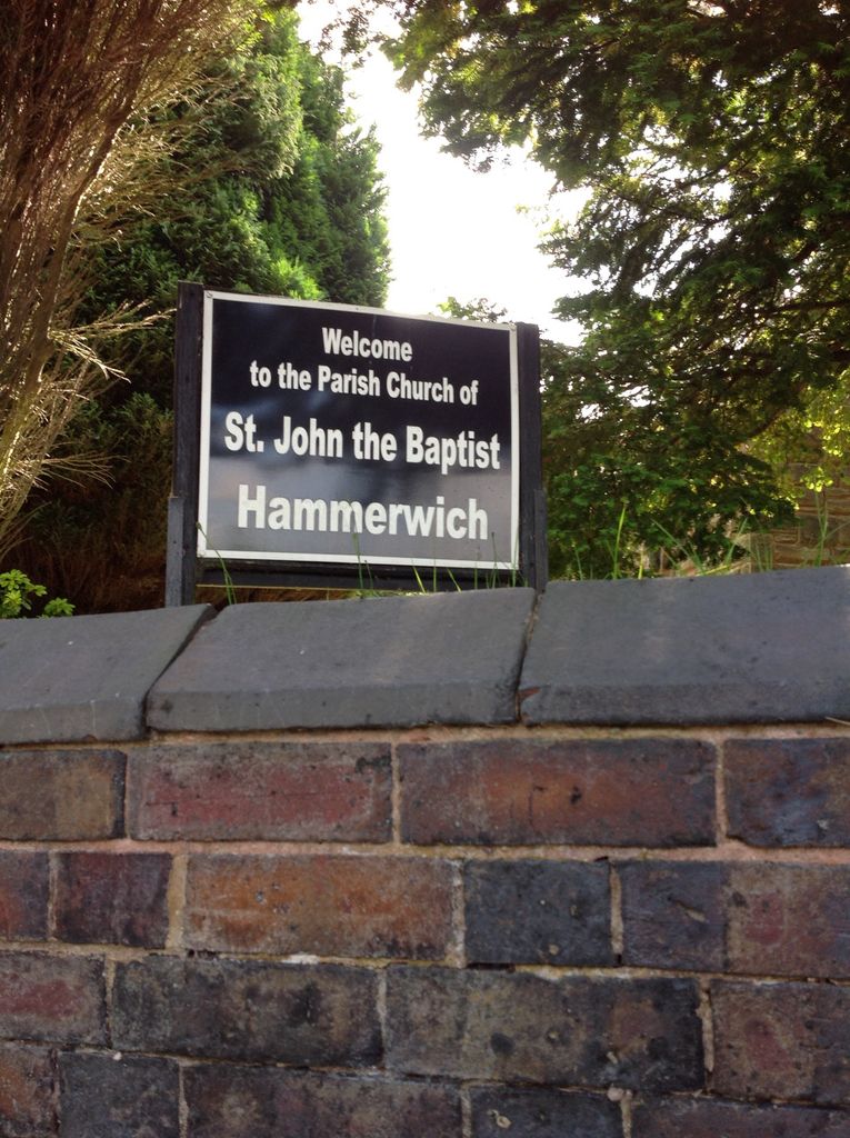
Where is St. John The Baptist Churchyard?
St. John The Baptist Churchyard is located at No GPS information available Add GPSChurch Lane Hammerwich, Lichfield District ,Staffordshire , WS7 0JWEngland.
-
St. John The Baptist Churchyard cemetery's updated grave count on graveviews.com?
9 memorials


Nearby Cemetories:
1. St. Mary's Churchyard
Colton, Lichfield District, England
Coordinate: 52.7200210, -1.7091480
2. St. Michael & All Angels Churchyard
Hamstall Ridware, Lichfield District, England
Coordinate: 52.6957682, -1.6832017
3. Christ Church Churchyard
Lichfield, Lichfield District, England
Coordinate: 52.6010000, -1.8662300
4. Grey Friars Churchyard
Lichfield, Lichfield District, England
Coordinate: 52.6998096, -1.8347392
5. Lichfield Cathedral
Lichfield, Lichfield District, England
Coordinate: 52.6575100, -1.8553200
6. St Chad Churchyard
Lichfield, Lichfield District, England
Coordinate: 52.6704490, -1.6927530
7. St Michael's Churchyard
Lichfield, Lichfield District, England
Coordinate: 52.6928330, -1.7274120
8. St Mary the Virgin New Churchyard
Weeford, Lichfield District, England
Coordinate: 52.6946050, -1.6514690
9. St. Mary the Virgin Churchyard
Weeford, Lichfield District, England
10. All Saints Churchyard
Alrewas, Lichfield District, England
Coordinate: 52.6723850, -1.7677160
11. National Memorial Arboretum
Alrewas, Lichfield District, England
12. Holy Trinity
Edingale, Lichfield District, England
Coordinate: 52.7250710, -1.8800360
13. Croxall, St John the Baptist Churchyard
Edingale, Lichfield District, England
Coordinate: 52.7200210, -1.7091480
14. St. Matthew's churchyard
Harlaston, Lichfield District, England
Coordinate: 52.6957682, -1.6832017
15. St Peters Churchyard
Little Aston, Lichfield District, England
Coordinate: 52.6010000, -1.8662300
16. Stychbrook Cemetery
Lichfield District, England
Coordinate: 52.6998096, -1.8347392
17. St. John's Churchyard
Wall, Lichfield District, England
Coordinate: 52.6575100, -1.8553200
18. St Leonard Churchyard
Wigginton and Hopwas, Lichfield District, England
Coordinate: 52.6704490, -1.6927530
19. St Peter's Churchyard
Elford, Lichfield District, England
Coordinate: 52.6928330, -1.7274120
20. St Michael & St James Catholic Churchyard
Haunton, Lichfield District, England
Coordinate: 52.6946050, -1.6514690
21. St James Churchyard
Pipe Ridware, Lichfield District, England
22. St. Giles' Churchyard
Whittington, Lichfield District, England
Coordinate: 52.6723850, -1.7677160
23. St Andrew Churchyard
Clifton Campville, Lichfield District, England
24. St. James the Great Churchyard
Longdon, Lichfield District, England
Coordinate: 52.7250710, -1.8800360