
| Memorials | : | 15 |
| Location | : | Priddy, Mendip District, England |
| Coordinate | : | 51.2596770, -2.6777600 |
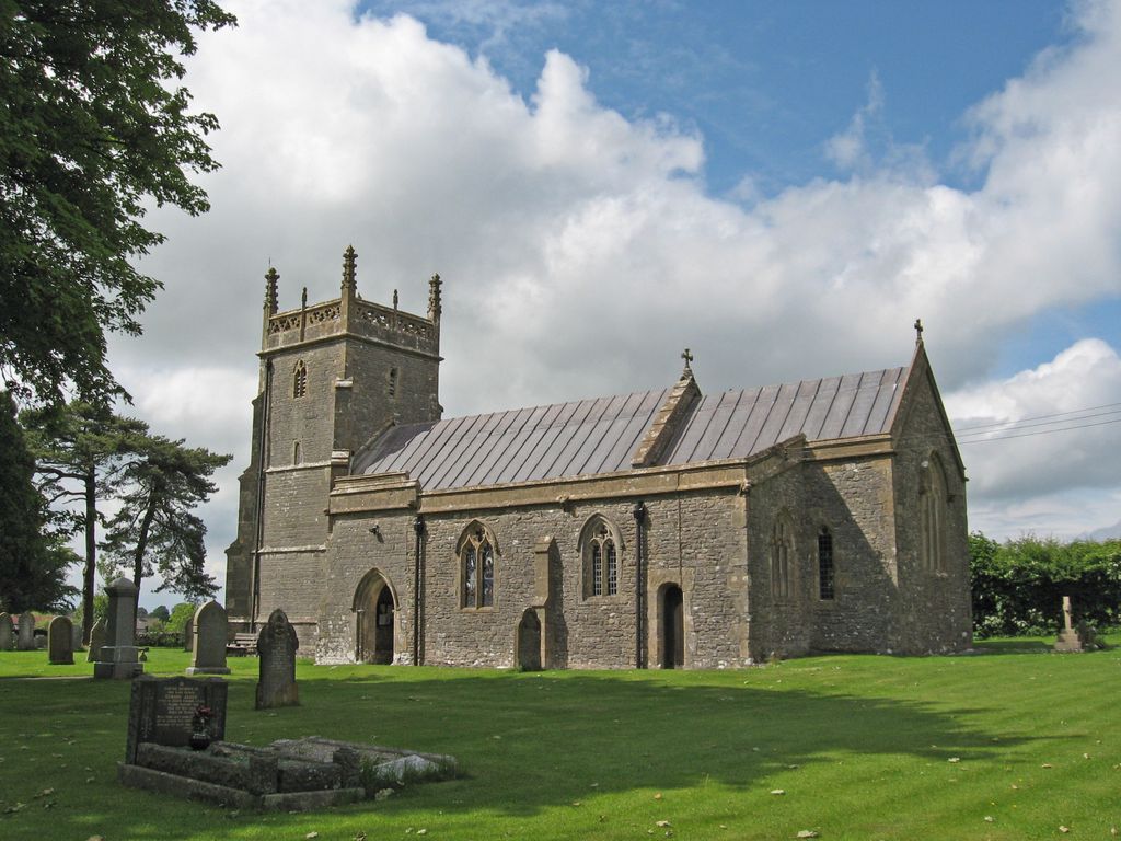
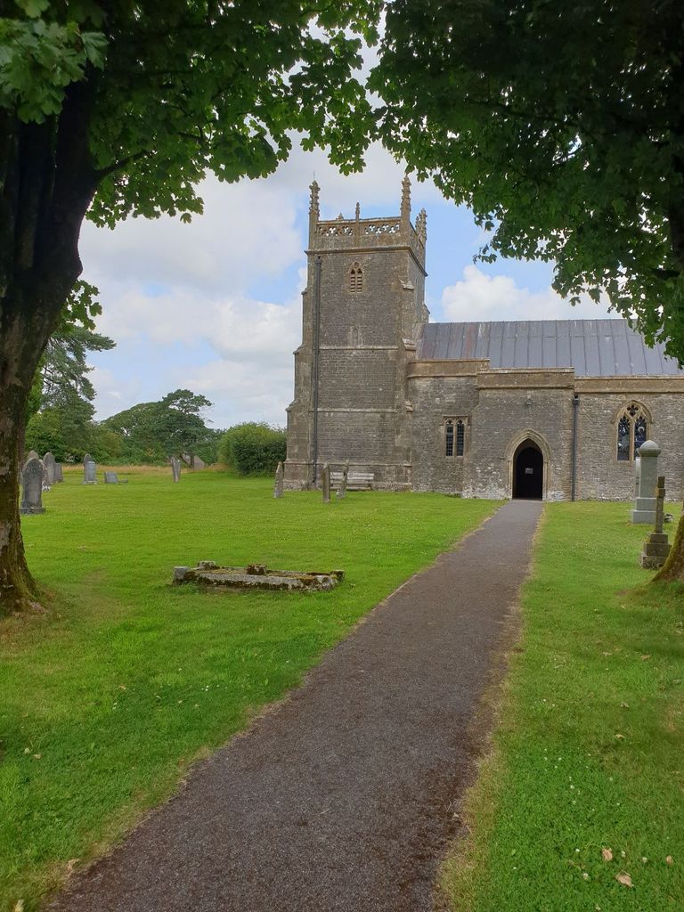
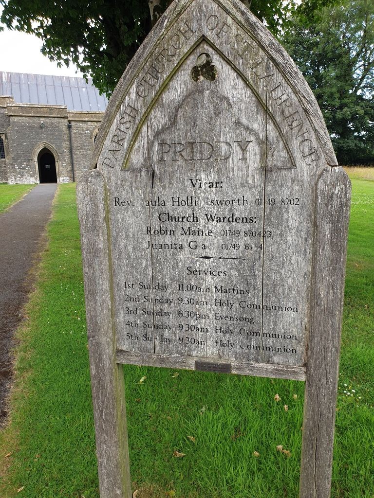
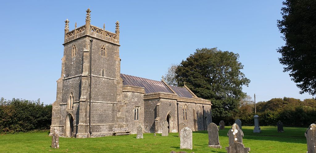
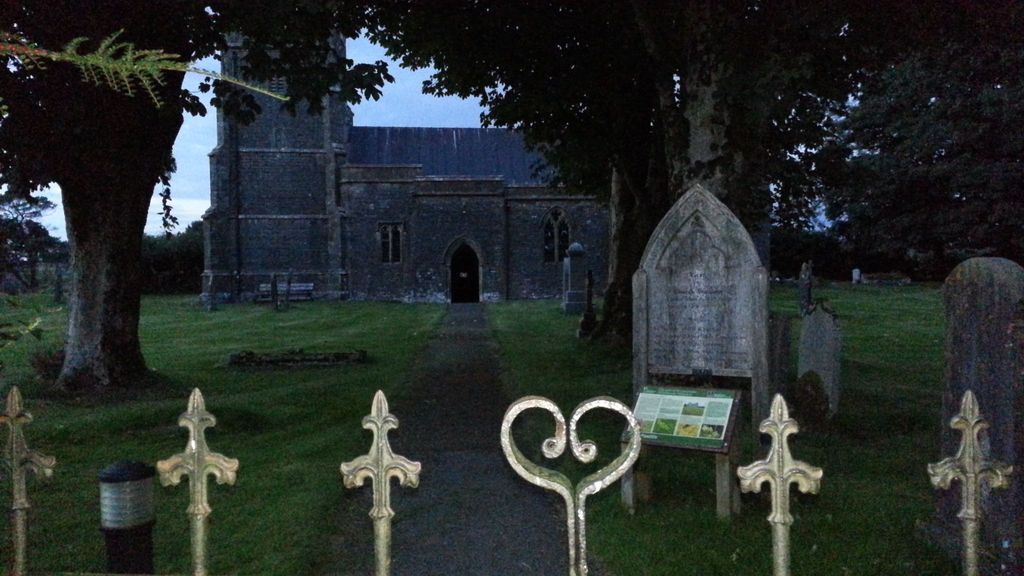
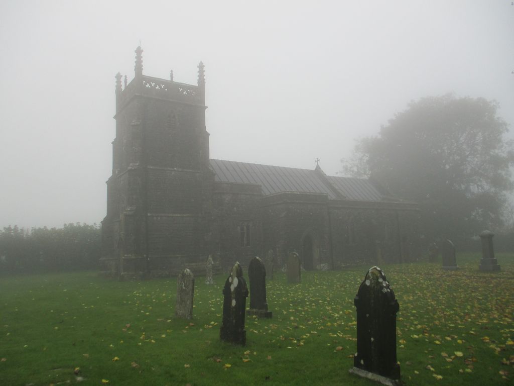
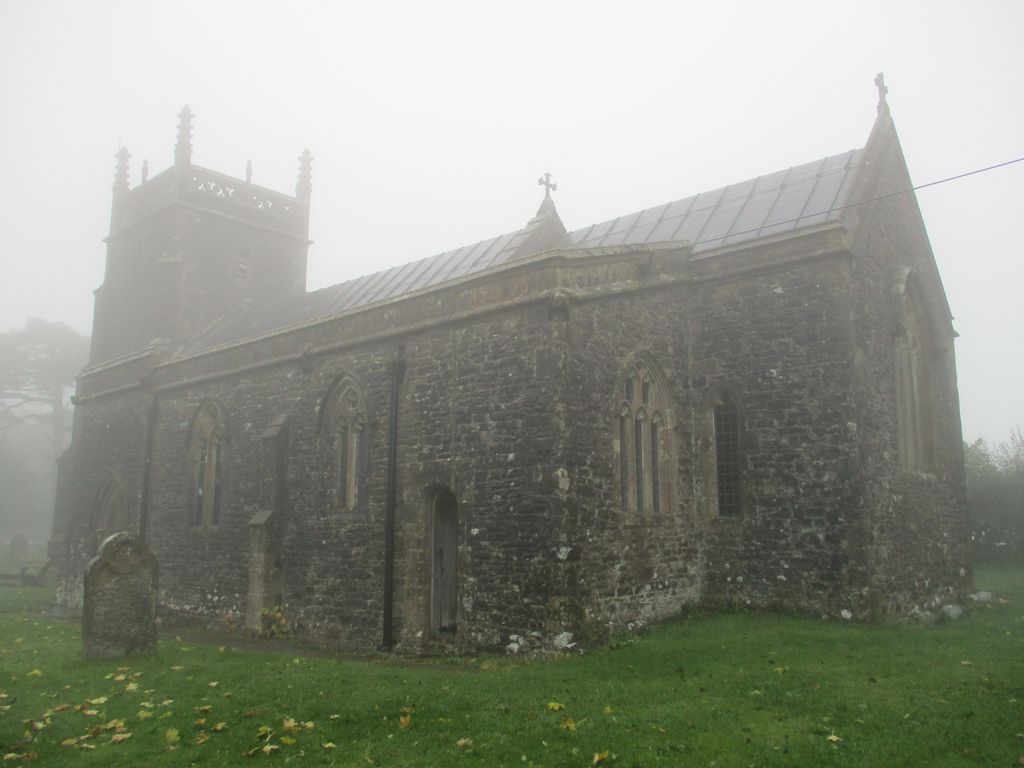
| Description | : | The Anglican Church of St Lawrence (St Laurence) is situated in the beautiful circular churchyard in Priddy, Somerset, England. The churchyard predates the church, as the building dates from the 13th century, with some rebuilding in the 15th century and was restored in 1881–88 it is now a Grade I listed building. The Church is part of the Diocese of Bath & Wells. It was dedicated to St Lawrence on 10 August 1352. By the 19th century the church was in a bad state of repair and water was coming in through the roof and underwent extensive restoration including repairs to the... Read More |
frequently asked questions (FAQ):
-
Where is St. Lawrence's Churchyard?
St. Lawrence's Churchyard is located at Priddy, Mendip District ,Somerset ,England.
-
St. Lawrence's Churchyard cemetery's updated grave count on graveviews.com?
11 memorials
-
Where are the coordinates of the St. Lawrence's Churchyard?
Latitude: 51.2596770
Longitude: -2.6777600
Nearby Cemetories:
1. St Lawrence Churchyard
Westbury, Mendip District, England
Coordinate: 51.2354140, -2.7182630
2. St. Leonard's Churchyard
Rodney Stoke, Mendip District, England
Coordinate: 51.2455140, -2.7431800
3. St. Mary's Churchyard
West Harptree, Bath and North East Somerset Unitary Authority, England
Coordinate: 51.3032530, -2.6582110
4. St. Peter's Churchyard
Draycott, Mendip District, England
Coordinate: 51.2580900, -2.7523800
5. St. Matthew Churchyard
Wookey, Mendip District, England
Coordinate: 51.2093000, -2.6893000
6. Wells Cemetery
Wells, Mendip District, England
Coordinate: 51.2088240, -2.6640120
7. St Thomas Churchyard
Wells, Mendip District, England
Coordinate: 51.2132380, -2.6370870
8. Saint Laurence Churchyard
East Harptree, Bath and North East Somerset Unitary Authority, England
Coordinate: 51.3011730, -2.6245740
9. St Michael the Archangel Churchyard
Compton Martin, Bath and North East Somerset Unitary Authority, England
Coordinate: 51.3107380, -2.6534510
10. Wells Cathedral
Wells, Mendip District, England
Coordinate: 51.2103610, -2.6433940
11. St. Cuthbert Churchyard
Wells, Mendip District, England
Coordinate: 51.2080930, -2.6502690
12. Harptree Cemetery
East Harptree, Bath and North East Somerset Unitary Authority, England
Coordinate: 51.3056390, -2.6238890
13. Mendip Hospital Cemetery
Wells, Mendip District, England
Coordinate: 51.2106490, -2.6262980
14. St. Bartholomew Churchyard
Ubley, Bath and North East Somerset Unitary Authority, England
Coordinate: 51.3214600, -2.6766900
15. Christ Church Churchyard
Henton, Mendip District, England
Coordinate: 51.2056460, -2.7256380
16. St. Andrew's Churchyard
Cheddar, Sedgemoor District, England
Coordinate: 51.2736740, -2.7761330
17. St Mary Magdalene Churchyard
Chewton Mendip, Mendip District, England
Coordinate: 51.2760790, -2.5800490
18. Saint John the Evangelist
East Horrington, Mendip District, England
Coordinate: 51.2180000, -2.6006900
19. Cheddar Baptist Burial Ground
Cheddar, Sedgemoor District, England
Coordinate: 51.2767330, -2.7792010
20. Saint Mary the Virgin Churchyard
Litton, Mendip District, England
Coordinate: 51.2899860, -2.5838440
21. Coxley Methodist Churchyard
Coxley, Mendip District, England
Coordinate: 51.1918900, -2.6723700
22. St Andrew Churchyard
Blagdon, North Somerset Unitary Authority, England
Coordinate: 51.3275610, -2.7127710
23. Christ Church Theale
Wedmore, Sedgemoor District, England
Coordinate: 51.2113720, -2.7631570
24. Christ Church
Coxley, Mendip District, England
Coordinate: 51.1869530, -2.6797580