
| Memorials | : | 2 |
| Location | : | Cusop, Herefordshire Unitary Authority, England |
| Coordinate | : | 52.0670000, -3.1100000 |
| Description | : | Location: Church Lane, Hereford HR3 5RF Locality: Cusop County: Herefordshire Country: England Postcode: HR3 5RF |
frequently asked questions (FAQ):
-
Where is Church of St. Mary?
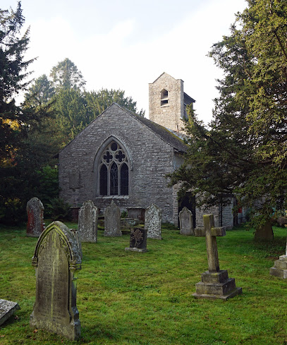
Church of St. Mary is located at Cusop, Herefordshire Unitary Authority ,Herefordshire ,England.
-
Church of St. Mary cemetery's updated grave count on graveviews.com?
2 memorials
-
Where are the coordinates of the Church of St. Mary?
Latitude: 52.0670000
Longitude: -3.1100000
Nearby Cemetories:
1. St Andrew Churchyard
Bredwardine, Herefordshire Unitary Authority, England
Coordinate: 52.0948000, -2.9725000
2. St. Mary Magdalene Churchyard
Eardisley, Herefordshire Unitary Authority, England
Coordinate: 52.1366310, -3.0055730
3. St. Leonard's Churchyard
Blakemere, Herefordshire Unitary Authority, England
Coordinate: 52.0646460, -2.9322980
4. St. Mary's Churchyard
Almeley, Herefordshire Unitary Authority, England
Coordinate: 52.1576900, -2.9767400
5. Kington Cemetery
Kington, Herefordshire Unitary Authority, England
Coordinate: 52.1936780, -3.0209970
6. St Mary Churchyard
Kington, Herefordshire Unitary Authority, England
Coordinate: 52.2044990, -3.0384990
7. Holy Trinity and St Mary Churchyard
Abbey Dore, Herefordshire Unitary Authority, England
Coordinate: 51.9686570, -2.8936760
8. Ewyas Harold Priory (Defunct)
Ewyas Harold, Herefordshire Unitary Authority, England
Coordinate: 51.9539100, -2.8969800
9. St. Michael and All Angels Churchyard
Ewyas Harold, Herefordshire Unitary Authority, England
Coordinate: 51.9539100, -2.8926070
10. St Michael and All Angels Churchyard
Knill, Herefordshire Unitary Authority, England
Coordinate: 52.2377070, -3.0396000
11. St. Mary's Churchyard
Credenhill, Herefordshire Unitary Authority, England
Coordinate: 52.0905490, -2.8037610
12. St. Mary the Virgin
Kings Pyon, Herefordshire Unitary Authority, England
Coordinate: 52.1510000, -2.8218000
13. Credenhill Military Cemetery
Credenhill, Herefordshire Unitary Authority, England
Coordinate: 52.0869980, -2.7899910
14. All Saints Church
Clehonger, Herefordshire Unitary Authority, England
Coordinate: 52.0373470, -2.7806970
15. St. Mary & David Churchyard
Kilpeck, Herefordshire Unitary Authority, England
Coordinate: 51.9692310, -2.8076150
16. St Mary's Churchyard
Kentchurch, Herefordshire Unitary Authority, England
Coordinate: 51.9263169, -2.8456161
17. Belmont Abbey
Hereford, Herefordshire Unitary Authority, England
Coordinate: 52.0393000, -2.7564000
18. Hereford Cemetery and Crematorium
Hereford, Herefordshire Unitary Authority, England
Coordinate: 52.0579510, -2.7389730
19. Barton Hall Cemetery
Hereford, Herefordshire Unitary Authority, England
Coordinate: 52.0541484, -2.7227701
20. Church of the Grey Friars
Hereford, Herefordshire Unitary Authority, England
Coordinate: 52.0528480, -2.7209559
21. St. Nicholas' Churchyard
Hereford, Herefordshire Unitary Authority, England
Coordinate: 52.0542540, -2.7207160
22. St. Margaret Church Cemetery
Wellington, Telford and Wrekin Unitary Authority, England
Coordinate: 52.1289570, -2.7320440
23. St Elli’s Churchyard
Wales
Coordinate: 51.8264420, -3.1154820
24. St Martin Churchyard
Hereford, Herefordshire Unitary Authority, England
Coordinate: 52.0450100, -2.7202700