
| Memorials | : | 45 |
| Location | : | Eardisley, Herefordshire Unitary Authority, England |
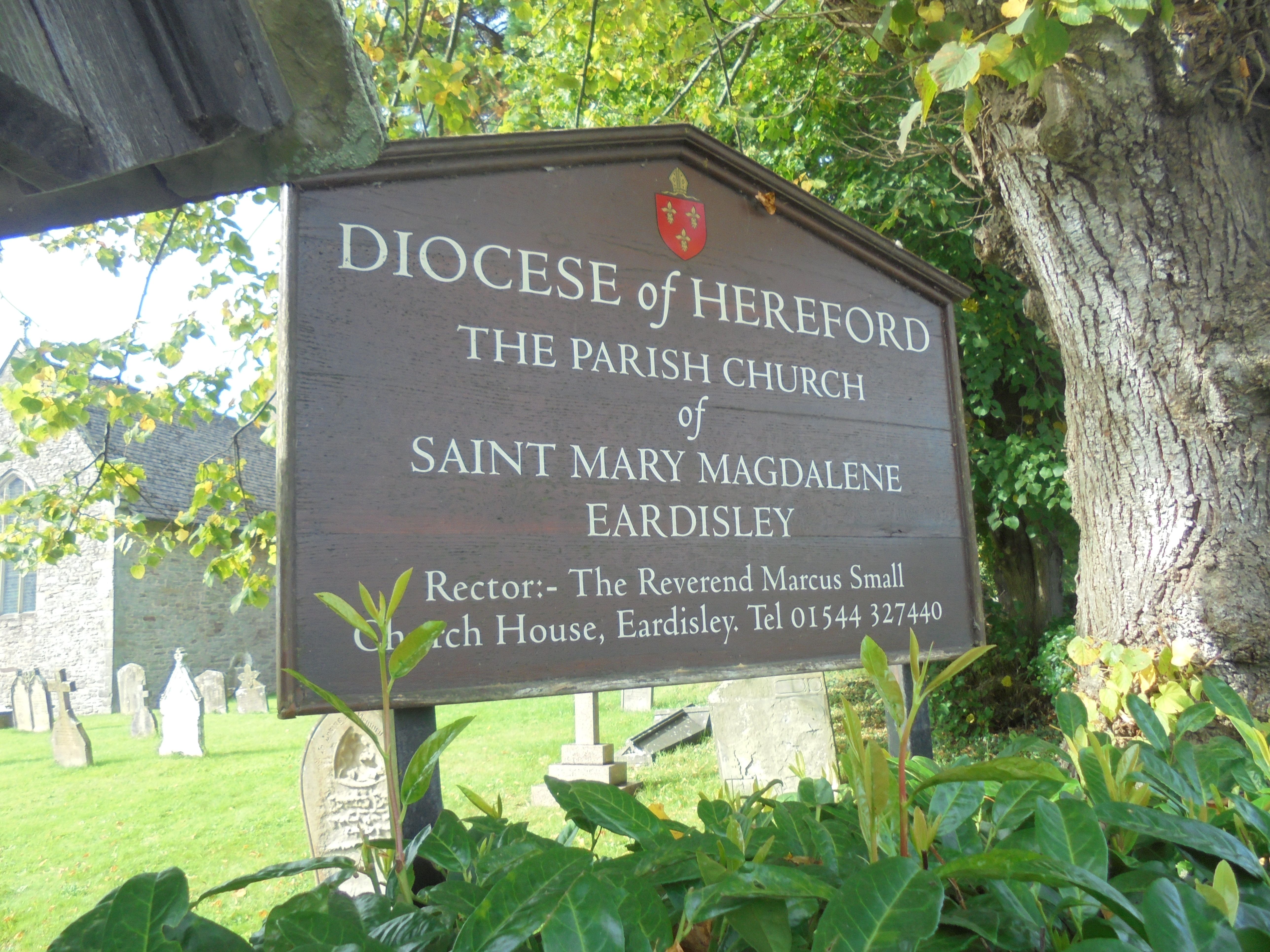
| Phone | : | 01544327440 |
| Coordinate | : | 52.1366310, -3.0055730 |
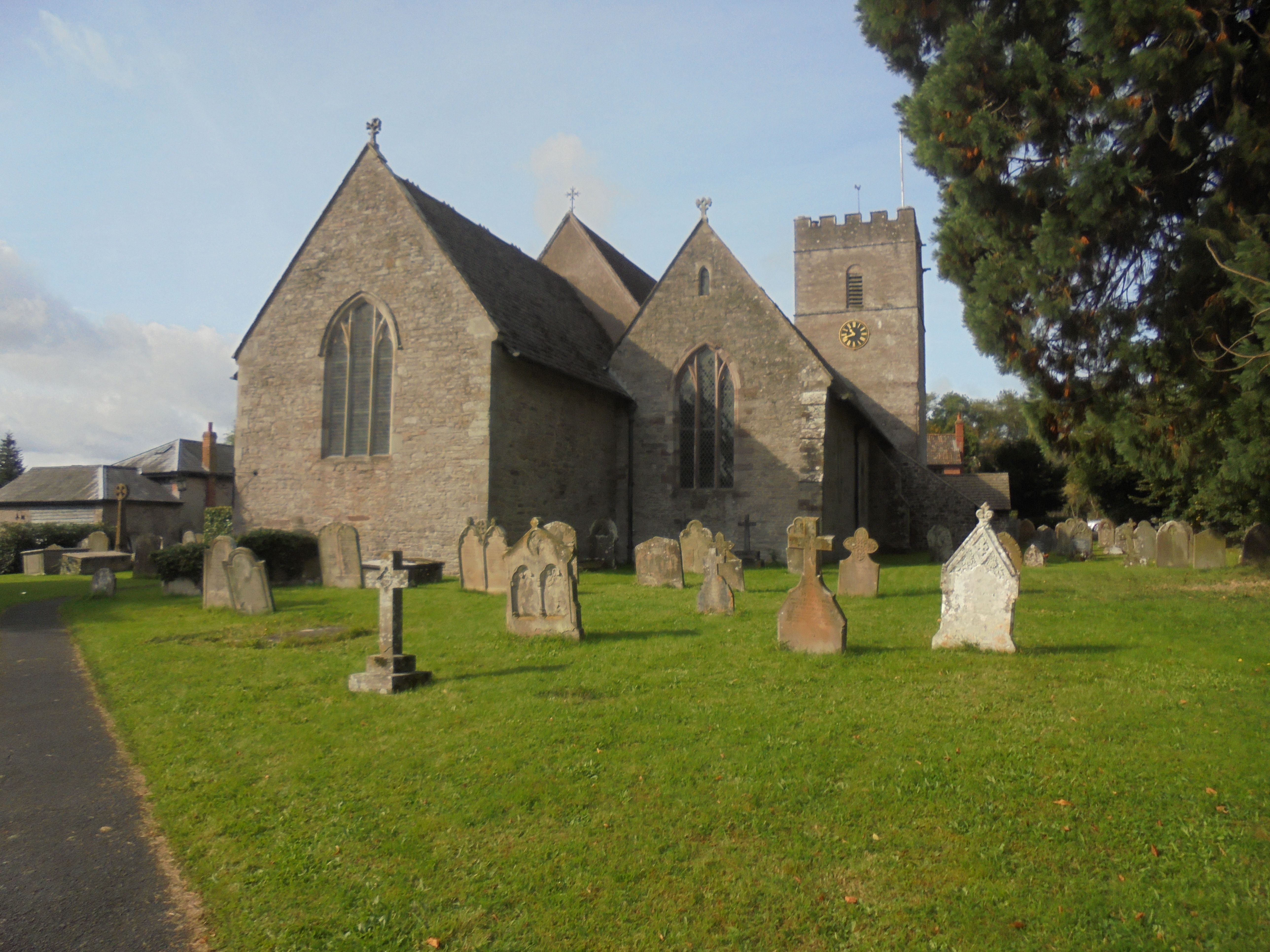
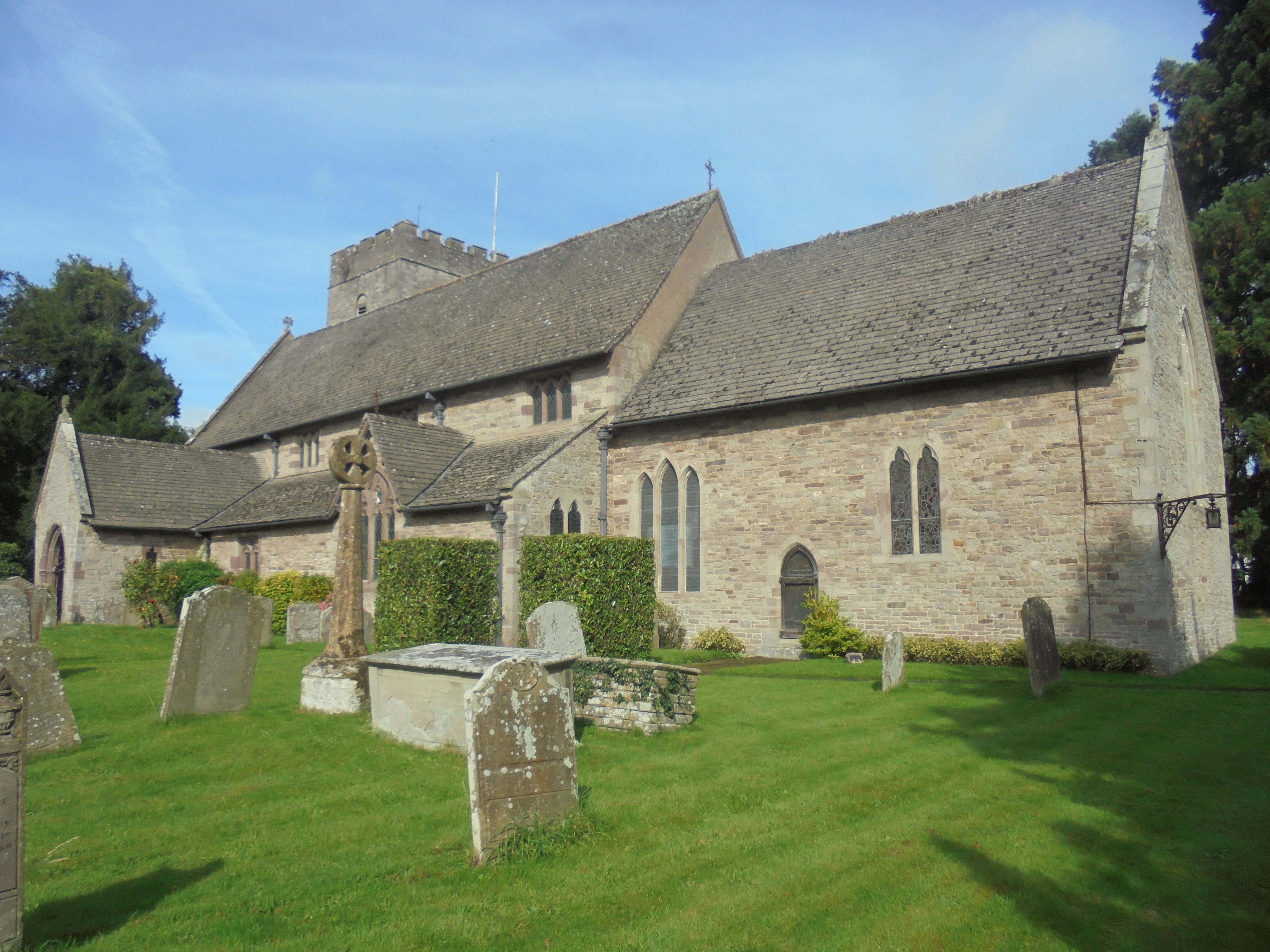
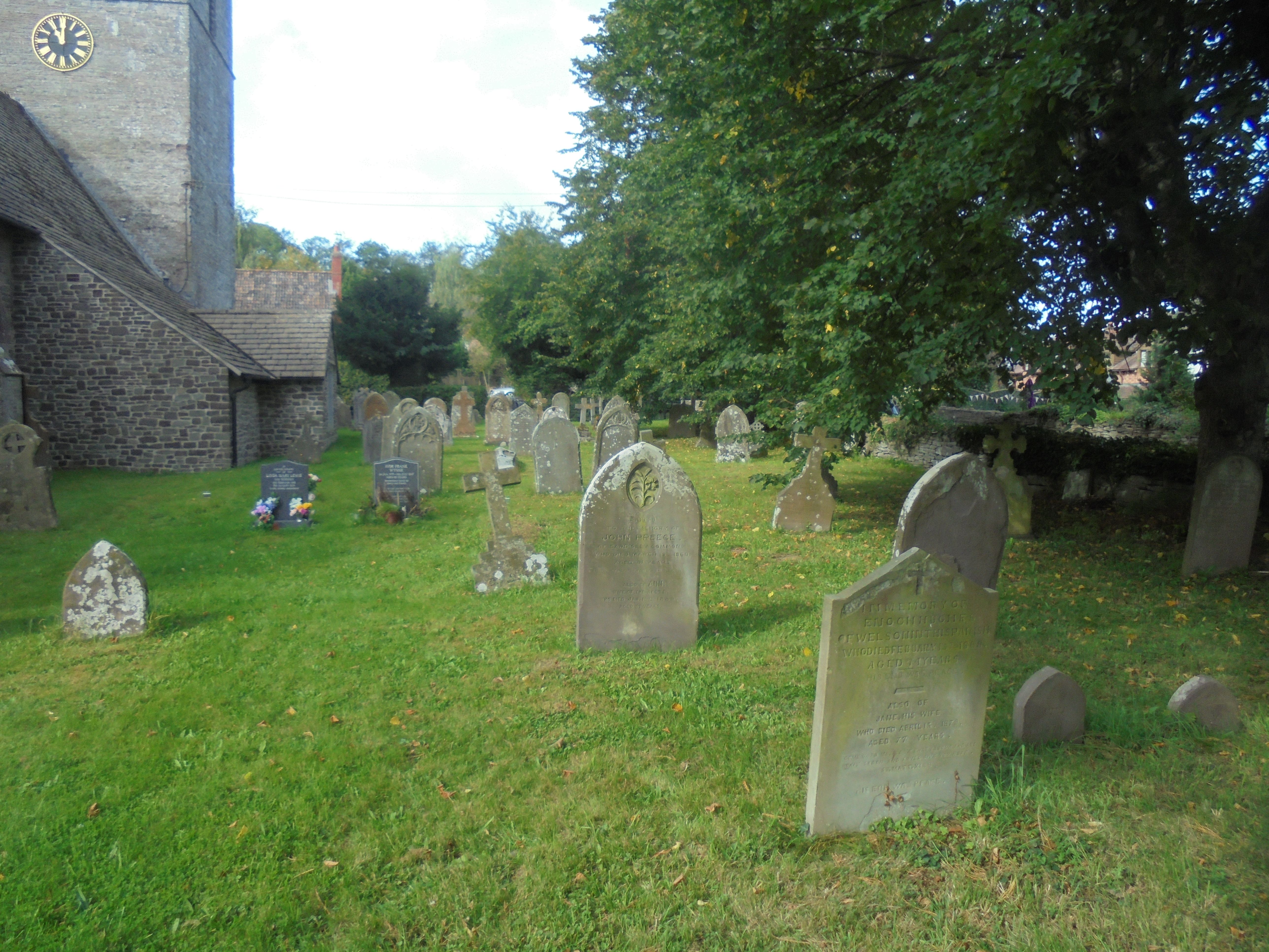
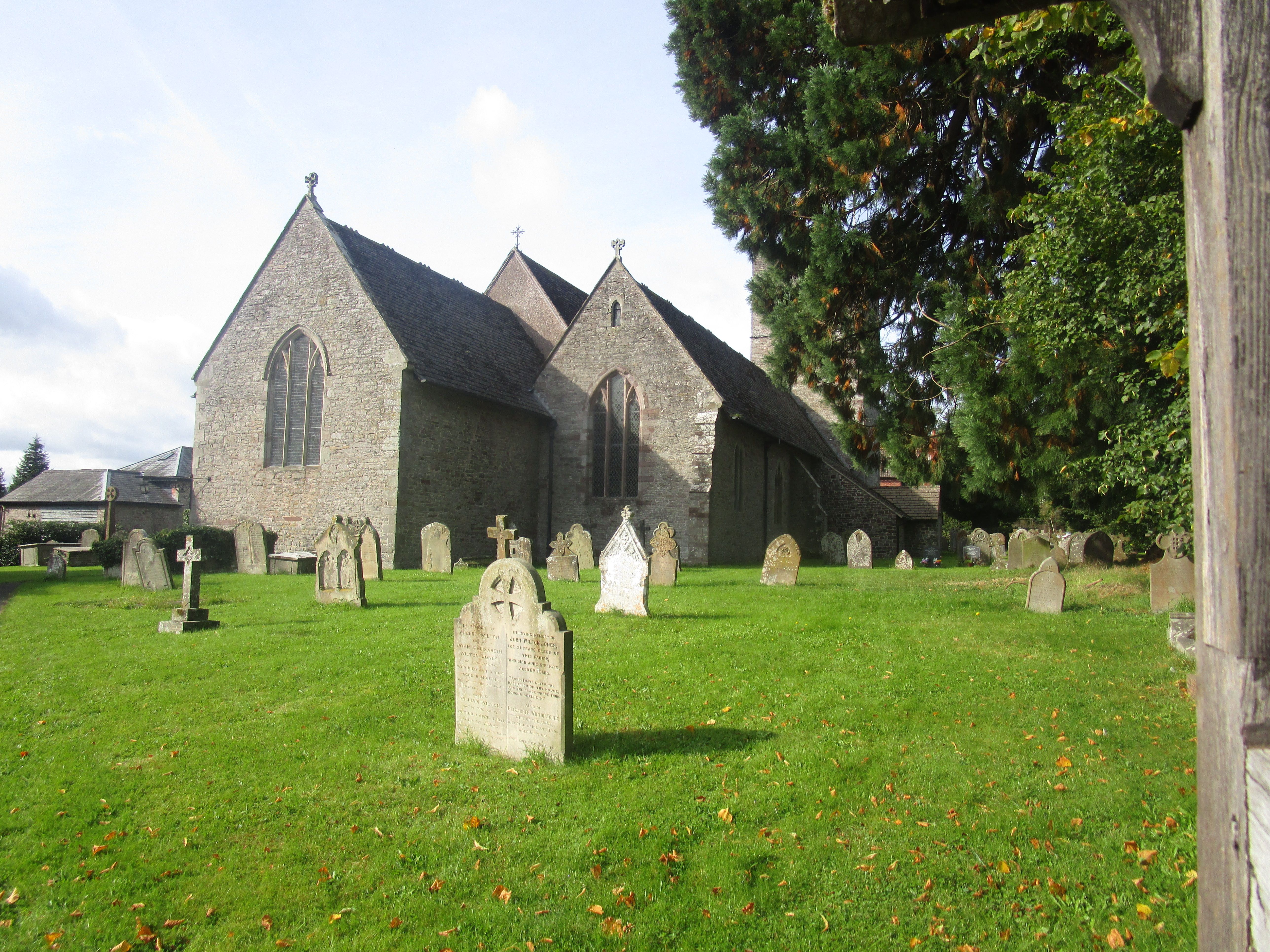
| Description | : | The church originated in the twelfth century. Alterations were made c. 1200, the late thirteenth century, and the late fourteenth century, and was partly rebuilt in the early eighteenth century. It was restored in 1863. One of the chief attractions of the church is a large carved Norman font dating from the twelfth century, the work of a group of medieval sculptors known as the Herefordshire School. |
frequently asked questions (FAQ):
-
Where is St. Mary Magdalene Churchyard?
St. Mary Magdalene Churchyard is located at A4111 (Church Road) Eardisley, Herefordshire Unitary Authority ,Herefordshire , HR3 6NSEngland.
-
St. Mary Magdalene Churchyard cemetery's updated grave count on graveviews.com?
45 memorials
-
Where are the coordinates of the St. Mary Magdalene Churchyard?
Latitude: 52.1366310
Longitude: -3.0055730
Nearby Cemetories:
1. St. Mary's Churchyard
Almeley, Herefordshire Unitary Authority, England
Coordinate: 52.1576900, -2.9767400
2. St Andrew Churchyard
Bredwardine, Herefordshire Unitary Authority, England
Coordinate: 52.0948000, -2.9725000
3. Kington Cemetery
Kington, Herefordshire Unitary Authority, England
Coordinate: 52.1936780, -3.0209970
4. St Mary Churchyard
Kington, Herefordshire Unitary Authority, England
Coordinate: 52.2044990, -3.0384990
5. St. Leonard's Churchyard
Blakemere, Herefordshire Unitary Authority, England
Coordinate: 52.0646460, -2.9322980
6. Church of St. Mary
Cusop, Herefordshire Unitary Authority, England
Coordinate: 52.0670000, -3.1100000
7. St Michael and All Angels Churchyard
Knill, Herefordshire Unitary Authority, England
Coordinate: 52.2377070, -3.0396000
8. St. Mary the Virgin
Kings Pyon, Herefordshire Unitary Authority, England
Coordinate: 52.1510000, -2.8218000
9. St. Mary's Churchyard
Credenhill, Herefordshire Unitary Authority, England
Coordinate: 52.0905490, -2.8037610
10. Credenhill Military Cemetery
Credenhill, Herefordshire Unitary Authority, England
Coordinate: 52.0869980, -2.7899910
11. St. John's Churchyard
Ivington, Herefordshire Unitary Authority, England
Coordinate: 52.2054890, -2.7700320
12. St Michael and All Angels Churchyard
Kingsland, Herefordshire Unitary Authority, England
Coordinate: 52.2469640, -2.8117000
13. St. Margaret Church Cemetery
Wellington, Telford and Wrekin Unitary Authority, England
Coordinate: 52.1289570, -2.7320440
14. St. Michael and All Angels Churchyard
Lingen, Herefordshire Unitary Authority, England
Coordinate: 52.2992480, -2.9317460
15. All Saints Church
Clehonger, Herefordshire Unitary Authority, England
Coordinate: 52.0373470, -2.7806970
16. Church of St John the Baptist and St Alkmund
Aymestrey, Herefordshire Unitary Authority, England
Coordinate: 52.2813000, -2.8428000
17. Belmont Abbey
Hereford, Herefordshire Unitary Authority, England
Coordinate: 52.0393000, -2.7564000
18. Holy Trinity and St Mary Churchyard
Abbey Dore, Herefordshire Unitary Authority, England
Coordinate: 51.9686570, -2.8936760
19. Leominster Cemetery
Leominster, Herefordshire Unitary Authority, England
Coordinate: 52.2144280, -2.7380940
20. Hereford Cemetery and Crematorium
Hereford, Herefordshire Unitary Authority, England
Coordinate: 52.0579510, -2.7389730
21. All Saint's Churchyard
Leominster, Herefordshire Unitary Authority, England
Coordinate: 52.2496430, -2.7703330
22. Leominster Moravian Burial Ground
Leominster, Herefordshire Unitary Authority, England
Coordinate: 52.2230890, -2.7394685
23. Priory Churchyard
Leominster, Herefordshire Unitary Authority, England
Coordinate: 52.2293470, -2.7357830
24. Leominster Nunnery (Defunct)
Leominster, Herefordshire Unitary Authority, England
Coordinate: 52.2294090, -2.7343900