
| Memorials | : | 0 |
| Location | : | Broad Blunsdon, Swindon Unitary Authority, England |
| Coordinate | : | 51.6153980, -1.7804317 |
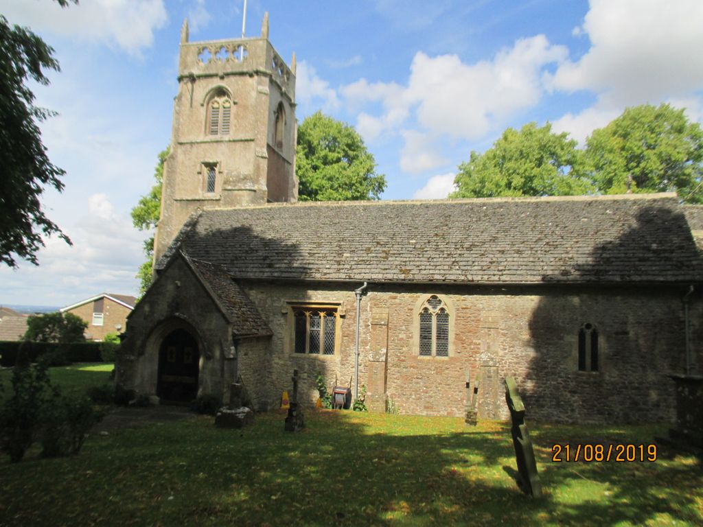
| Description | : | The church is built from local limestone, and consists of a nave, a south aisle, a chantry chapel - now the choir vestry - the chancel where the communion table and choir stalls are situated, the tower and the vestry.The church is built from local limestone, and consists of a nave, a south aisle, a chantry chapel - now the choir vestry - the chancel where the communion table and choir stalls are situated, the tower and the vestry. You have entered the church through the south doorway and are standing in the south aisle, which is... Read More |
frequently asked questions (FAQ):
-
Where is St. Leonard's Churchyard?
St. Leonard's Churchyard is located at Broad Blunsdon, Swindon Unitary Authority ,Wiltshire ,England.
-
St. Leonard's Churchyard cemetery's updated grave count on graveviews.com?
0 memorials
-
Where are the coordinates of the St. Leonard's Churchyard?
Latitude: 51.6153980
Longitude: -1.7804317
Nearby Cemetories:
1. Blunsdon Cemetery
Broad Blunsdon, Swindon Unitary Authority, England
Coordinate: 51.6160210, -1.7774919
2. St Andrew's Church
Blunsdon St Andrew, Swindon Unitary Authority, England
Coordinate: 51.6059595, -1.8048494
3. Kingsdown Crematorium
Swindon, Swindon Unitary Authority, England
Coordinate: 51.5968450, -1.7513770
4. Whitworth Road Cemetery
Swindon, Swindon Unitary Authority, England
Coordinate: 51.5836530, -1.7862070
5. Upper Stratton Cemetery
Stratton St Margaret, Swindon Unitary Authority, England
Coordinate: 51.5833283, -1.7661632
6. St. Mary's Churchyard
Swindon, Swindon Unitary Authority, England
Coordinate: 51.5790500, -1.7990100
7. Highworth Cemetery
Highworth, Swindon Unitary Authority, England
Coordinate: 51.6285450, -1.7212890
8. St Margaret Churchyard
Stratton St Margaret, Swindon Unitary Authority, England
Coordinate: 51.5824430, -1.7422550
9. Saint Mary Magdalene Church Cemetery
South Marston, Swindon Unitary Authority, England
Coordinate: 51.5903900, -1.7195100
10. Parish Church of St. Mary
Castle Eaton, Swindon Unitary Authority, England
Coordinate: 51.6624180, -1.7896647
11. St. James' Churchyard
Sevenhampton, Swindon Unitary Authority, England
Coordinate: 51.6119590, -1.6984440
12. St. Mary's Churchyard
Kempsford, Cotswold District, England
Coordinate: 51.6670420, -1.7681363
13. St. Mary's Churchyard
Cricklade, Wiltshire Unitary Authority, England
Coordinate: 51.6435624, -1.8553451
14. St. Sampson Churchyard
Cricklade, Wiltshire Unitary Authority, England
Coordinate: 51.6405970, -1.8580760
15. Cricklade Cemetery
Cricklade, Wiltshire Unitary Authority, England
Coordinate: 51.6414360, -1.8605570
16. Radnor Street Cemetery
Swindon, Swindon Unitary Authority, England
Coordinate: 51.5556150, -1.7885900
17. Christ Church Burial Ground
Swindon, Swindon Unitary Authority, England
Coordinate: 51.5537243, -1.7744208
18. Lydiard Tregoze St Mary Church
Blagrove, Swindon Unitary Authority, England
Coordinate: 51.5617700, -1.8514300
19. All Saints Churchyard
Down Ampney, Cotswold District, England
Coordinate: 51.6674850, -1.8592640
20. All Saints Churchyard
Coleshill, Vale of White Horse District, England
Coordinate: 51.6422960, -1.6611320
21. St. Andrew's Churchyard
Shrivenham, Vale of White Horse District, England
Coordinate: 51.6000270, -1.6537370
22. St. James Churchyard
Bourton, Cherwell District, England
Coordinate: 51.5794090, -1.6638890
23. Shrivenham Parish Cemetery
Shrivenham, Vale of White Horse District, England
Coordinate: 51.5942061, -1.6517227
24. Watchfield Military Cemetery
Watchfield, Vale of White Horse District, England
Coordinate: 51.6110800, -1.6469400