
| Memorials | : | 258 |
| Location | : | Down Ampney, Cotswold District, England |
| Coordinate | : | 51.6674850, -1.8592640 |
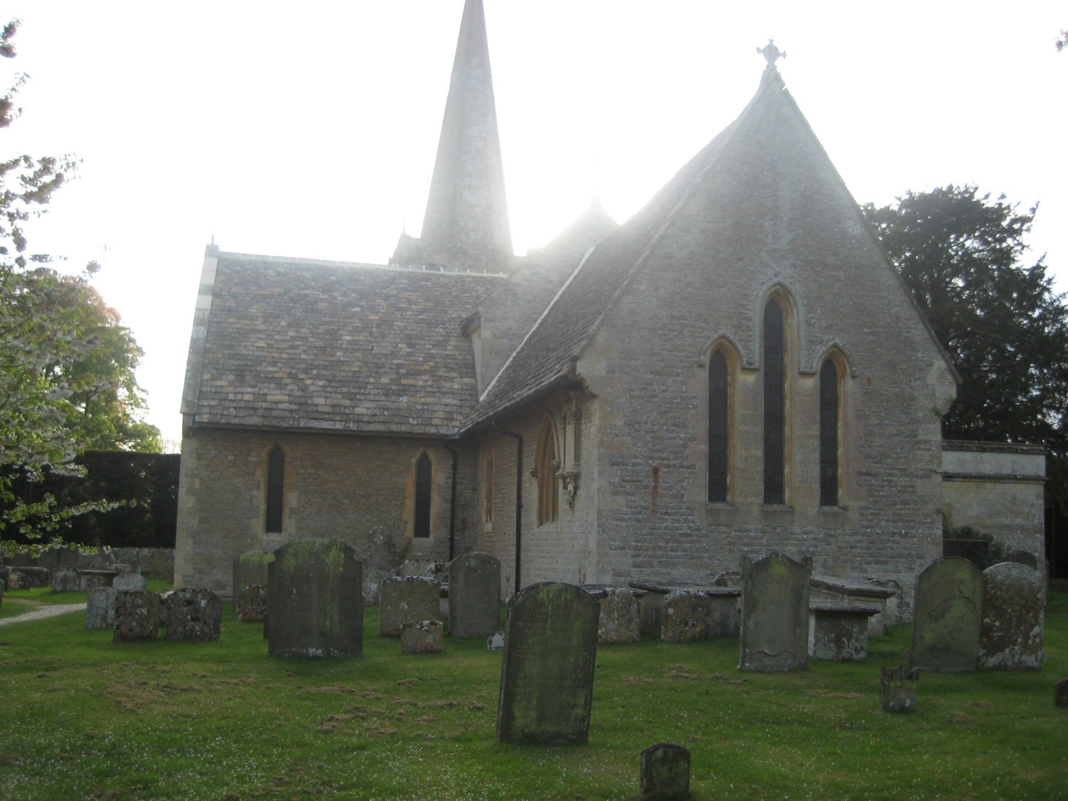
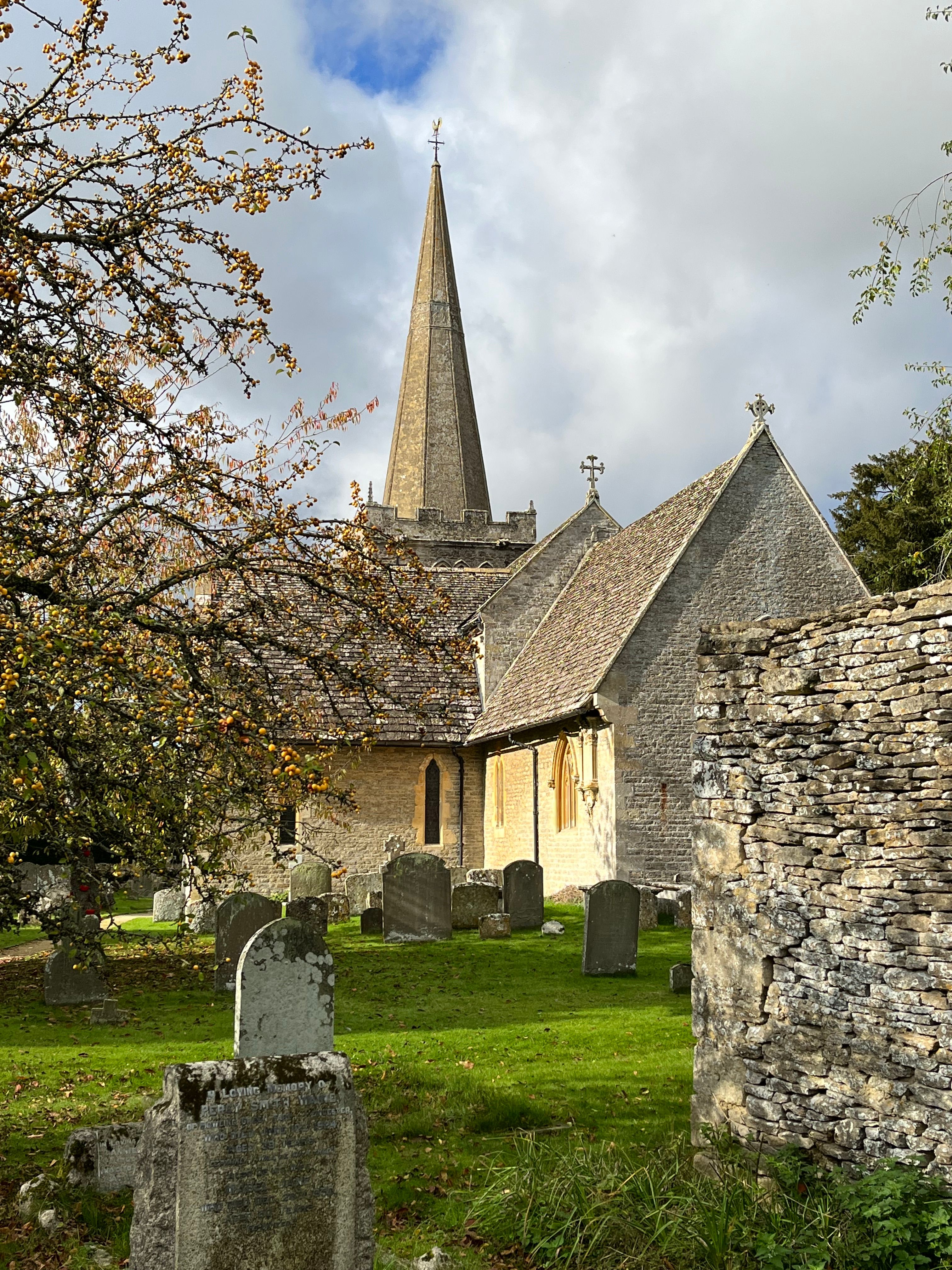
| Description | : | In 1261, Edmund, Earl of Lancaster, second son of King Henry III, granted Down Ampney to Sir Nicholas de Valers, a Templar knight who actually fought in the last Crusade, He and other Knights Templar founded the church in 1260. When Templars were suppressed by the crown in 1315, the church passed to the Abbey of Cirencester, who retained it until the Dissolution of the Monasteries, after which it passed again to Christ's Church College, Oxford. Much of the current shape of the church is the result of a Victorian rebuilding. The striking spire dates to the 14th century, when... Read More |
frequently asked questions (FAQ):
-
Where is All Saints Churchyard?
All Saints Churchyard is located at Down Ampney, Cotswold District ,Gloucestershire , GL7 5BDEngland.
-
All Saints Churchyard cemetery's updated grave count on graveviews.com?
258 memorials
-
Where are the coordinates of the All Saints Churchyard?
Latitude: 51.6674850
Longitude: -1.8592640
Nearby Cemetories:
1. St. Mary's Churchyard
Cricklade, Wiltshire Unitary Authority, England
Coordinate: 51.6435624, -1.8553451
2. Cricklade Cemetery
Cricklade, Wiltshire Unitary Authority, England
Coordinate: 51.6414360, -1.8605570
3. St. Sampson Churchyard
Cricklade, Wiltshire Unitary Authority, England
Coordinate: 51.6405970, -1.8580760
4. Poulton Priory
Poulton, Cotswold District, England
Coordinate: 51.6989750, -1.8638940
5. Parish Church of St. Mary
Castle Eaton, Swindon Unitary Authority, England
Coordinate: 51.6624180, -1.7896647
6. All Hallows Churchyard
South Cerney, Cotswold District, England
Coordinate: 51.6748248, -1.9292083
7. Ampney St. Mary Parish Churchyard
Ampney St Mary, Cotswold District, England
Coordinate: 51.7125000, -1.8919000
8. Ampney St Peter Churchyard
Ampney St Peter, Cotswold District, England
Coordinate: 51.7126320, -1.8918160
9. Holy Cross Churchyard
Ashton Keynes, Wiltshire Unitary Authority, England
Coordinate: 51.6479000, -1.9394000
10. St. Mary's Churchyard
Kempsford, Cotswold District, England
Coordinate: 51.6670420, -1.7681363
11. St. Thomas Churchyard
Fairford, Cotswold District, England
Coordinate: 51.7028776, -1.7801562
12. St. Mary the Virgin Churchyard
Fairford, Cotswold District, England
Coordinate: 51.7088500, -1.7814600
13. St Andrew's Church
Blunsdon St Andrew, Swindon Unitary Authority, England
Coordinate: 51.6059595, -1.8048494
14. St. Leonard's Churchyard
Broad Blunsdon, Swindon Unitary Authority, England
Coordinate: 51.6153980, -1.7804317
15. Blunsdon Cemetery
Broad Blunsdon, Swindon Unitary Authority, England
Coordinate: 51.6160210, -1.7774919
16. St Mary Churchyard
Barnsley, Cotswold District, England
Coordinate: 51.7445030, -1.8894860
17. St. John the Baptist Churchyard
Cirencester, Cotswold District, England
Coordinate: 51.7175600, -1.9678580
18. Chesterton Cemetery
Cirencester, Cotswold District, England
Coordinate: 51.7099230, -1.9801340
19. St. John the Baptist Churchyard
Coln St Aldwyns, Cotswold District, England
Coordinate: 51.7447000, -1.7928600
20. St. Nicholas' Churchyard
Hatherop, Cotswold District, England
Coordinate: 51.7443000, -1.7786600
21. St. Nicholas Churchyard
Hatherop, Cotswold District, England
Coordinate: 51.7444700, -1.7780800
22. St. Mary the Virgin Churchyard
Bibury, Cotswold District, England
Coordinate: 51.7587037, -1.8376852
23. Highworth Cemetery
Highworth, Swindon Unitary Authority, England
Coordinate: 51.6285450, -1.7212890
24. Whitworth Road Cemetery
Swindon, Swindon Unitary Authority, England
Coordinate: 51.5836530, -1.7862070