
| Memorials | : | 285 |
| Location | : | Beverley, East Riding of Yorkshire Unitary Authority, England |
| Coordinate | : | 53.8440200, -0.4338100 |
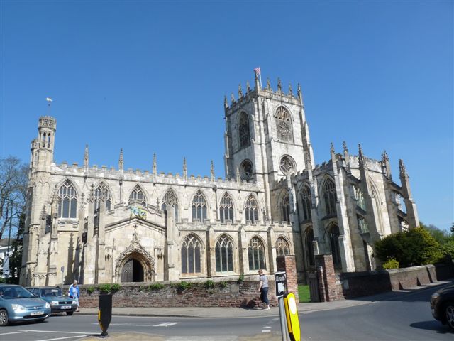
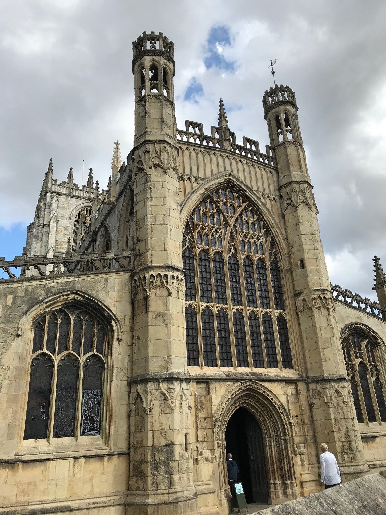
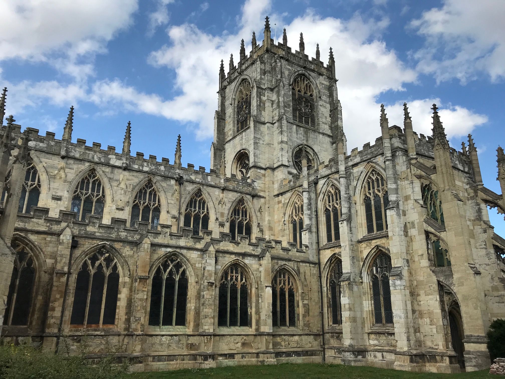
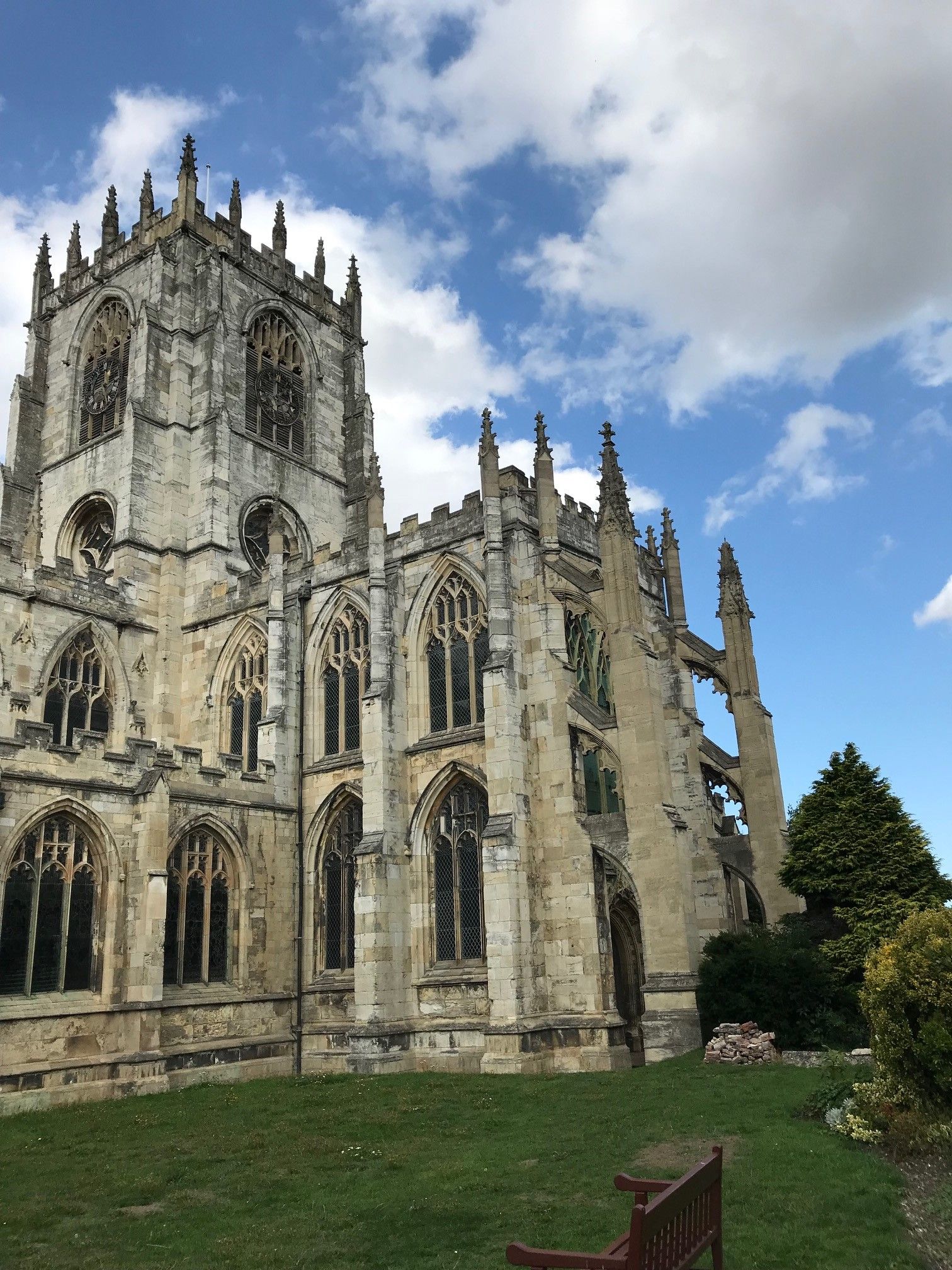
| Description | : | A church has been on this location since at least the 12th century. Visible remains of the original 12th century building are found in the present Church. The church building contains many memorial plaques and installations dedicated to the memory of its wealthy patrons who are buried in the Churchyard. The exterior of the south chancel aisle contains a unusual dedication two ordinary Danish soldiers, Daniel Straker and Johannes Frederick Bellow, who were buried in 1689. By the early 1800s, another burial ground for St Mary parish was needed as the Churchyard was becoming full and encroached upon by urbanization.... Read More |
frequently asked questions (FAQ):
-
Where is St. Mary's Churchyard?
St. Mary's Churchyard is located at Hengate & North Bar Within Beverley, East Riding of Yorkshire Unitary Authority ,East Riding of Yorkshire , HU17 8DLEngland.
-
St. Mary's Churchyard cemetery's updated grave count on graveviews.com?
285 memorials
-
Where are the coordinates of the St. Mary's Churchyard?
Latitude: 53.8440200
Longitude: -0.4338100
Nearby Cemetories:
1. St. Mary North Bar Within Cemetery
Beverley, East Riding of Yorkshire Unitary Authority, England
Coordinate: 53.8445340, -0.4355770
2. St. Mary's Molescroft Road Cemetery
Beverley, East Riding of Yorkshire Unitary Authority, England
Coordinate: 53.8490070, -0.4421000
3. Beverley Minster Churchyard
Beverley, East Riding of Yorkshire Unitary Authority, England
Coordinate: 53.8389560, -0.4247920
4. St. Martin's Cemetery
Beverley, East Riding of Yorkshire Unitary Authority, England
Coordinate: 53.8360660, -0.4370590
5. St John Cemetery
Beverley, East Riding of Yorkshire Unitary Authority, England
Coordinate: 53.8350750, -0.4354910
6. St Nicholas Churchyard
Beverley, East Riding of Yorkshire Unitary Authority, England
Coordinate: 53.8411520, -0.4142730
7. Queensgate Cemetery
Beverley, East Riding of Yorkshire Unitary Authority, England
Coordinate: 53.8314000, -0.4385100
8. All Saints Churchyard
Bishop Burton, East Riding of Yorkshire Unitary Authority, England
Coordinate: 53.8443750, -0.4959940
9. St Catherine Churchyard
Leconfield, East Riding of Yorkshire Unitary Authority, England
Coordinate: 53.8800640, -0.4572990
10. St Michael and All Angels Churchyard
Cherry Burton, East Riding of Yorkshire Unitary Authority, England
Coordinate: 53.8658140, -0.4952220
11. St Mary Churchyard
Etton, East Riding of Yorkshire Unitary Authority, England
Coordinate: 53.8791000, -0.5086000
12. Cottingham Municipal Cemetery
Cottingham, East Riding of Yorkshire Unitary Authority, England
Coordinate: 53.7829540, -0.4307820
13. St Mary the Virgin Churchyard
Cottingham, East Riding of Yorkshire Unitary Authority, England
Coordinate: 53.7821910, -0.4117230
14. St Mary Churchyard
Lockington, East Riding of Yorkshire Unitary Authority, England
Coordinate: 53.9081670, -0.4837860
15. Priory Woods Cemetery
Cottingham, East Riding of Yorkshire Unitary Authority, England
Coordinate: 53.7748730, -0.4089420
16. St. Faith Churchyard
Leven, East Riding of Yorkshire Unitary Authority, England
Coordinate: 53.8943111, -0.3407167
17. St Margaret Churchyard
Beswick, East Riding of Yorkshire Unitary Authority, England
Coordinate: 53.9194140, -0.4599290
18. Haltemprice Priory
Cottingham, East Riding of Yorkshire Unitary Authority, England
Coordinate: 53.7642860, -0.4207310
19. Holy Trinity Churchyard
Leven, East Riding of Yorkshire Unitary Authority, England
Coordinate: 53.8915167, -0.3172194
20. Northern Cemetery
Kingston upon Hull, Kingston upon Hull Unitary Authority, England
Coordinate: 53.7678410, -0.3737990
21. Chanterlands Crematorium and Columbarium
Kingston upon Hull, Kingston upon Hull Unitary Authority, England
Coordinate: 53.7647830, -0.3768310
22. St Margaret Churchyard
Long Riston, East Riding of Yorkshire Unitary Authority, England
Coordinate: 53.8686420, -0.2928580
23. St John Churchyard
Newland, Kingston upon Hull Unitary Authority, England
Coordinate: 53.7687010, -0.3525730
24. St Andrew Churchyard
Kirk Ella, East Riding of Yorkshire Unitary Authority, England
Coordinate: 53.7538430, -0.4542050