
| Memorials | : | 103 |
| Location | : | Beverley, East Riding of Yorkshire Unitary Authority, England |
| Coordinate | : | 53.8490070, -0.4421000 |
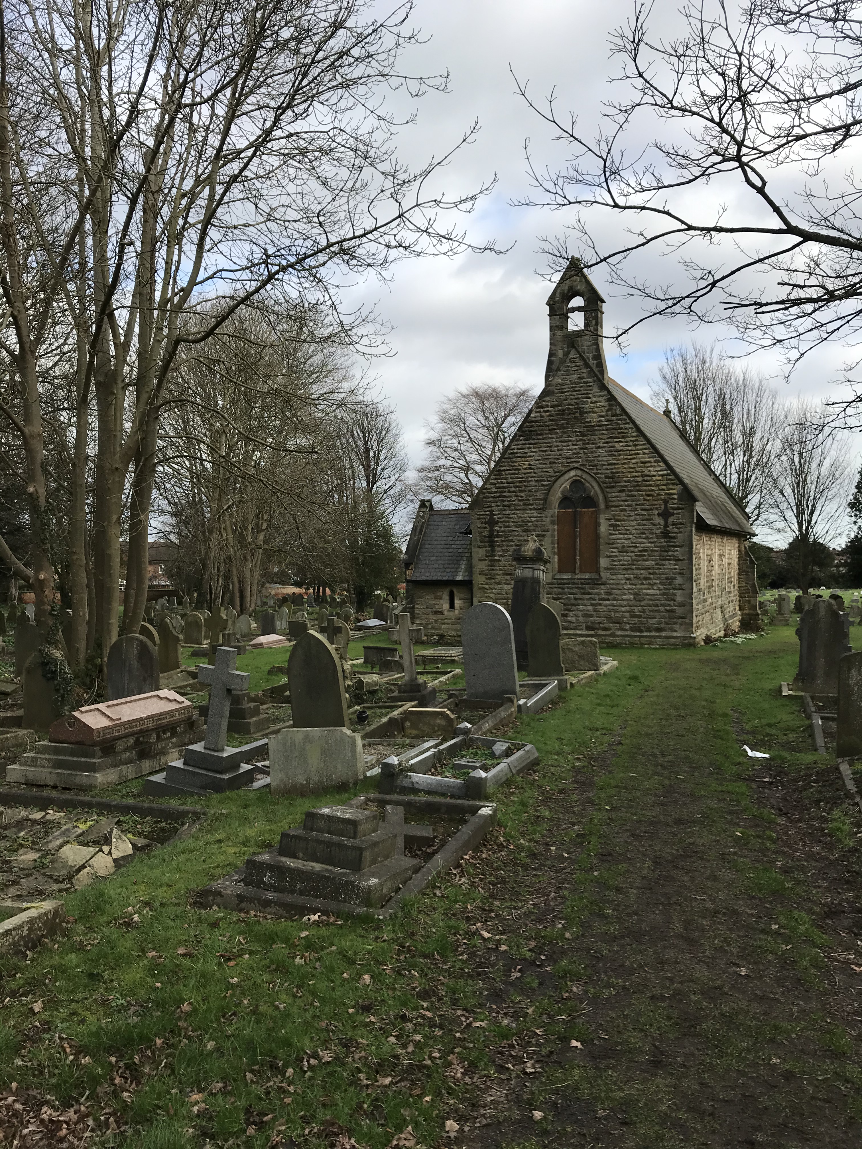
| Description | : | In 1864, Rachel Myers gifted five acres on Molescroft Road as an additional burial ground for St Mary parish. This was the third burial ground for the St Mary parish, the other two being St Mary Churchyard and a separate cemetery opened on North Bar Within in 1829. A three acre plot at the Molecroft Road location was consecrated and parish burials officially commenced in 1869. However, temporary burial licenses were issued in prior years, including one for the burial of Mrs. Myers in 1867. A mortuary chapel with a later 13th-century style was designed by William Hawe... Read More |
frequently asked questions (FAQ):
-
Where is St. Mary's Molescroft Road Cemetery?
St. Mary's Molescroft Road Cemetery is located at 5 Molescroft Road Beverley, East Riding of Yorkshire Unitary Authority ,East Riding of Yorkshire ,England.
-
St. Mary's Molescroft Road Cemetery cemetery's updated grave count on graveviews.com?
103 memorials
-
Where are the coordinates of the St. Mary's Molescroft Road Cemetery?
Latitude: 53.8490070
Longitude: -0.4421000
Nearby Cemetories:
1. St. Mary North Bar Within Cemetery
Beverley, East Riding of Yorkshire Unitary Authority, England
Coordinate: 53.8445340, -0.4355770
2. St. Mary's Churchyard
Beverley, East Riding of Yorkshire Unitary Authority, England
Coordinate: 53.8440200, -0.4338100
3. St. Martin's Cemetery
Beverley, East Riding of Yorkshire Unitary Authority, England
Coordinate: 53.8360660, -0.4370590
4. Beverley Minster Churchyard
Beverley, East Riding of Yorkshire Unitary Authority, England
Coordinate: 53.8389560, -0.4247920
5. St John Cemetery
Beverley, East Riding of Yorkshire Unitary Authority, England
Coordinate: 53.8350750, -0.4354910
6. Queensgate Cemetery
Beverley, East Riding of Yorkshire Unitary Authority, England
Coordinate: 53.8314000, -0.4385100
7. St Nicholas Churchyard
Beverley, East Riding of Yorkshire Unitary Authority, England
Coordinate: 53.8411520, -0.4142730
8. All Saints Churchyard
Bishop Burton, East Riding of Yorkshire Unitary Authority, England
Coordinate: 53.8443750, -0.4959940
9. St Catherine Churchyard
Leconfield, East Riding of Yorkshire Unitary Authority, England
Coordinate: 53.8800640, -0.4572990
10. St Michael and All Angels Churchyard
Cherry Burton, East Riding of Yorkshire Unitary Authority, England
Coordinate: 53.8658140, -0.4952220
11. St Mary Churchyard
Etton, East Riding of Yorkshire Unitary Authority, England
Coordinate: 53.8791000, -0.5086000
12. St Mary Churchyard
Lockington, East Riding of Yorkshire Unitary Authority, England
Coordinate: 53.9081670, -0.4837860
13. Cottingham Municipal Cemetery
Cottingham, East Riding of Yorkshire Unitary Authority, England
Coordinate: 53.7829540, -0.4307820
14. St Mary the Virgin Churchyard
Cottingham, East Riding of Yorkshire Unitary Authority, England
Coordinate: 53.7821910, -0.4117230
15. St Margaret Churchyard
Beswick, East Riding of Yorkshire Unitary Authority, England
Coordinate: 53.9194140, -0.4599290
16. St. Faith Churchyard
Leven, East Riding of Yorkshire Unitary Authority, England
Coordinate: 53.8943111, -0.3407167
17. Priory Woods Cemetery
Cottingham, East Riding of Yorkshire Unitary Authority, England
Coordinate: 53.7748730, -0.4089420
18. Holy Trinity Churchyard
Leven, East Riding of Yorkshire Unitary Authority, England
Coordinate: 53.8915167, -0.3172194
19. Haltemprice Priory
Cottingham, East Riding of Yorkshire Unitary Authority, England
Coordinate: 53.7642860, -0.4207310
20. All Saints Churchyard
Kilnwick, East Riding of Yorkshire Unitary Authority, England
Coordinate: 53.9320900, -0.4830980
21. St Margaret Churchyard
Long Riston, East Riding of Yorkshire Unitary Authority, England
Coordinate: 53.8686420, -0.2928580
22. Northern Cemetery
Kingston upon Hull, Kingston upon Hull Unitary Authority, England
Coordinate: 53.7678410, -0.3737990
23. Chanterlands Crematorium and Columbarium
Kingston upon Hull, Kingston upon Hull Unitary Authority, England
Coordinate: 53.7647830, -0.3768310
24. St Andrew Churchyard
Kirk Ella, East Riding of Yorkshire Unitary Authority, England
Coordinate: 53.7538430, -0.4542050