
| Memorials | : | 191 |
| Location | : | Beverley, East Riding of Yorkshire Unitary Authority, England |
| Coordinate | : | 53.8445340, -0.4355770 |
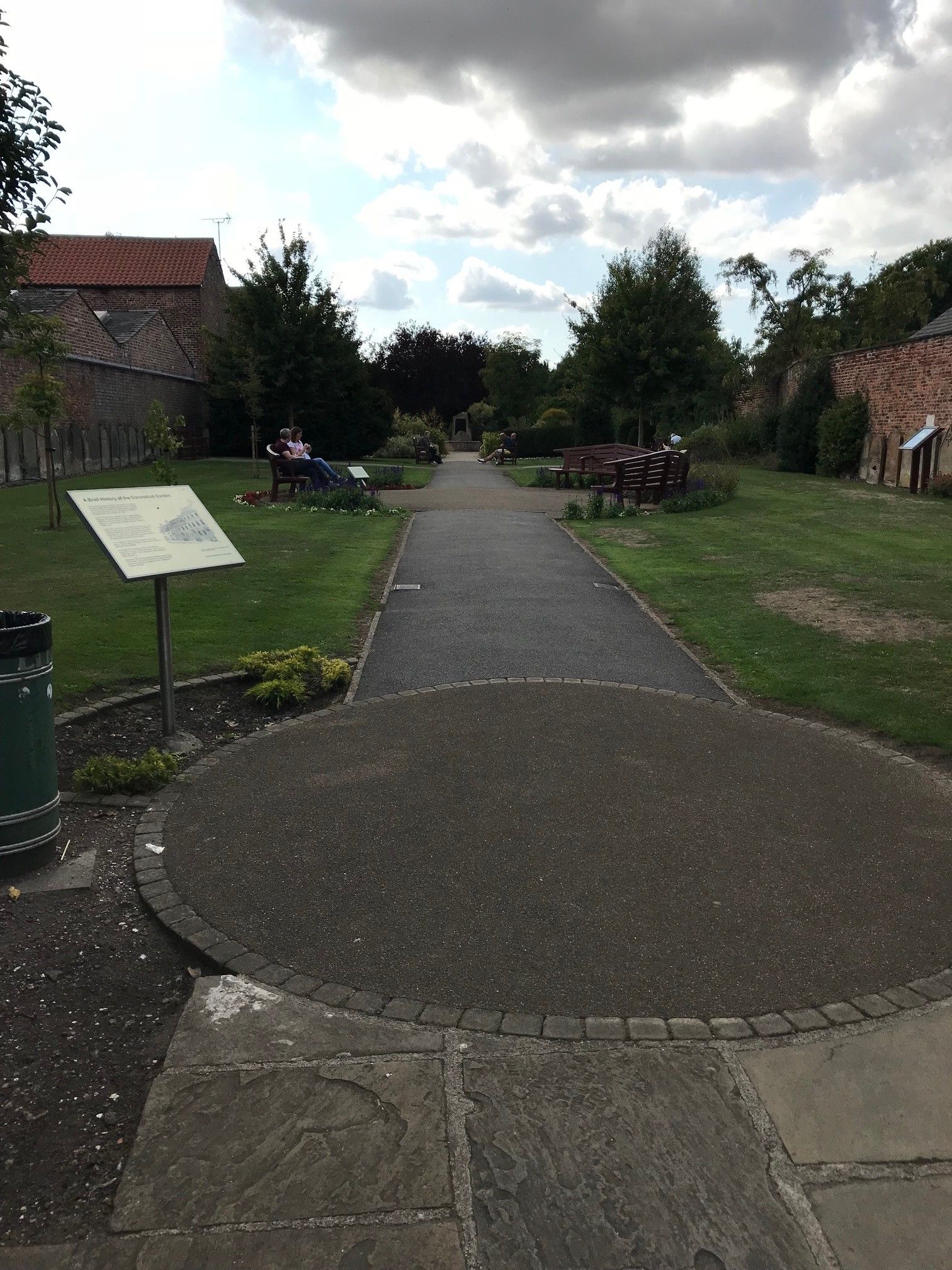
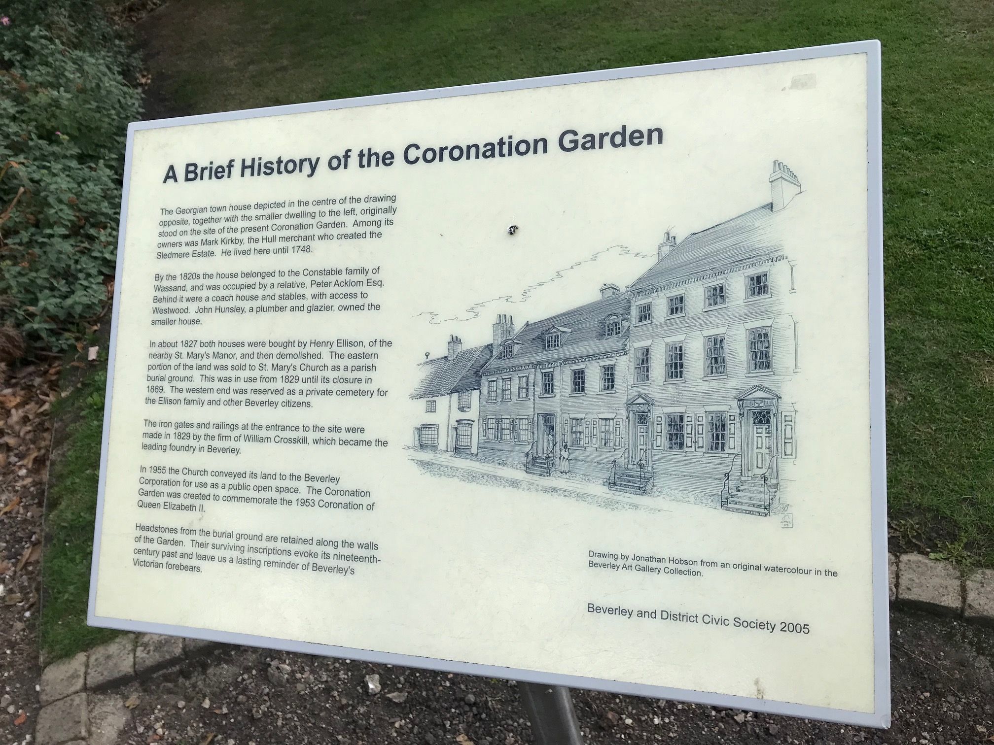
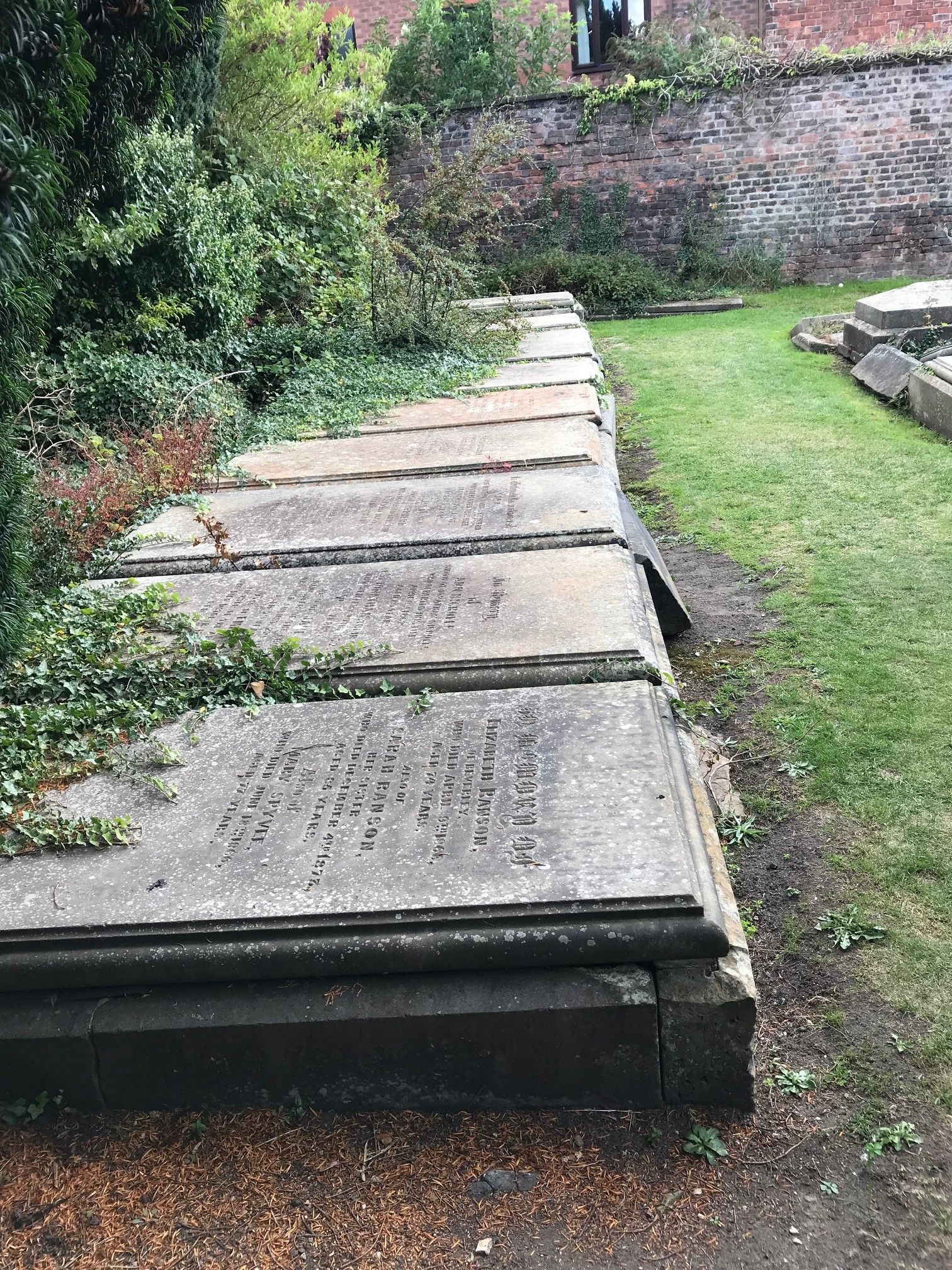
| Description | : | This cemetery contains two sections separated by an old metal fence. The largest portion on the easterly side was consecrated for burials from St Mary parish, with a smaller section on the westerly end reserved as a private burial ground for Henry Ellison and his family. This is the second location in Beverley to be developed for the burial of parishioners from St Mary Church. The first location is the St Mary Churchyard immediately adjacent to the church building where burials continued to about 1859. A third cemetery on Molescroft Road was consecrated for use by St Mary’s... Read More |
frequently asked questions (FAQ):
-
Where is St. Mary North Bar Within Cemetery?
St. Mary North Bar Within Cemetery is located at 55 North Bar Within Beverley, East Riding of Yorkshire Unitary Authority ,East Riding of Yorkshire , HU17 8DGEngland.
-
St. Mary North Bar Within Cemetery cemetery's updated grave count on graveviews.com?
191 memorials
-
Where are the coordinates of the St. Mary North Bar Within Cemetery?
Latitude: 53.8445340
Longitude: -0.4355770
Nearby Cemetories:
1. St. Mary's Churchyard
Beverley, East Riding of Yorkshire Unitary Authority, England
Coordinate: 53.8440200, -0.4338100
2. St. Mary's Molescroft Road Cemetery
Beverley, East Riding of Yorkshire Unitary Authority, England
Coordinate: 53.8490070, -0.4421000
3. Beverley Minster Churchyard
Beverley, East Riding of Yorkshire Unitary Authority, England
Coordinate: 53.8389560, -0.4247920
4. St. Martin's Cemetery
Beverley, East Riding of Yorkshire Unitary Authority, England
Coordinate: 53.8360660, -0.4370590
5. St John Cemetery
Beverley, East Riding of Yorkshire Unitary Authority, England
Coordinate: 53.8350750, -0.4354910
6. St Nicholas Churchyard
Beverley, East Riding of Yorkshire Unitary Authority, England
Coordinate: 53.8411520, -0.4142730
7. Queensgate Cemetery
Beverley, East Riding of Yorkshire Unitary Authority, England
Coordinate: 53.8314000, -0.4385100
8. All Saints Churchyard
Bishop Burton, East Riding of Yorkshire Unitary Authority, England
Coordinate: 53.8443750, -0.4959940
9. St Catherine Churchyard
Leconfield, East Riding of Yorkshire Unitary Authority, England
Coordinate: 53.8800640, -0.4572990
10. St Michael and All Angels Churchyard
Cherry Burton, East Riding of Yorkshire Unitary Authority, England
Coordinate: 53.8658140, -0.4952220
11. St Mary Churchyard
Etton, East Riding of Yorkshire Unitary Authority, England
Coordinate: 53.8791000, -0.5086000
12. Cottingham Municipal Cemetery
Cottingham, East Riding of Yorkshire Unitary Authority, England
Coordinate: 53.7829540, -0.4307820
13. St Mary the Virgin Churchyard
Cottingham, East Riding of Yorkshire Unitary Authority, England
Coordinate: 53.7821910, -0.4117230
14. St Mary Churchyard
Lockington, East Riding of Yorkshire Unitary Authority, England
Coordinate: 53.9081670, -0.4837860
15. Priory Woods Cemetery
Cottingham, East Riding of Yorkshire Unitary Authority, England
Coordinate: 53.7748730, -0.4089420
16. St. Faith Churchyard
Leven, East Riding of Yorkshire Unitary Authority, England
Coordinate: 53.8943111, -0.3407167
17. St Margaret Churchyard
Beswick, East Riding of Yorkshire Unitary Authority, England
Coordinate: 53.9194140, -0.4599290
18. Haltemprice Priory
Cottingham, East Riding of Yorkshire Unitary Authority, England
Coordinate: 53.7642860, -0.4207310
19. Holy Trinity Churchyard
Leven, East Riding of Yorkshire Unitary Authority, England
Coordinate: 53.8915167, -0.3172194
20. Northern Cemetery
Kingston upon Hull, Kingston upon Hull Unitary Authority, England
Coordinate: 53.7678410, -0.3737990
21. Chanterlands Crematorium and Columbarium
Kingston upon Hull, Kingston upon Hull Unitary Authority, England
Coordinate: 53.7647830, -0.3768310
22. St Margaret Churchyard
Long Riston, East Riding of Yorkshire Unitary Authority, England
Coordinate: 53.8686420, -0.2928580
23. St John Churchyard
Newland, Kingston upon Hull Unitary Authority, England
Coordinate: 53.7687010, -0.3525730
24. St Andrew Churchyard
Kirk Ella, East Riding of Yorkshire Unitary Authority, England
Coordinate: 53.7538430, -0.4542050