
| Memorials | : | 1 |
| Location | : | Leconfield, East Riding of Yorkshire Unitary Authority, England |
| Coordinate | : | 53.8800640, -0.4572990 |
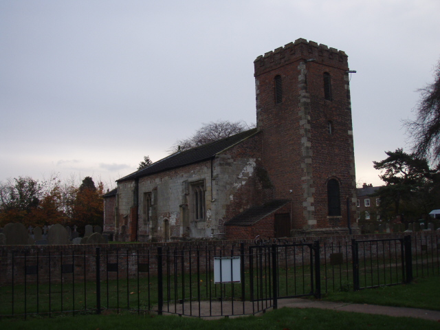
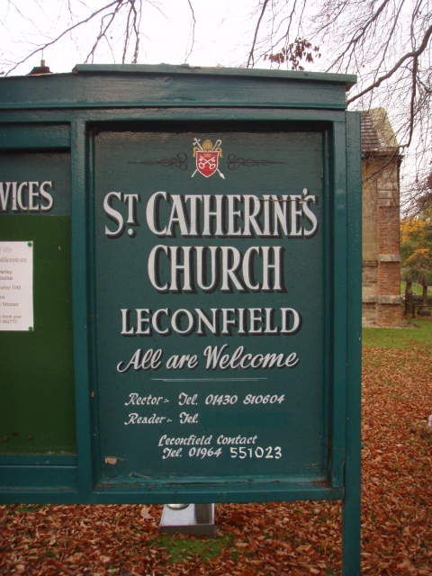
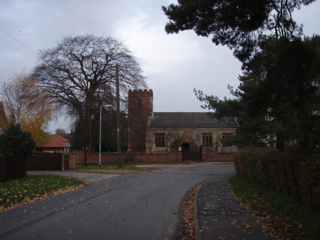
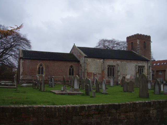
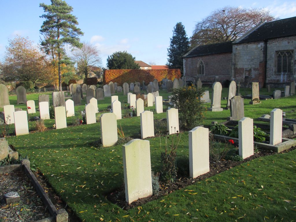
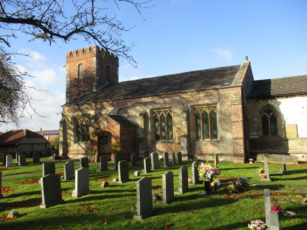
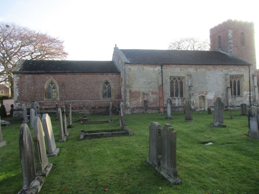
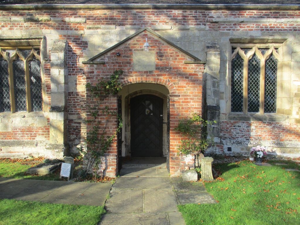
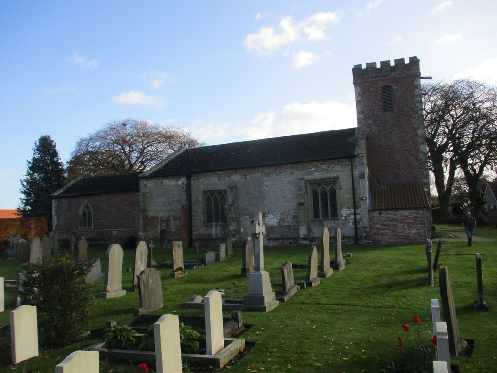
| Description | : | There are two churches in the parish of Leconfield, the church of St Catherine in Leconfield village on the east side of the A164, on the road to Arram, and the church of St Leonard at Scorborough. Both churches are Church of England denomination and services are held each Sunday. The church of St Catherine holds particular interest. The fi church on the site dated from the 7th century .The present church dates from the 11 th century, with many fine features, notably brick tower at the west end, the porch and the pulpit. There are 51 wargraves here.... Read More |
frequently asked questions (FAQ):
-
Where is St Catherine Churchyard?
St Catherine Churchyard is located at Leconfield, East Riding of Yorkshire Unitary Authority ,East Riding of Yorkshire ,England.
-
St Catherine Churchyard cemetery's updated grave count on graveviews.com?
1 memorials
-
Where are the coordinates of the St Catherine Churchyard?
Latitude: 53.8800640
Longitude: -0.4572990


Nearby Cemetories:
1. St Michael and All Angels Churchyard
Cherry Burton, East Riding of Yorkshire Unitary Authority, England
Coordinate: 53.8658140, -0.4952220
2. St Mary Churchyard
Etton, East Riding of Yorkshire Unitary Authority, England
Coordinate: 53.8791000, -0.5086000
3. St Mary Churchyard
Lockington, East Riding of Yorkshire Unitary Authority, England
Coordinate: 53.9081670, -0.4837860
4. St. Mary's Molescroft Road Cemetery
Beverley, East Riding of Yorkshire Unitary Authority, England
Coordinate: 53.8490070, -0.4421000
5. St. Mary North Bar Within Cemetery
Beverley, East Riding of Yorkshire Unitary Authority, England
Coordinate: 53.8445340, -0.4355770
6. St. Mary's Churchyard
Beverley, East Riding of Yorkshire Unitary Authority, England
Coordinate: 53.8440200, -0.4338100
7. St Margaret Churchyard
Beswick, East Riding of Yorkshire Unitary Authority, England
Coordinate: 53.9194140, -0.4599290
8. All Saints Churchyard
Bishop Burton, East Riding of Yorkshire Unitary Authority, England
Coordinate: 53.8443750, -0.4959940
9. Beverley Minster Churchyard
Beverley, East Riding of Yorkshire Unitary Authority, England
Coordinate: 53.8389560, -0.4247920
10. St. Martin's Cemetery
Beverley, East Riding of Yorkshire Unitary Authority, England
Coordinate: 53.8360660, -0.4370590
11. St Nicholas Churchyard
Beverley, East Riding of Yorkshire Unitary Authority, England
Coordinate: 53.8411520, -0.4142730
12. St John Cemetery
Beverley, East Riding of Yorkshire Unitary Authority, England
Coordinate: 53.8350750, -0.4354910
13. Queensgate Cemetery
Beverley, East Riding of Yorkshire Unitary Authority, England
Coordinate: 53.8314000, -0.4385100
14. All Saints Churchyard
Kilnwick, East Riding of Yorkshire Unitary Authority, England
Coordinate: 53.9320900, -0.4830980
15. St. Faith Churchyard
Leven, East Riding of Yorkshire Unitary Authority, England
Coordinate: 53.8943111, -0.3407167
16. Holy Trinity Churchyard
Leven, East Riding of Yorkshire Unitary Authority, England
Coordinate: 53.8915167, -0.3172194
17. St Peter Churchyard
Hutton Cranswick, East Riding of Yorkshire Unitary Authority, England
Coordinate: 53.9660000, -0.4405180
18. St. Andrew's Churchyard
Bainton, East Riding of Yorkshire Unitary Authority, England
Coordinate: 53.9583420, -0.5309270
19. St Margaret Churchyard
Long Riston, East Riding of Yorkshire Unitary Authority, England
Coordinate: 53.8686420, -0.2928580
20. Cottingham Municipal Cemetery
Cottingham, East Riding of Yorkshire Unitary Authority, England
Coordinate: 53.7829540, -0.4307820
21. St. Mary's Churchyard
Brandesburton, East Riding of Yorkshire Unitary Authority, England
Coordinate: 53.9129460, -0.2968880
22. St Mary the Virgin Churchyard
Cottingham, East Riding of Yorkshire Unitary Authority, England
Coordinate: 53.7821910, -0.4117230
23. St. Michael's Churchyard
Catwick, East Riding of Yorkshire Unitary Authority, England
Coordinate: 53.8921250, -0.2805722
24. St Mary Churchyard
Kirkburn, East Riding of Yorkshire Unitary Authority, England
Coordinate: 53.9820470, -0.5073770