
| Memorials | : | 0 |
| Location | : | Balcombe, Mid Sussex District, England |
| Coordinate | : | 51.0626380, -0.1362240 |
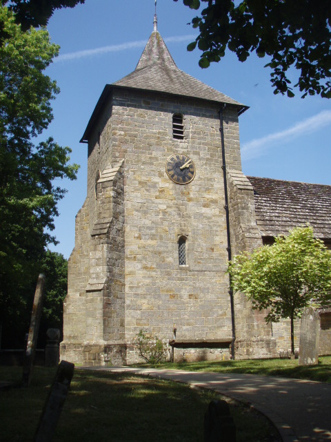
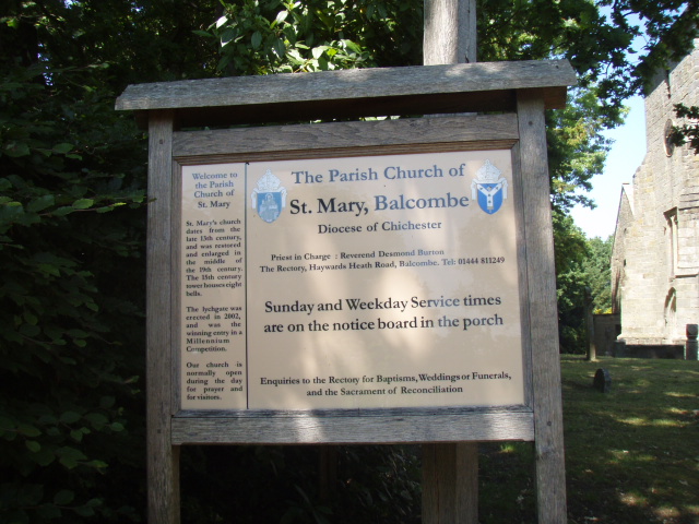
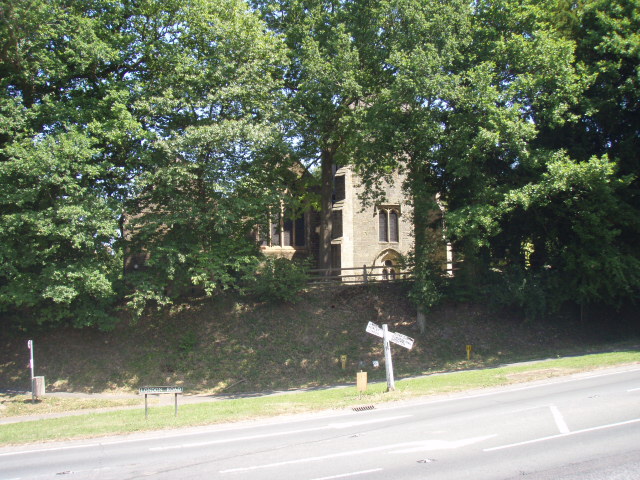
| Description | : | The village of Balcombe is situated between the towns of Haywards Heath and Crawley and lies at the heart of the High Weald Area of Outstanding Natural Beauty. Although parts of this beautiful church date back to the 13th Century, the prominent tower was built later in the 15th Century and houses eight bells. St. Mary's was restored and enlarged in the mid-19th century and the lychgate, erected in 2002 from locally grown oak, Added by Wertypop. |
frequently asked questions (FAQ):
-
Where is St Mary's Churchyard?
St Mary's Churchyard is located at London Road Balcombe, Mid Sussex District ,West Sussex , RH17 6PXEngland.
-
St Mary's Churchyard cemetery's updated grave count on graveviews.com?
0 memorials
-
Where are the coordinates of the St Mary's Churchyard?
Latitude: 51.0626380
Longitude: -0.1362240


Nearby Cemetories:
1. Saatchi Tomb
Mid Sussex District, England
Coordinate: 51.0398900, -0.1647300
2. St Mark's Churchyard
Staplefield, Mid Sussex District, England
Coordinate: 51.0387526, -0.1788845
3. St Nicholas Churchyard
Worth, Mid Sussex District, England
Coordinate: 51.1102870, -0.1415280
4. St Leonard's Church
Turners Hill, Mid Sussex District, England
Coordinate: 51.1023030, -0.0911310
5. All Saints Churchyard
Highbrook, Mid Sussex District, England
Coordinate: 51.0547981, -0.0573000
6. St Mary Churchyard
Slaugham, Mid Sussex District, England
Coordinate: 51.0385470, -0.2081720
7. St Margaret of Antioch Churchyard
West Hoathly, Mid Sussex District, England
Coordinate: 51.0762500, -0.0555430
8. Holy Trinity Churchyard
Cuckfield, Mid Sussex District, England
Coordinate: 51.0048580, -0.1434300
9. All Saints Churchyard
Lindfield, Mid Sussex District, England
Coordinate: 51.0163470, -0.0784980
10. Friary Churchyard of St. Francis and St. Anthony
Crawley, Crawley Borough, England
Coordinate: 51.1133670, -0.1875970
11. St John the Baptist Church
Crawley, Crawley Borough, England
Coordinate: 51.1140840, -0.1892240
12. St Wilfrid's Churchyard
Haywards Heath, Mid Sussex District, England
Coordinate: 50.9993130, -0.1046570
13. All Saints Churchyard
Crawley Down, Mid Sussex District, England
Coordinate: 51.1211200, -0.0830650
14. Snell Hatch Cemetery
Crawley, Crawley Borough, England
Coordinate: 51.1164130, -0.2053970
15. Western Road Cemetery
Haywards Heath, Mid Sussex District, England
Coordinate: 50.9987100, -0.0920000
16. St Saviour Churchyard
Colgate, Horsham District, England
Coordinate: 51.0817080, -0.2444000
17. St Giles Churchyard
Horsted Keynes, Mid Sussex District, England
Coordinate: 51.0400680, -0.0276550
18. Surrey and Sussex Crematorium
Crawley, Crawley Borough, England
Coordinate: 51.1357000, -0.1469230
19. St John the Evangelist Churchyard
Copthorne, Crawley Borough, England
Coordinate: 51.1394100, -0.1175700
20. Friends Meeting House
Ifield, Crawley Borough, England
Coordinate: 51.1263400, -0.2120200
21. St Margaret of Antioch Churchyard
Ifield, Crawley Borough, England
Coordinate: 51.1238700, -0.2194760
22. Holy Trinity Churchyard
Lower Beeding, Horsham District, England
Coordinate: 51.0331850, -0.2610280
23. St. Mary Magdalene Churchyard
Bolney, Mid Sussex District, England
Coordinate: 50.9898000, -0.2035200
24. Danehill Cemetery
Danehill, Wealden District, England
Coordinate: 51.0295210, -0.0010970