
| Memorials | : | 0 |
| Location | : | South Bersted, Arun District, England |
| Coordinate | : | 50.7940070, -0.6751900 |
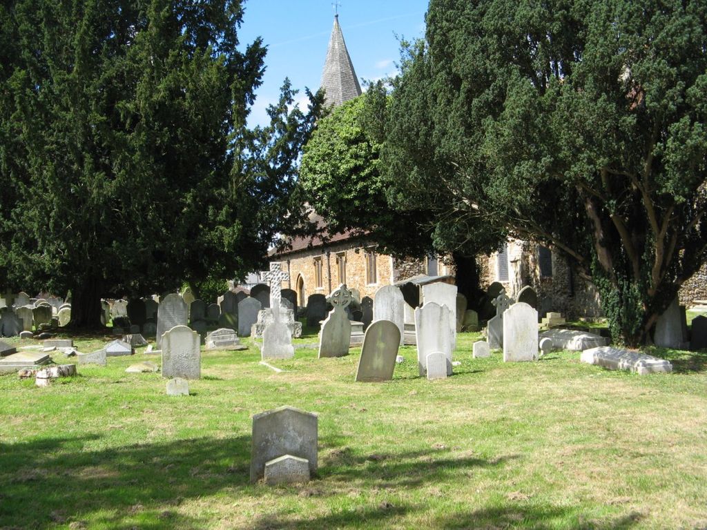
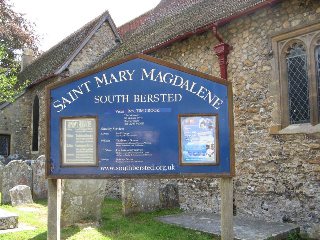
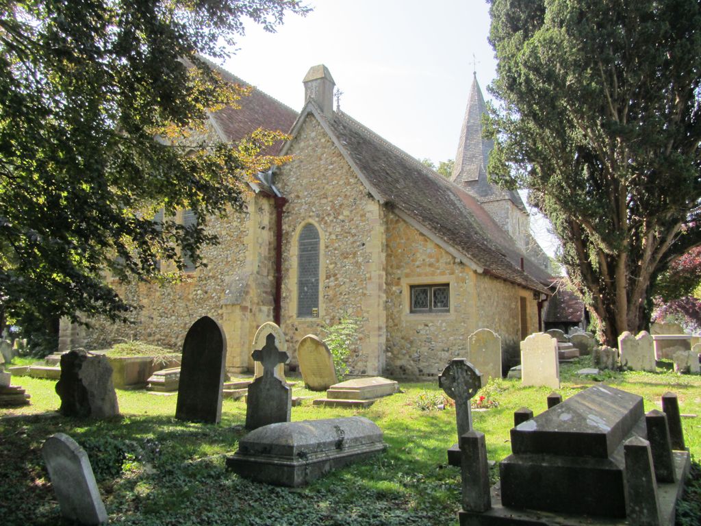
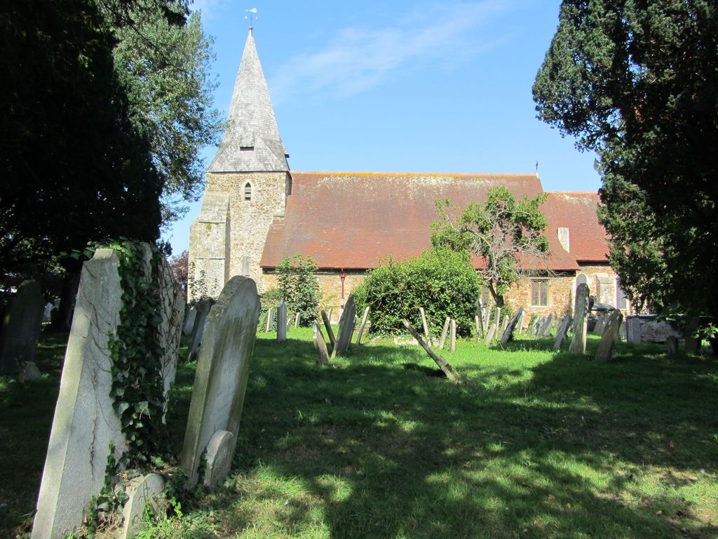
| Description | : | The church at South Bersted was consecrated and dedicated by the Bishop Reade of Chichester in 1405 before a large congregation. The original church had been a focal point of Bersted since the mid thirteenth century. John Farndon in 1254 was the first named Vicar. The village of Bersted itself, known by its Saxon name 'Beorghamsted' (translating to 'Hill village place' in modern English), was part of the Hundred of Pagham given to St Wilfred by Caedwalla all the way back in the 7th century, and transferred by him to the Archbishop of Canterbury, who remains the... Read More |
frequently asked questions (FAQ):
-
Where is St Mary Magdalene Churchyard?
St Mary Magdalene Churchyard is located at Bersted Street South Bersted, Arun District ,West Sussex , PO22 9QDEngland.
-
St Mary Magdalene Churchyard cemetery's updated grave count on graveviews.com?
0 memorials
-
Where are the coordinates of the St Mary Magdalene Churchyard?
Latitude: 50.7940070
Longitude: -0.6751900


Nearby Cemetories:
1. Bognor Regis Old Cemetery
Bognor Regis, Arun District, England
Coordinate: 50.7907867, -0.6811950
2. Chalcraft Lane Cemetery
Bersted, Arun District, England
Coordinate: 50.7960950, -0.7002410
3. St Mary The Virgin Churchyard
Barnham, Arun District, England
Coordinate: 50.8236310, -0.6436550
4. St Nicholas Churchyard
Middleton-on-Sea, Arun District, England
Coordinate: 50.7942900, -0.6147400
5. Saint George's Churchyard
Eastergate, Arun District, England
Coordinate: 50.8379600, -0.6592400
6. St Mary Churchyard
Aldingbourne, Arun District, England
Coordinate: 50.8436400, -0.6935500
7. St. Mary the Virgin
Yapton, Arun District, England
Coordinate: 50.8230000, -0.6076000
8. St Andrew Churchyard and Extension
Oving, Chichester District, England
Coordinate: 50.8379190, -0.7219220
9. St. Stephen Churchyard
North Mundham, Chichester District, England
Coordinate: 50.8122060, -0.7603850
10. St Andrew Churchyard
Tangmere, Chichester District, England
Coordinate: 50.8479850, -0.7207170
11. St Mary Churchyard
Walberton, Arun District, England
Coordinate: 50.8436840, -0.6186680
12. St Mary Churchyard
Climping (Clymping), Arun District, England
Coordinate: 50.8137720, -0.5777690
13. St. Mary's Churchyard
Chichester, Chichester District, England
Coordinate: 50.8300340, -0.7659220
14. St Andrew-by-the-Ford Church
Ford, Arun District, England
Coordinate: 50.8242700, -0.5780060
15. St Wilfrid Churchyard
Church Norton, Chichester District, England
Coordinate: 50.7549150, -0.7651610
16. St Mary and St Blaise Church
Boxgrove, Chichester District, England
Coordinate: 50.8599300, -0.7110320
17. Portfield Cemetery
Chichester, Chichester District, England
Coordinate: 50.8408650, -0.7581440
18. St Peter Churchyard
Westhampnett, Chichester District, England
Coordinate: 50.8483570, -0.7501950
19. Chichester Crematorium and Garden of Remembrance
Chichester, Chichester District, England
Coordinate: 50.8438740, -0.7593710
20. Saint Mary Magdalene Churchyard
Tortington, Arun District, England
Coordinate: 50.8357610, -0.5768007
21. St Mary Churchyard
Slindon, Arun District, England
Coordinate: 50.8666480, -0.6355800
22. St Andrew Oxmarket Churchyard
Chichester, Chichester District, England
Coordinate: 50.8366000, -0.7769000
23. St Richards Catholic Churchyard
Slindon, Arun District, England
Coordinate: 50.8680000, -0.6359000
24. Chichester Cathedral
Chichester, Chichester District, England
Coordinate: 50.8362579, -0.7806380