
| Memorials | : | 1 |
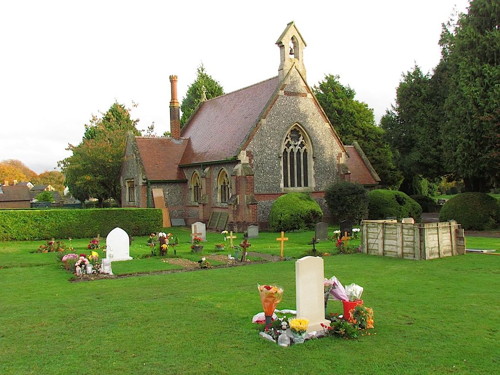
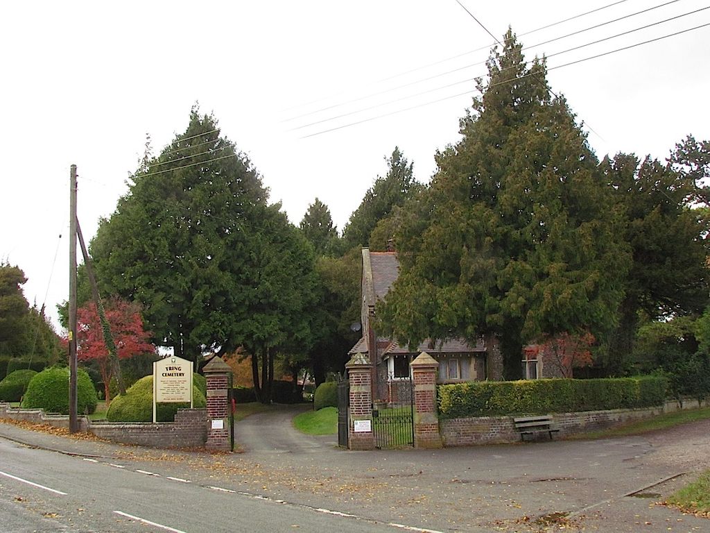
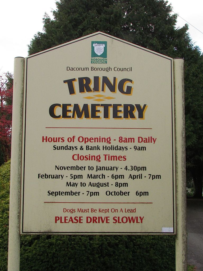
| Location | : | Tring, Dacorum Borough, England |
| Coordinate | : | 51.7893700, -0.6754900 |
| Description | : | Telephone: 01442 228066 |
frequently asked questions (FAQ):
-
Where is Tring Cemetery?
Tring Cemetery is located at Aylesbury Road Tring, Dacorum Borough ,Hertfordshire , HP23 4DHEngland.
-
Tring Cemetery cemetery's updated grave count on graveviews.com?
1 memorials
-
Where are the coordinates of the Tring Cemetery?
Latitude: 51.7893700
Longitude: -0.6754900
Nearby Cemetories:
1. Akeman Street Baptist Churchyard
Tring, Dacorum Borough, England
Coordinate: 51.7929500, -0.6624700
2. St Mary the Virgin Churchyard
Drayton Beauchamp, Aylesbury Vale District, England
Coordinate: 51.7979700, -0.6936800
3. New Mill Baptist Church Cemetery
Tring, Dacorum Borough, England
Coordinate: 51.8048400, -0.6604100
4. Wilstone Cemetery
Wilstone, Dacorum Borough, England
Coordinate: 51.8123300, -0.6773960
5. St Bartholomew Churchyard
Wigginton, Dacorum Borough, England
Coordinate: 51.7835990, -0.6351040
6. All Saints Churchyard
Buckland, Aylesbury Vale District, England
Coordinate: 51.8037310, -0.7134010
7. St. Michael and All Angels Churchyard
Aston Clinton, Aylesbury Vale District, England
Coordinate: 51.7993580, -0.7261320
8. St. Leonard's Churchyard
St Leonards, Chiltern District, England
Coordinate: 51.7547000, -0.6830429
9. St. Lawrence Churchyard
Cholesbury, Chiltern District, England
Coordinate: 51.7554990, -0.6550650
10. St. Michael Churchyard
Halton, Aylesbury Vale District, England
Coordinate: 51.7828900, -0.7341500
11. St. Mary's Churchyard
Pitstone, Aylesbury Vale District, England
Coordinate: 51.8251170, -0.6341170
12. St John the Baptist Churchyard
Aldbury, Dacorum Borough, England
Coordinate: 51.8025650, -0.6040510
13. All Saints Churchyard
Long Marston, Dacorum Borough, England
Coordinate: 51.8340100, -0.7029500
14. St Mary the Virgin Churchyard
Weston Turville, Aylesbury Vale District, England
Coordinate: 51.7846280, -0.7557710
15. St Mary Churchyard
Wendover, Aylesbury Vale District, England
Coordinate: 51.7578360, -0.7390050
16. St. Mary's Churchyard
Hawridge, Chiltern District, England
Coordinate: 51.7438010, -0.6252150
17. St. Mary's Churchyard
Northchurch, Dacorum Borough, England
Coordinate: 51.7697820, -0.5891900
18. Baptist Chapel Burial Ground
Northchurch, Dacorum Borough, England
Coordinate: 51.7680500, -0.5895400
19. St. John The Baptist Churchyard
The Lee, Chiltern District, England
Coordinate: 51.7309539, -0.6998248
20. Lee Common Primitive Methodist Chapel
Great Missenden, Chiltern District, England
Coordinate: 51.7286620, -0.6853732
21. St. Giles Churchyard
Cheddington, Aylesbury Vale District, England
Coordinate: 51.8530810, -0.6624440
22. St Mary's Ballinger
Great Missenden, Chiltern District, England
Coordinate: 51.7202550, -0.6832341
23. Coombe Hill Second Boer War Monument
Wendover, Aylesbury Vale District, England
Coordinate: 51.7530340, -0.7716060
24. St. Mary the Virgin Churchyard
Stoke Mandeville, Aylesbury Vale District, England
Coordinate: 51.7861990, -0.7913990