
| Memorials | : | 0 |
| Location | : | Rye, Rother District, England |
| Coordinate | : | 50.9501686, 0.7341530 |
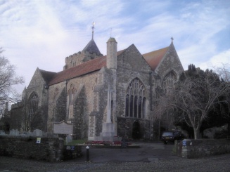
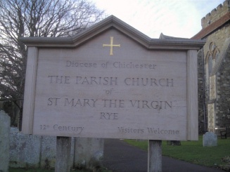
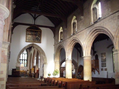
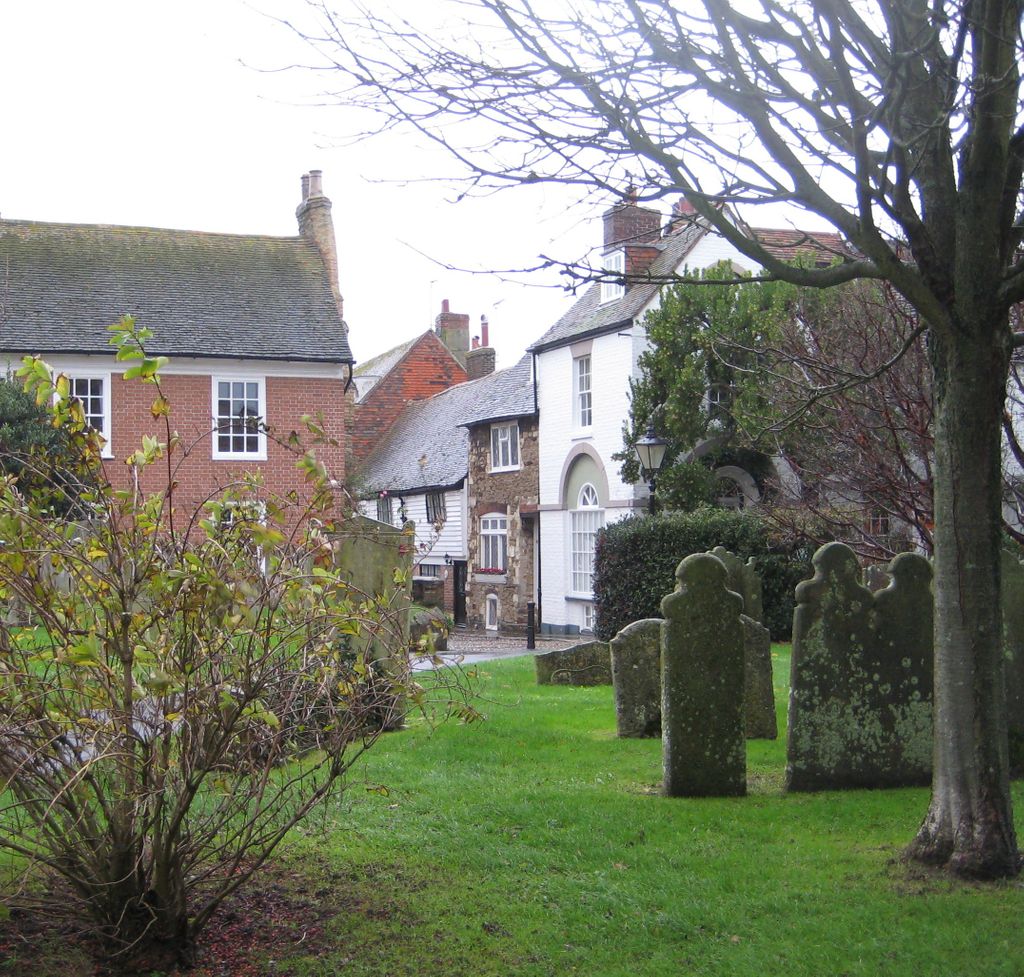
| Description | : | Dating from the 12th century with later additions, this large Anglican parish church is sometimes known as the Cathedral of East Sussex. There is a visitor’s centre and a climbable bell tower. The churchyard extends south and west from the church. In 1742 the churchyard was the site of a murder. John Breads, the town butcher, accidentally killed Allen Grebell in place of the mayor, his intended victim. John Breads was hanged and gibbeted. His skull was brought to the town hall where it still remains. It is claimed both men still haunt the churchyard. |
frequently asked questions (FAQ):
-
Where is St Mary the Virgin Churchyard?
St Mary the Virgin Churchyard is located at Rye, Rother District ,East Sussex ,England.
-
St Mary the Virgin Churchyard cemetery's updated grave count on graveviews.com?
0 memorials
-
Where are the coordinates of the St Mary the Virgin Churchyard?
Latitude: 50.9501686
Longitude: 0.7341530
Nearby Cemetories:
1. Rye Cemetery
Rye, Rother District, England
Coordinate: 50.9595370, 0.7322520
2. St. Michael's Churchyard
Playden, Rother District, England
Coordinate: 50.9621200, 0.7327000
3. Holy Spirit Churchyard
Rye Harbour, Rother District, England
Coordinate: 50.9387970, 0.7567050
4. Winchelsea Churchyard
Winchelsea, Rother District, England
Coordinate: 50.9241920, 0.7091480
5. All Saints Churchyard
Iden, Rother District, England
Coordinate: 50.9812930, 0.7275500
6. Iden Burial Ground
Iden, Rother District, England
Coordinate: 50.9813000, 0.7275300
7. Saint Peter & Saint Paul Church Churchyard
Peasmarsh, Rother District, England
Coordinate: 50.9645500, 0.6859200
8. All Saints and St Nicholas Churchyard
Icklesham, Rother District, England
Coordinate: 50.9171000, 0.6739770
9. Saint Mary Churchyard
Udimore, Rother District, England
Coordinate: 50.9399770, 0.6508420
10. Wittersham
Wittersham, Ashford Borough, England
Coordinate: 51.0115600, 0.7016000
11. St Mary the Virgin Churchyard
Stone-cum-Ebony, Ashford Borough, England
Coordinate: 51.0127980, 0.7645592
12. St. Thomas à Becket Cemetery
Fairfield, Shepway District, England
Coordinate: 51.0043210, 0.7993930
13. Saints Mary and Peter Churchyard
Pett, Rother District, England
Coordinate: 50.8944100, 0.6616400
14. Pett Methodist Chapel
Pett, Rother District, England
Coordinate: 50.8948184, 0.6606219
15. All Saints Churchyard
Beckley, Rother District, England
Coordinate: 50.9832400, 0.6245300
16. St Augustine Church
Brookland, Shepway District, England
Coordinate: 50.9973880, 0.8337460
17. St Laurence Churchyard
Guestling, Rother District, England
Coordinate: 50.8996239, 0.6366920
18. BroadOak Methodist Chapel
Brede, Rother District, England
Coordinate: 50.9487320, 0.6015820
19. St Peter and St Paul Churchyard
Appledore, Ashford Borough, England
Coordinate: 51.0295660, 0.7903990
20. Ebony Old Cemetery
Stone-cum-Ebony, Ashford Borough, England
Coordinate: 51.0378926, 0.7422129
21. St George Churchyard
Brede, Rother District, England
Coordinate: 50.9349140, 0.5963830
22. St Theresa's Catholic Church
Northiam, Rother District, England
Coordinate: 50.9654510, 0.5958960
23. St Mary's Churchyard
Northiam, Rother District, England
Coordinate: 50.9911250, 0.6061390
24. St John the Baptist
Small Hythe, Ashford Borough, England
Coordinate: 51.0396260, 0.6996060