
| Memorials | : | 0 |
| Location | : | Fairfield, Shepway District, England |
| Coordinate | : | 51.0043210, 0.7993930 |
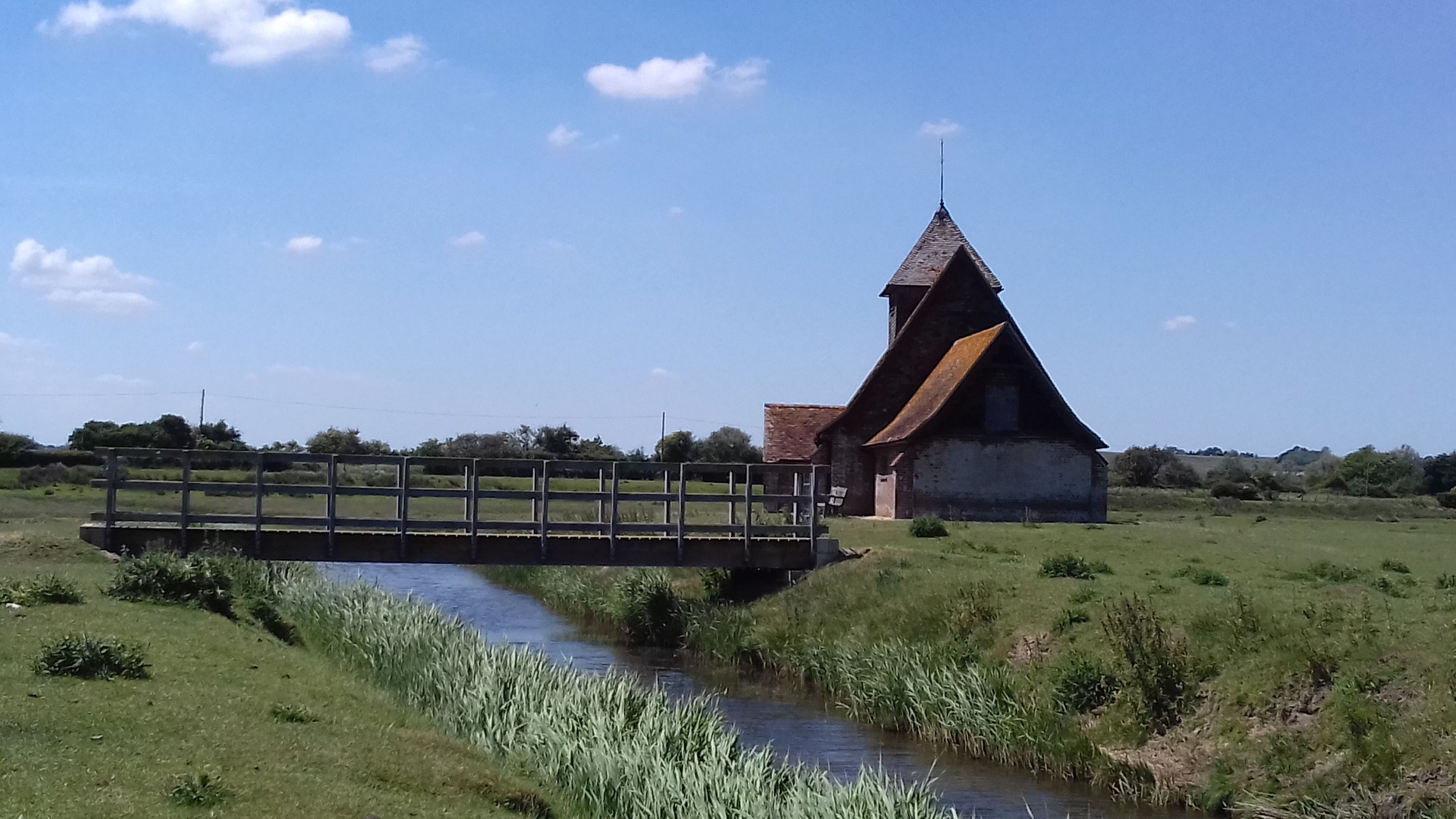
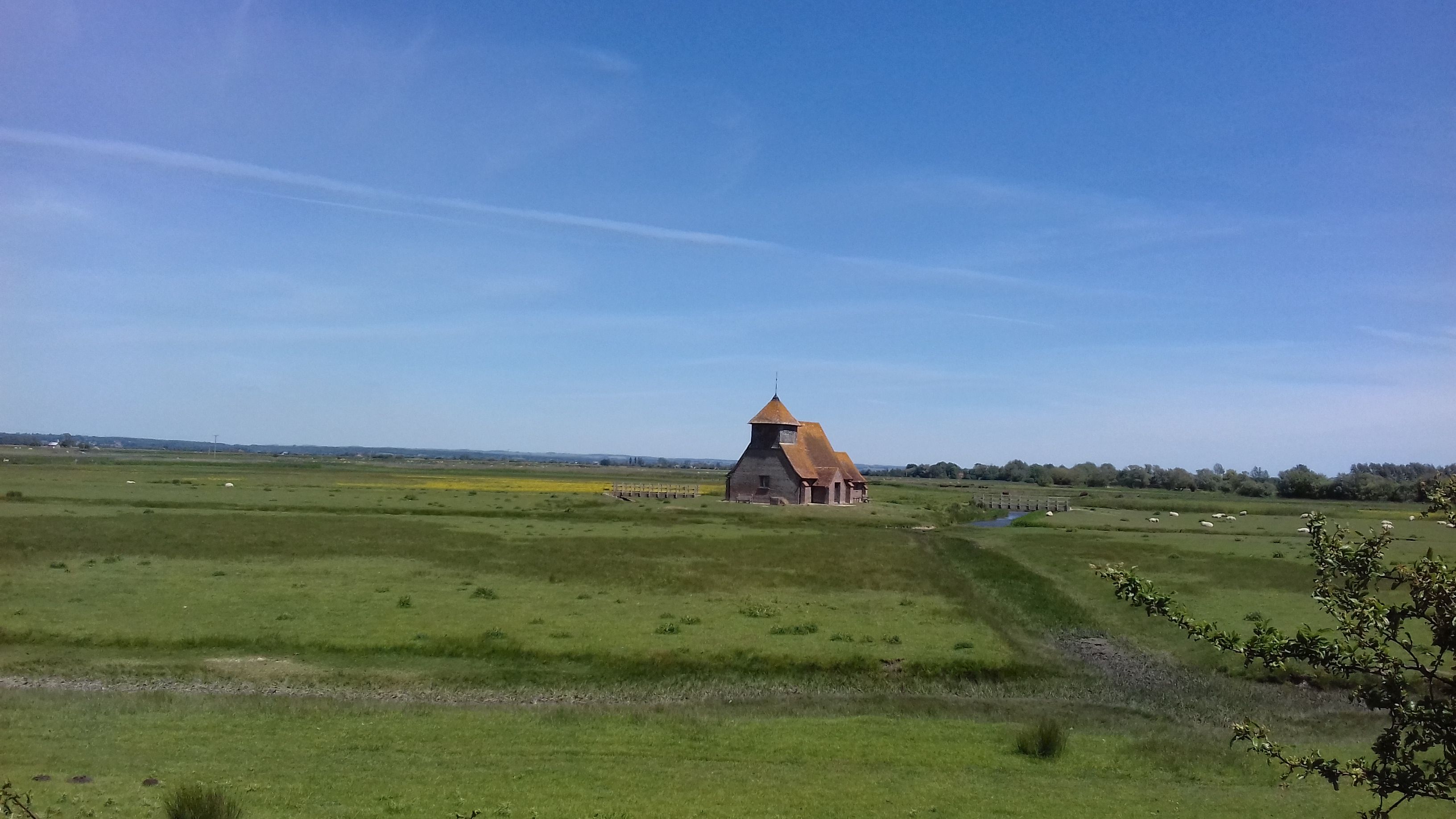
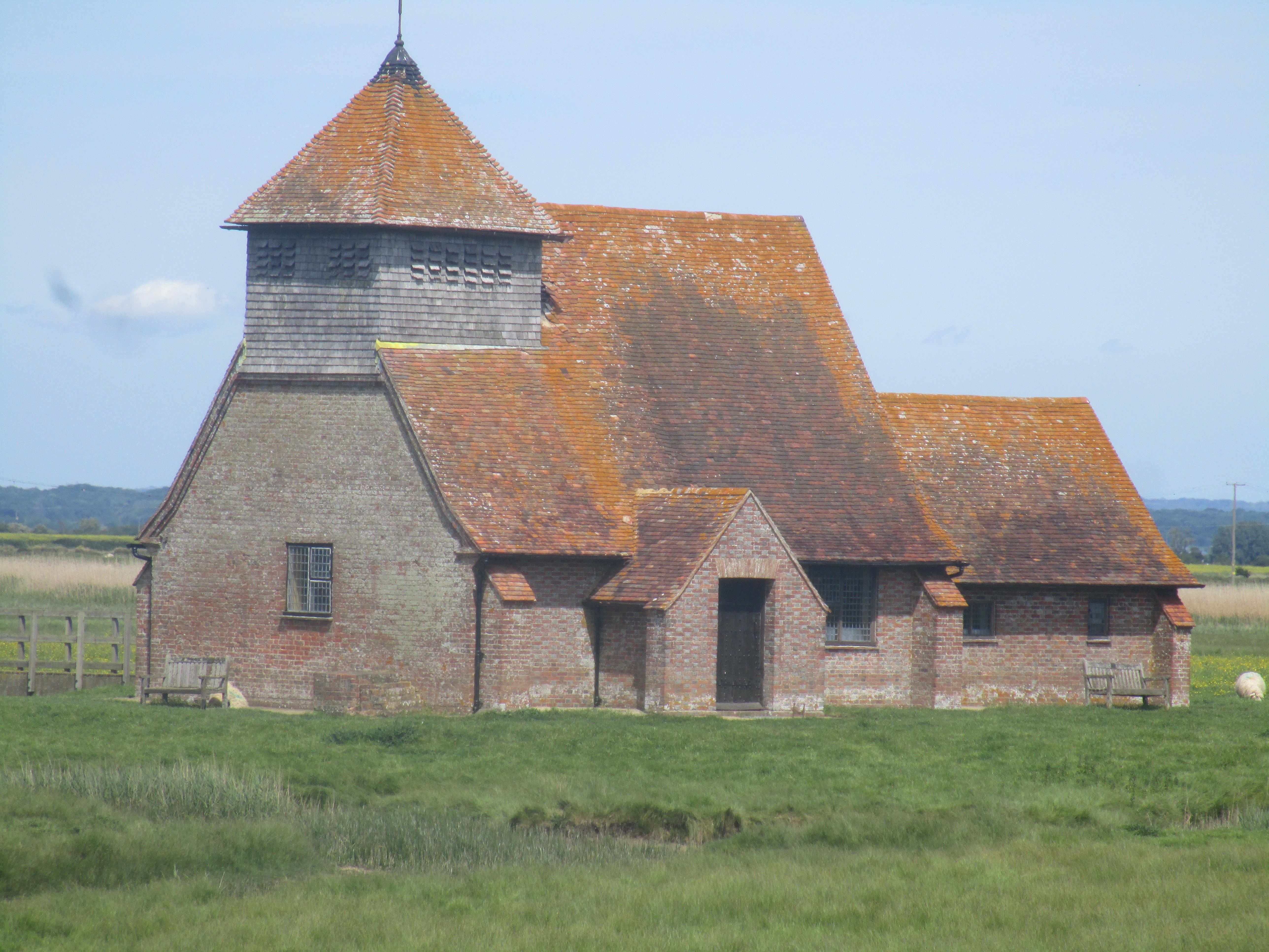
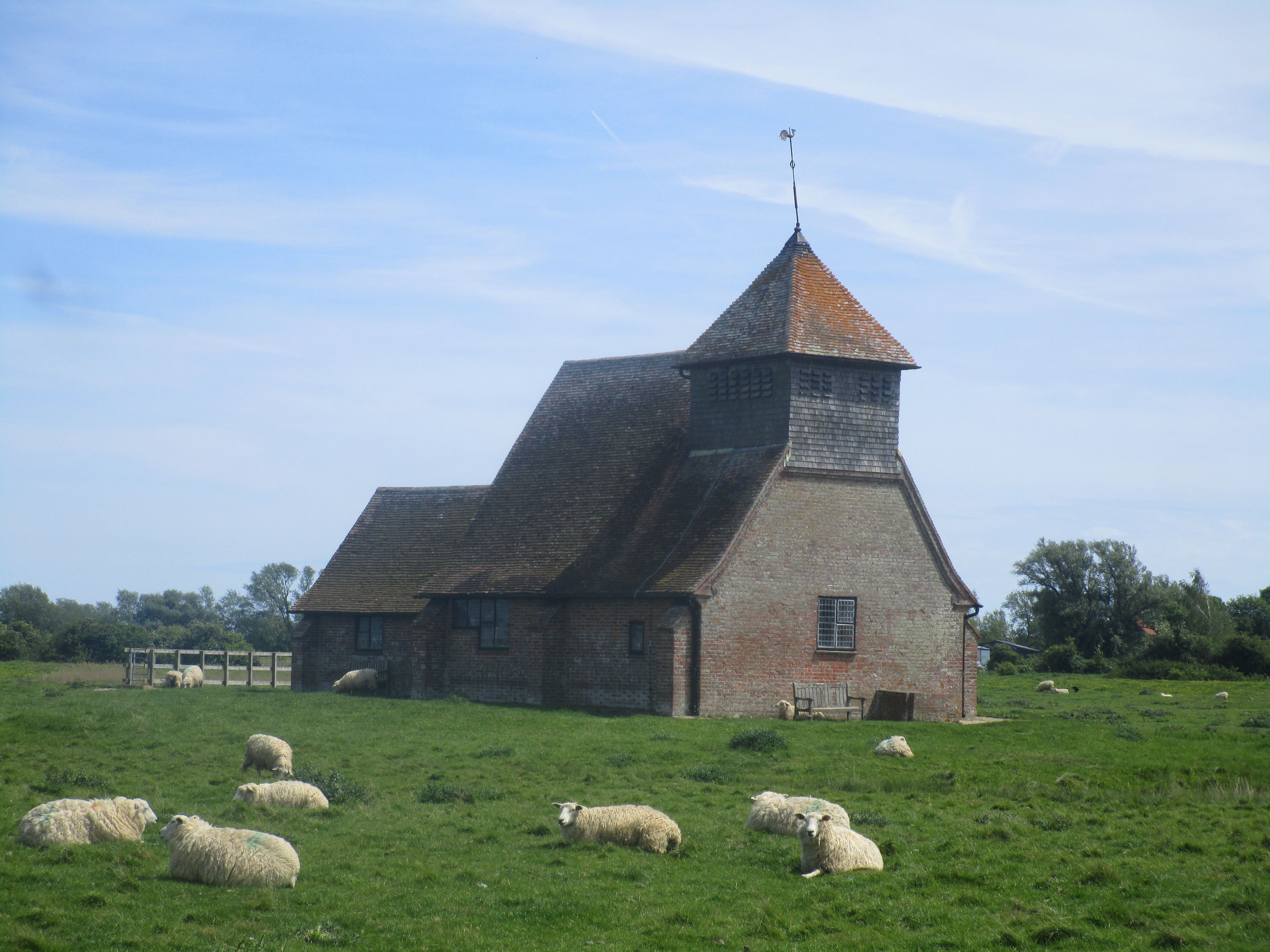
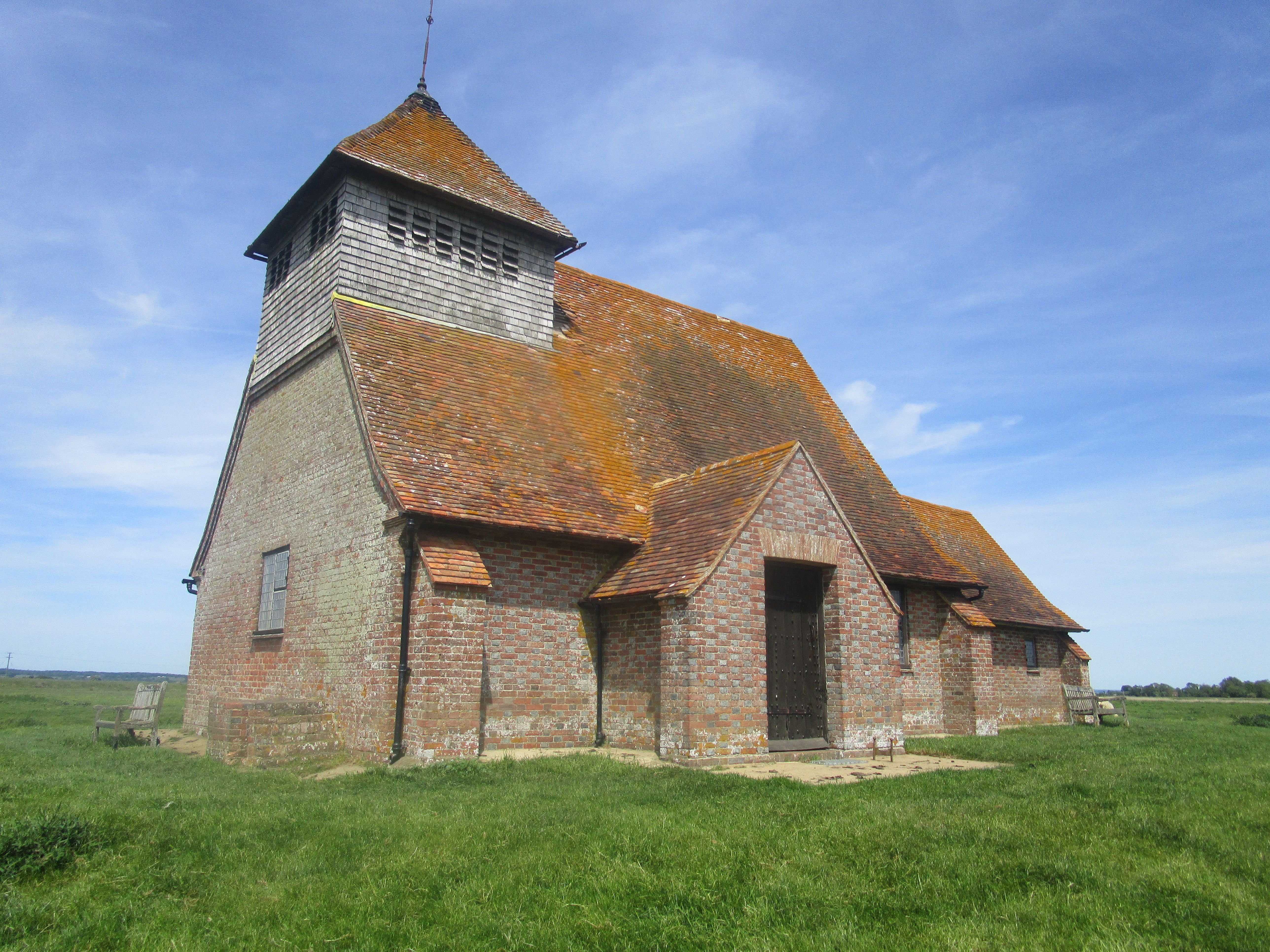
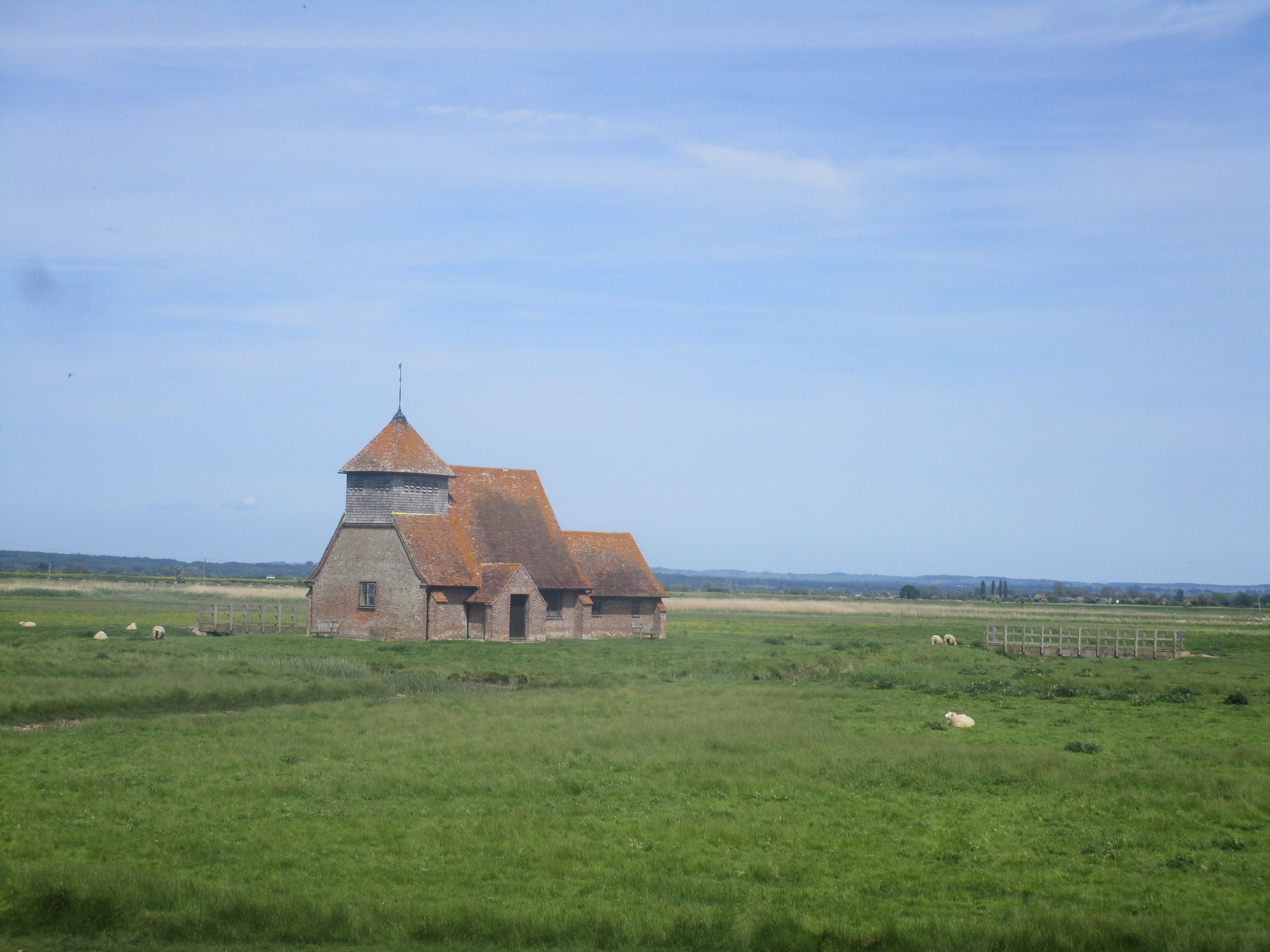
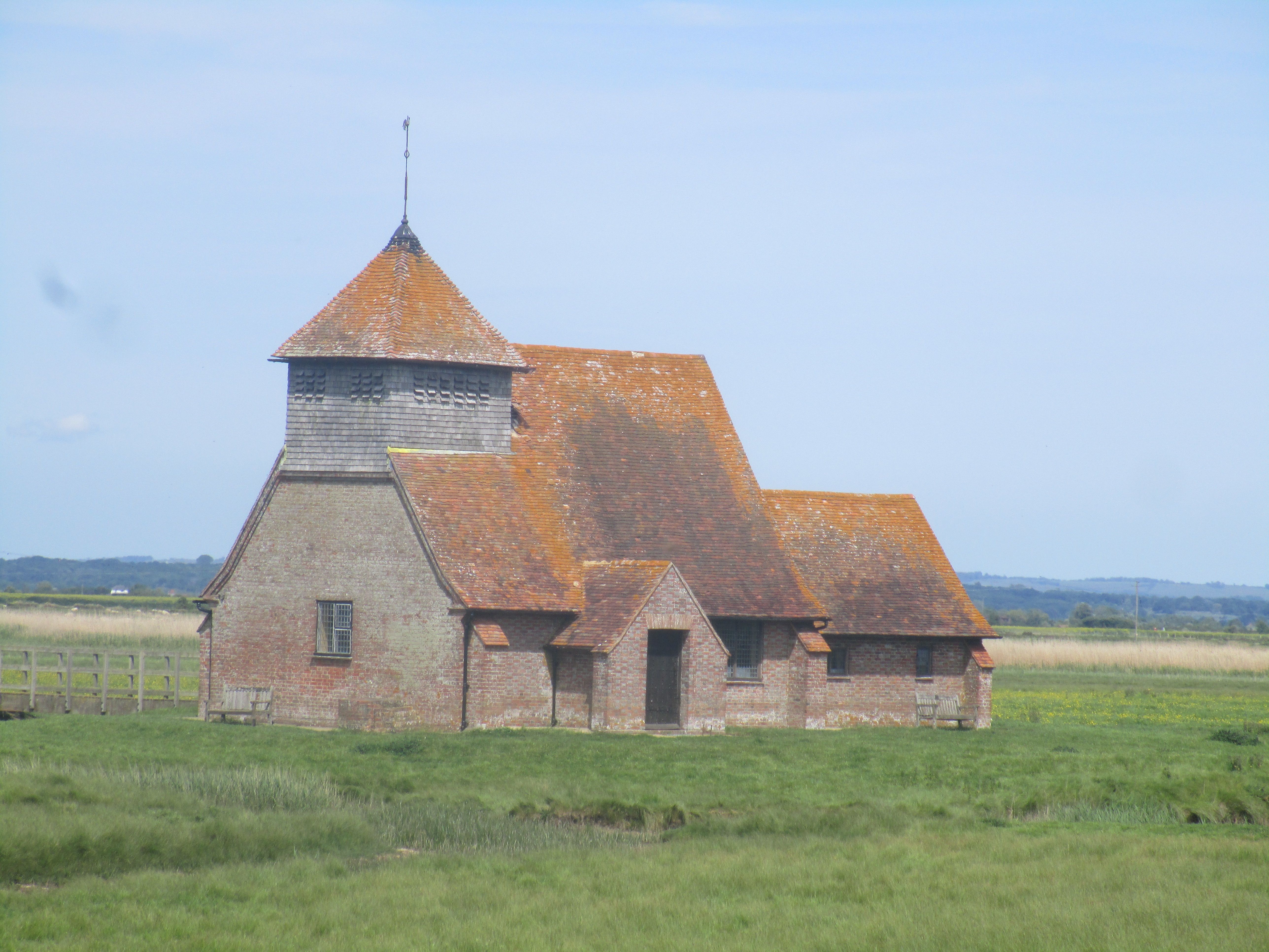
| Description | : | Dedicated to the murdered Archbishop of Canterbury, this isolated church stands alone on the Marsh, surrounded by water courses and fields of sheep, it is visible across the landscape for miles. It was not until 1913 that a causeway was built to reach the church, which was before then completely surrounded by water during the winter and spring months when boats were needed to ferry worshipers to and from the church. First constructed of timber lath and plaster, circa 1200 for the local farmers, it was encased with brickwork and its roof covered with red tiles in the 18th century. A complete... Read More |
frequently asked questions (FAQ):
-
Where is St. Thomas à Becket Cemetery?
St. Thomas à Becket Cemetery is located at Fairfield, Shepway District ,Kent , TN29 9RZEngland.
-
St. Thomas à Becket Cemetery cemetery's updated grave count on graveviews.com?
0 memorials
-
Where are the coordinates of the St. Thomas à Becket Cemetery?
Latitude: 51.0043210
Longitude: 0.7993930
Nearby Cemetories:
1. St Augustine Church
Brookland, Shepway District, England
Coordinate: 50.9973880, 0.8337460
2. St Mary the Virgin Churchyard
Stone-cum-Ebony, Ashford Borough, England
Coordinate: 51.0127980, 0.7645592
3. St Peter and St Paul Churchyard
Appledore, Ashford Borough, England
Coordinate: 51.0295660, 0.7903990
4. St. Dunstan Churchyard
Snargate, Shepway District, England
Coordinate: 51.0227100, 0.8371750
5. Brenzett Cemetery
Brenzett, Shepway District, England
Coordinate: 51.0130800, 0.8561300
6. St Enswith's Church
Brenzett, Shepway District, England
Coordinate: 51.0138510, 0.8573170
7. Ebony Old Cemetery
Stone-cum-Ebony, Ashford Borough, England
Coordinate: 51.0378926, 0.7422129
8. All Saints Churchyard
Iden, Rother District, England
Coordinate: 50.9812930, 0.7275500
9. Iden Burial Ground
Iden, Rother District, England
Coordinate: 50.9813000, 0.7275300
10. St Mary's Churchyard
Kenardington, Ashford Borough, England
Coordinate: 51.0546000, 0.8164000
11. St Augustine Church
Snave, Ashford Borough, England
Coordinate: 51.0334570, 0.8710390
12. St. Mary the Virgin Churchyard
Reading Street, Ashford Borough, England
Coordinate: 51.0431442, 0.7400970
13. St George's Church
Ivychurch, Shepway District, England
Coordinate: 51.0124590, 0.8895980
14. St. Matthew Churchyard
Warehorne, Ashford Borough, England
Coordinate: 51.0575460, 0.8375700
15. St. Michael's Churchyard
Playden, Rother District, England
Coordinate: 50.9621200, 0.7327000
16. Rye Cemetery
Rye, Rother District, England
Coordinate: 50.9595370, 0.7322520
17. Wittersham
Wittersham, Ashford Borough, England
Coordinate: 51.0115600, 0.7016000
18. St Clement Churchyard
Old Romney, Shepway District, England
Coordinate: 50.9901390, 0.8981780
19. St Mary the Virgin Churchyard
Rye, Rother District, England
Coordinate: 50.9501686, 0.7341530
20. Holy Spirit Churchyard
Rye Harbour, Rother District, England
Coordinate: 50.9387970, 0.7567050
21. St John the Baptist
Small Hythe, Ashford Borough, England
Coordinate: 51.0396260, 0.6996060
22. All Saints Churchyard
Woodchurch, Ashford Borough, England
Coordinate: 51.0807110, 0.7709980
23. St Mary the Virgin Churchyard
Orlestone, Ashford Borough, England
Coordinate: 51.0767000, 0.8539000
24. Saint Peter & Saint Paul Church Churchyard
Peasmarsh, Rother District, England
Coordinate: 50.9645500, 0.6859200