
| Memorials | : | 224 |
| Location | : | Stone-cum-Ebony, Ashford Borough, England |
| Coordinate | : | 51.0127980, 0.7645592 |
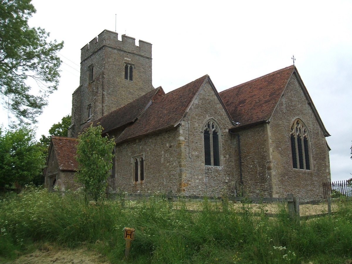
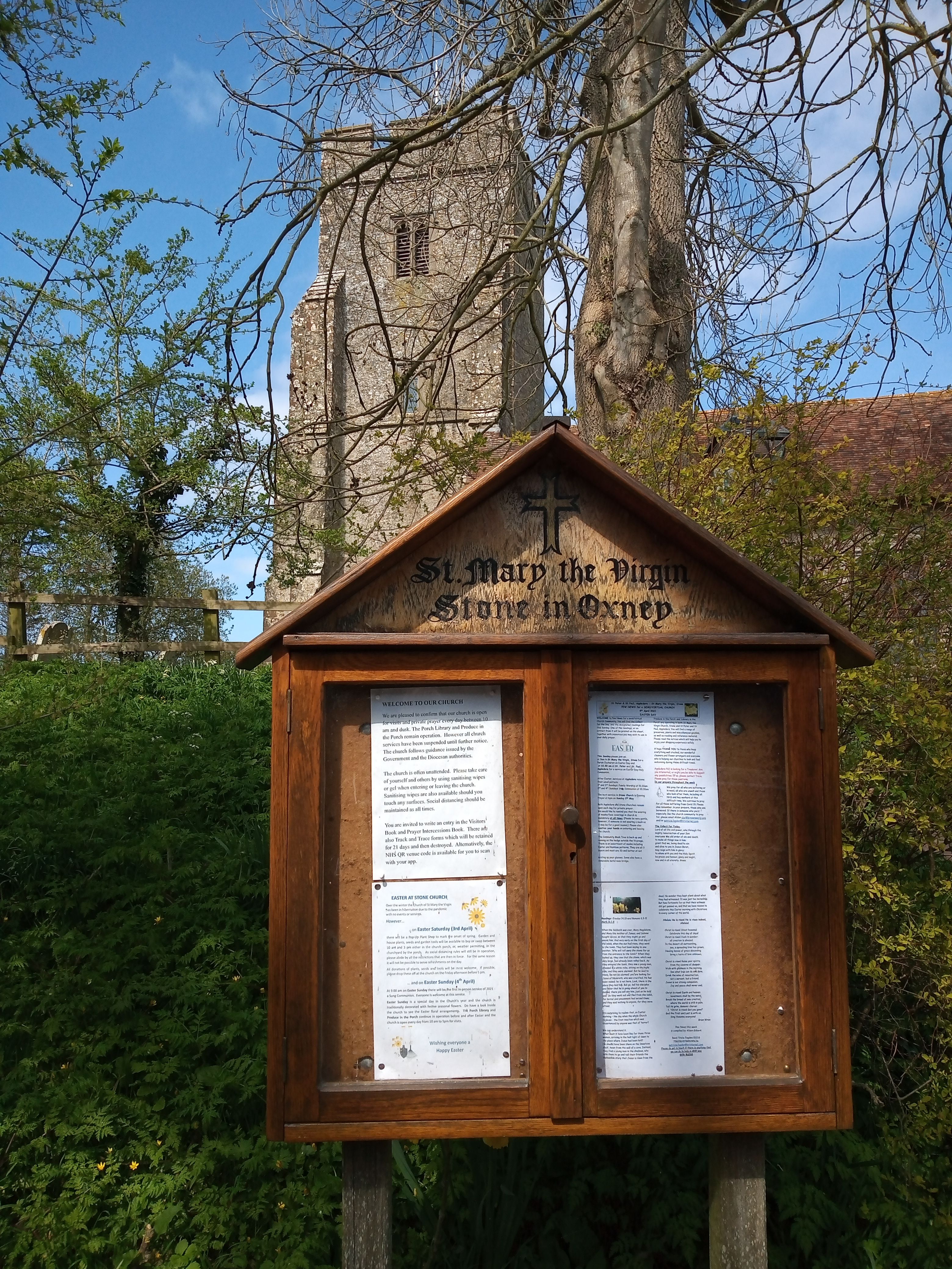
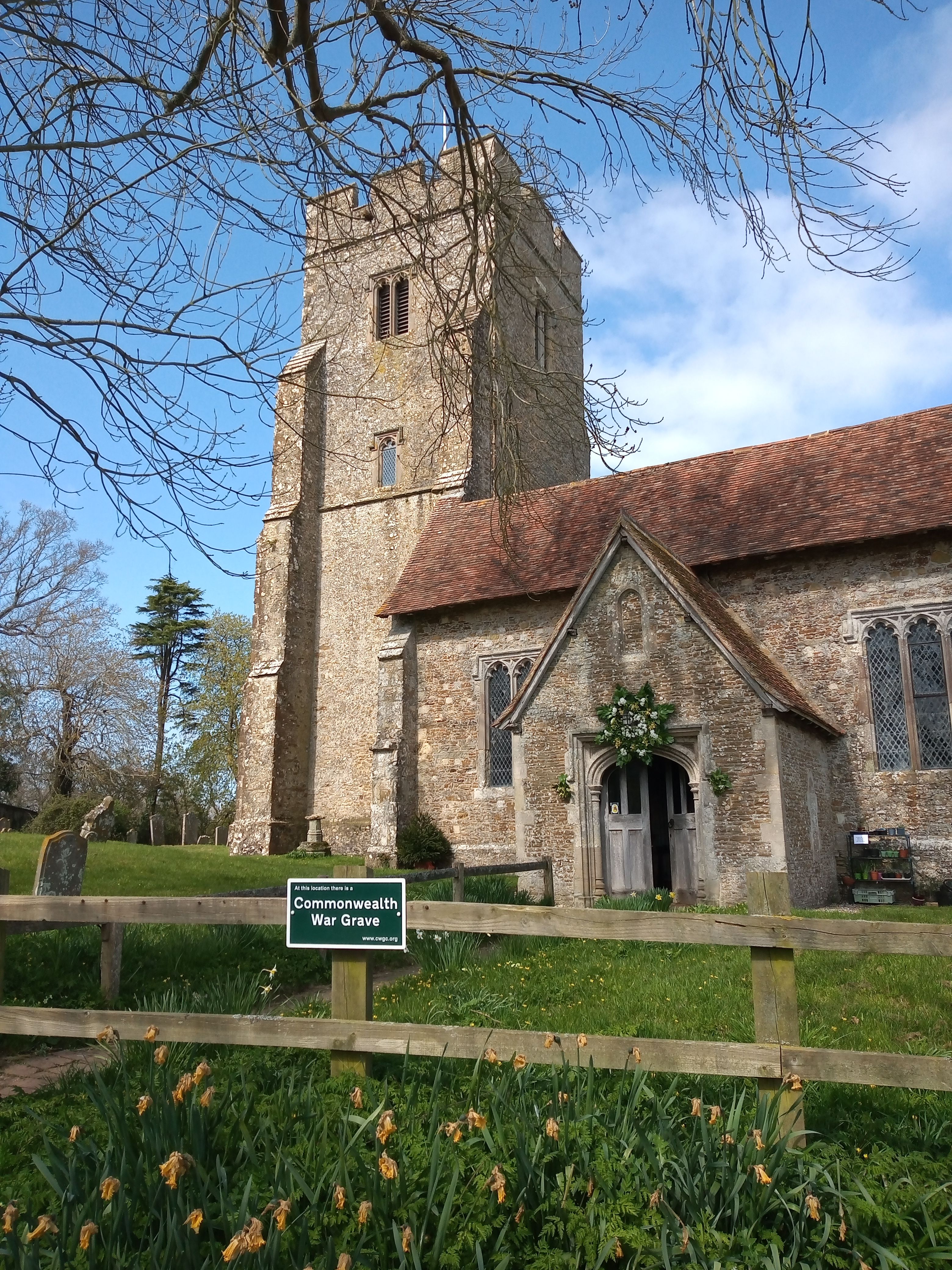
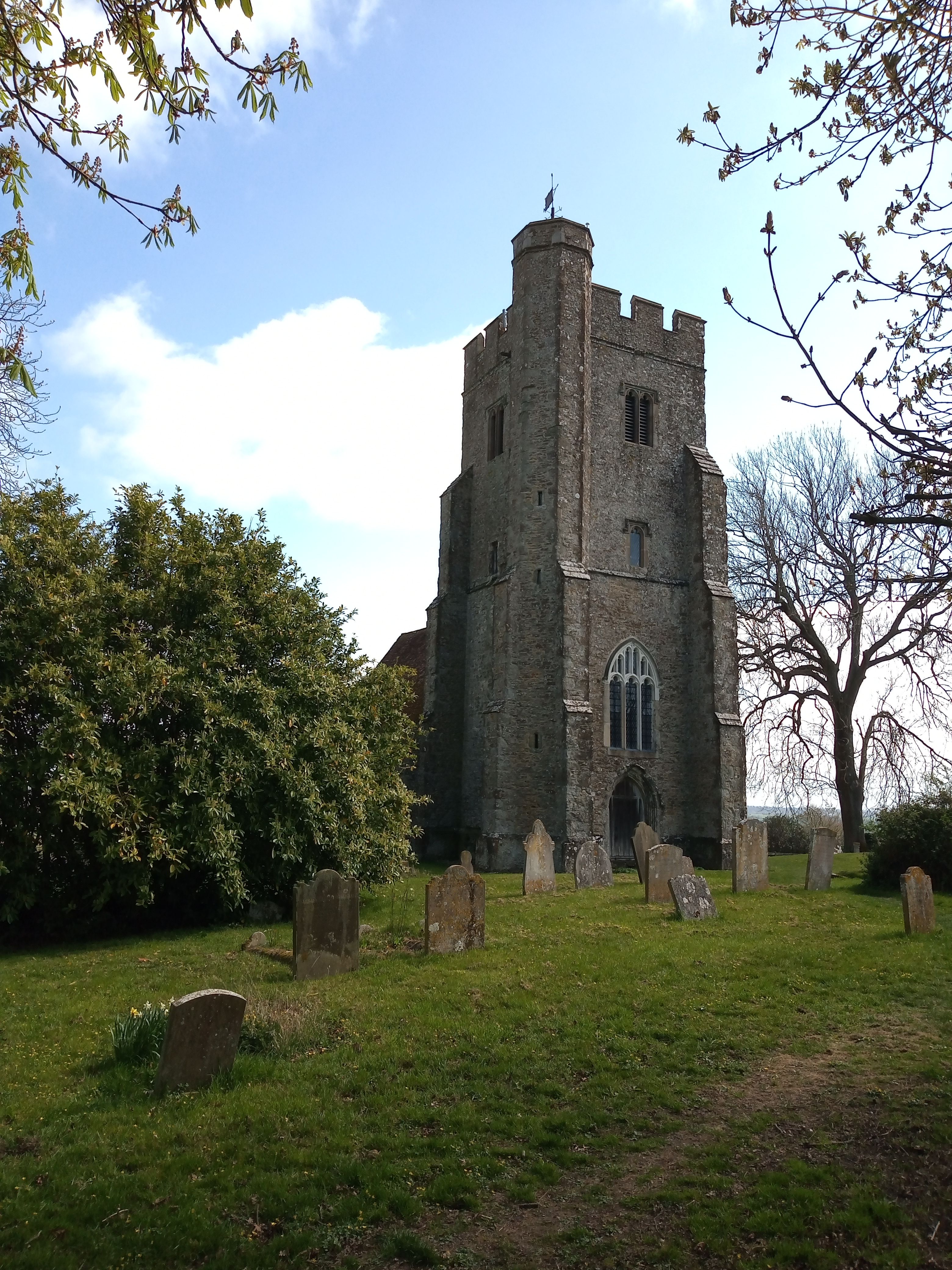
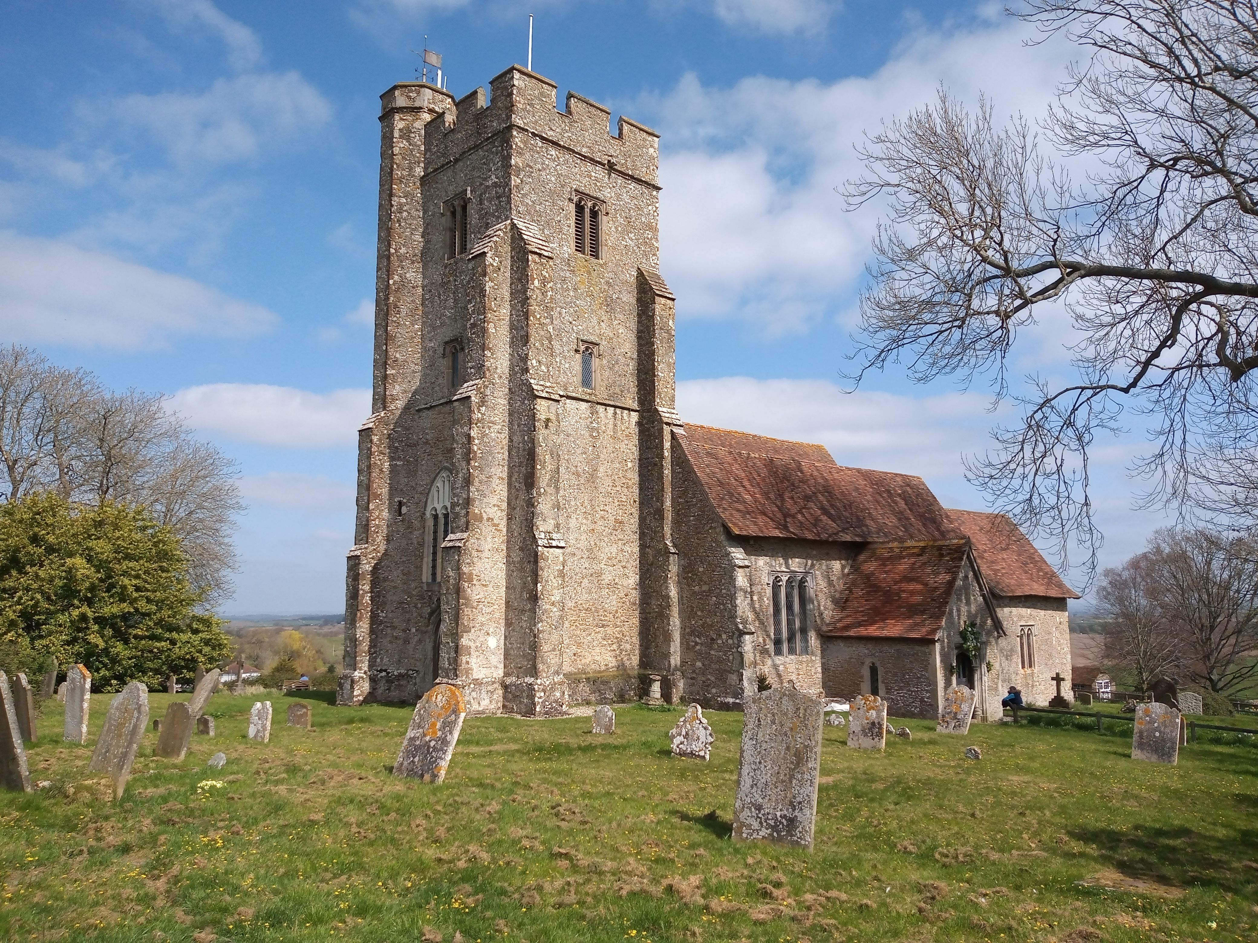
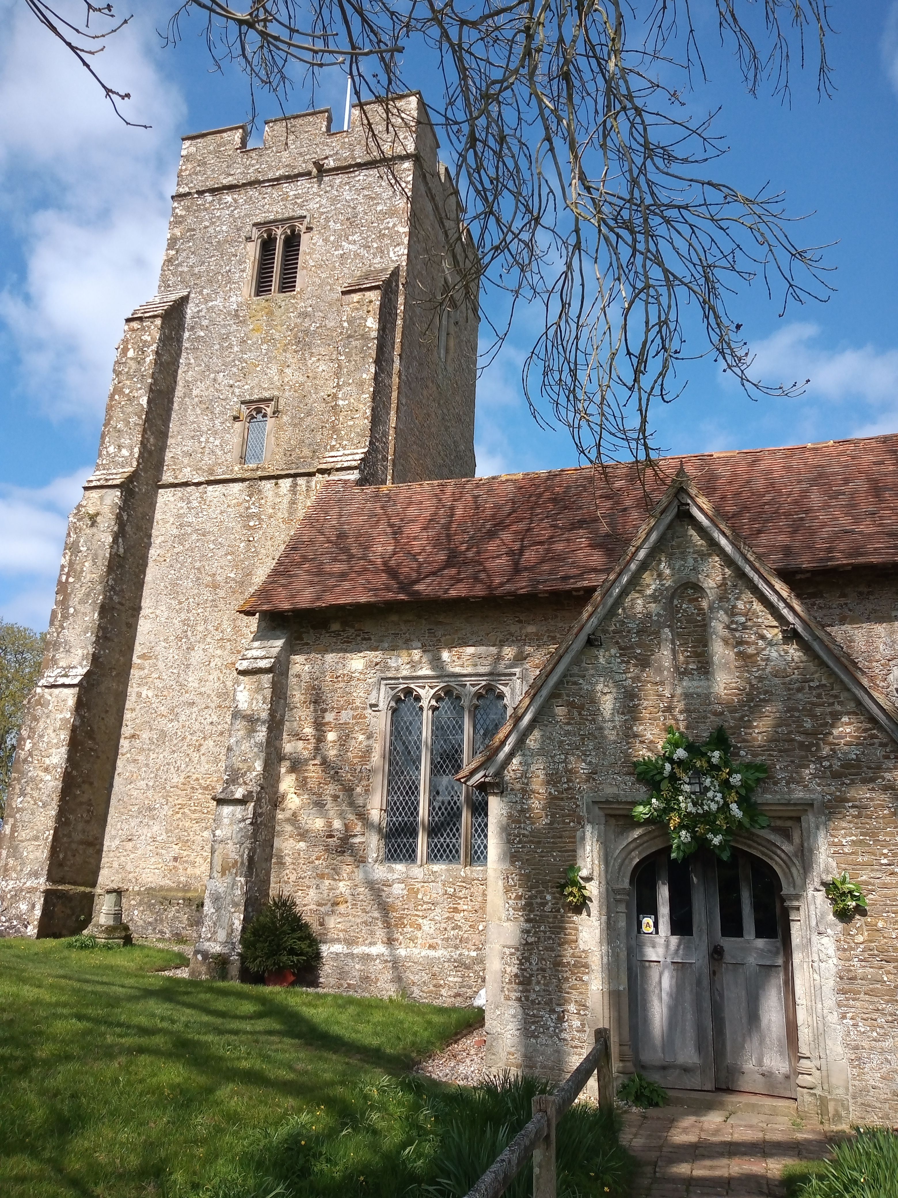
| Description | : | This small 13th Century Church should not be confused with the similarly named parish church at Stone near Dartford. The church of St Mary is an elegant building which stands on rising ground. It features a 14 ft square tower, which stands 62 ft high. Magnificent views over the surrounding countryside of Romney Marsh may be seen from the top of the tower. The most interesting possession of the church is a Roman Stone, which supposedly gives the village its name. Standing under the tower, near the west door, it served as an altar. It is 60cm long by 55cm, and... Read More |
frequently asked questions (FAQ):
-
Where is St Mary the Virgin Churchyard?
St Mary the Virgin Churchyard is located at Church Hill Stone-cum-Ebony, Ashford Borough ,Kent , TN30 7JREngland.
-
St Mary the Virgin Churchyard cemetery's updated grave count on graveviews.com?
224 memorials
-
Where are the coordinates of the St Mary the Virgin Churchyard?
Latitude: 51.0127980
Longitude: 0.7645592
Nearby Cemetories:
1. St Peter and St Paul Churchyard
Appledore, Ashford Borough, England
Coordinate: 51.0295660, 0.7903990
2. St. Thomas à Becket Cemetery
Fairfield, Shepway District, England
Coordinate: 51.0043210, 0.7993930
3. Ebony Old Cemetery
Stone-cum-Ebony, Ashford Borough, England
Coordinate: 51.0378926, 0.7422129
4. St. Mary the Virgin Churchyard
Reading Street, Ashford Borough, England
Coordinate: 51.0431442, 0.7400970
5. All Saints Churchyard
Iden, Rother District, England
Coordinate: 50.9812930, 0.7275500
6. Iden Burial Ground
Iden, Rother District, England
Coordinate: 50.9813000, 0.7275300
7. Wittersham
Wittersham, Ashford Borough, England
Coordinate: 51.0115600, 0.7016000
8. St Augustine Church
Brookland, Shepway District, England
Coordinate: 50.9973880, 0.8337460
9. St. Dunstan Churchyard
Snargate, Shepway District, England
Coordinate: 51.0227100, 0.8371750
10. St John the Baptist
Small Hythe, Ashford Borough, England
Coordinate: 51.0396260, 0.6996060
11. St Mary's Churchyard
Kenardington, Ashford Borough, England
Coordinate: 51.0546000, 0.8164000
12. St. Michael's Churchyard
Playden, Rother District, England
Coordinate: 50.9621200, 0.7327000
13. Rye Cemetery
Rye, Rother District, England
Coordinate: 50.9595370, 0.7322520
14. Brenzett Cemetery
Brenzett, Shepway District, England
Coordinate: 51.0130800, 0.8561300
15. St Enswith's Church
Brenzett, Shepway District, England
Coordinate: 51.0138510, 0.8573170
16. St. Matthew Churchyard
Warehorne, Ashford Borough, England
Coordinate: 51.0575460, 0.8375700
17. St Mary the Virgin Churchyard
Rye, Rother District, England
Coordinate: 50.9501686, 0.7341530
18. All Saints Churchyard
Woodchurch, Ashford Borough, England
Coordinate: 51.0807110, 0.7709980
19. Saint Peter & Saint Paul Church Churchyard
Peasmarsh, Rother District, England
Coordinate: 50.9645500, 0.6859200
20. St Augustine Church
Snave, Ashford Borough, England
Coordinate: 51.0334570, 0.8710390
21. St. Mildred's Churchyard
Tenterden, Ashford Borough, England
Coordinate: 51.0686264, 0.6870960
22. Holy Spirit Churchyard
Rye Harbour, Rother District, England
Coordinate: 50.9387970, 0.7567050
23. Station Road Extension
Tenterden, Ashford Borough, England
Coordinate: 51.0686640, 0.6852830
24. Unitarian Old Meeting House
Tenterden, Ashford Borough, England
Coordinate: 51.0717468, 0.6906880