
| Memorials | : | 94 |
| Location | : | Olveston, South Gloucestershire Unitary Authority, England |
| Coordinate | : | 51.5828740, -2.5774290 |
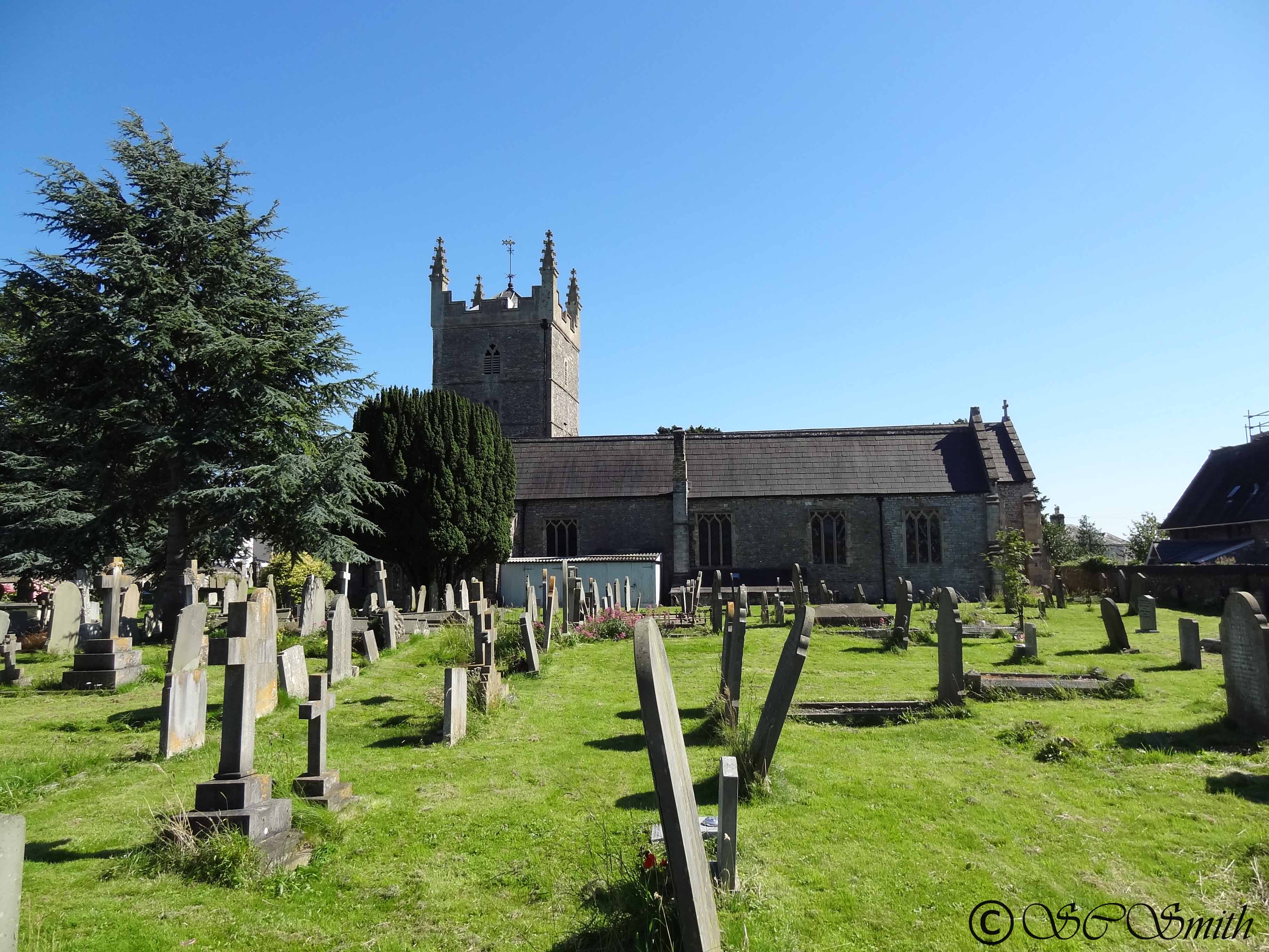
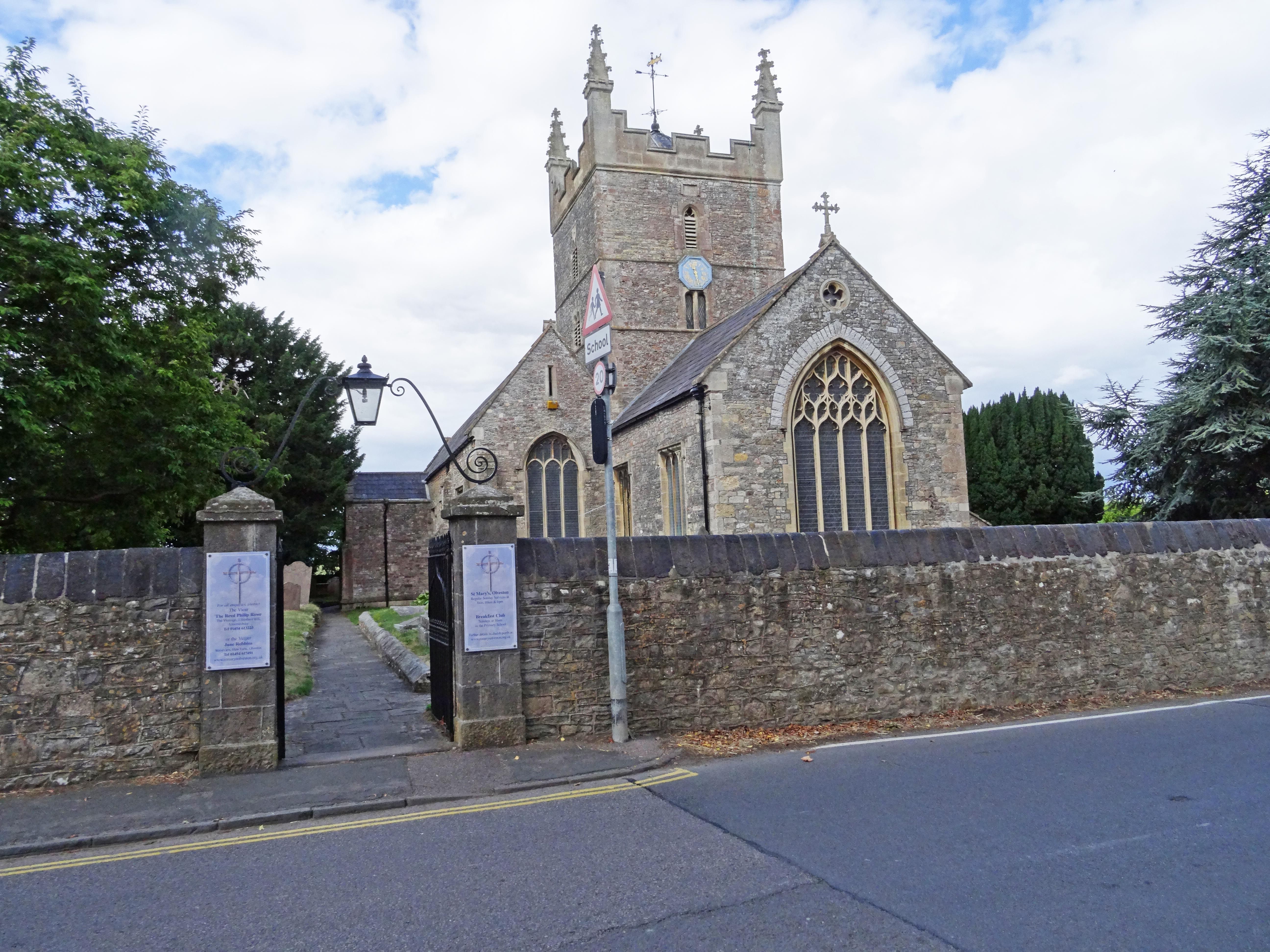
| Description | : | Built around 1170 and rebuilt in 1370. It was struck by lightning in 1605 and the bells, spire and much of the chancel were destroyed. The tower was rebuilt the following year, and the church has been restored and enlarged in later years. Parish registers survive from 1561. |
frequently asked questions (FAQ):
-
Where is St. Mary the Virgin Churchyard?
St. Mary the Virgin Churchyard is located at Olveston, South Gloucestershire Unitary Authority ,Gloucestershire ,England.
-
St. Mary the Virgin Churchyard cemetery's updated grave count on graveviews.com?
94 memorials
-
Where are the coordinates of the St. Mary the Virgin Churchyard?
Latitude: 51.5828740
Longitude: -2.5774290
Nearby Cemetories:
1. Almondsbury Cemetery
Bristol Unitary Authority, England
Coordinate: 51.5589695, -2.5768189
2. Almondsbury Cemetery
Almondsbury, South Gloucestershire Unitary Authority, England
Coordinate: 51.5588230, -2.5760360
3. St Mary's Churchyard
Almondsbury, South Gloucestershire Unitary Authority, England
Coordinate: 51.5542300, -2.5733390
4. St Helen Churchyard
Alveston, South Gloucestershire Unitary Authority, England
Coordinate: 51.5850600, -2.5303380
5. St. John's Churchyard
Aust, South Gloucestershire Unitary Authority, England
Coordinate: 51.5991080, -2.6186160
6. Thornbury Cemetery
Thornbury, South Gloucestershire Unitary Authority, England
Coordinate: 51.6099460, -2.5323000
7. St Mary the Virgin Parish Churchyard
Thornbury, South Gloucestershire Unitary Authority, England
Coordinate: 51.6132330, -2.5300090
8. Memorial Woodland Cemetery
Bristol Unitary Authority, England
Coordinate: 51.5754490, -2.5013060
9. Bristol Memorial Woodlands
Alveston, South Gloucestershire Unitary Authority, England
Coordinate: 51.5725340, -2.4983540
10. All Saints Churchyard
Compton Greenfield, South Gloucestershire Unitary Authority, England
Coordinate: 51.5372800, -2.6201320
11. St. John the Evangelist Churchyard
Beachley, Forest of Dean District, England
Coordinate: 51.6184750, -2.6505640
12. Beachley Barracks Military Cemetery
Beachley, Forest of Dean District, England
Coordinate: 51.6185000, -2.6512000
13. St James Parish Churchyard
Tytherington, South Gloucestershire Unitary Authority, England
Coordinate: 51.5932110, -2.4799250
14. St. Michael the Archangel Churchyard
Winterbourne, South Gloucestershire Unitary Authority, England
Coordinate: 51.5269000, -2.5183600
15. Mayshill Cemetery
South Gloucestershire Unitary Authority, England
Coordinate: 51.5562160, -2.4691663
16. St Oswald Churchyard
Rockhampton, South Gloucestershire Unitary Authority, England
Coordinate: 51.6374200, -2.5003500
17. St Peter's Churchyard
Filton, South Gloucestershire Unitary Authority, England
Coordinate: 51.5102600, -2.5733100
18. St Peter's Churchyard
Frampton Cotterell, South Gloucestershire Unitary Authority, England
Coordinate: 51.5359115, -2.4801320
19. Church of the Holy Trinity
Rangeworthy, South Gloucestershire Unitary Authority, England
Coordinate: 51.5742000, -2.4536000
20. St James the Less Churchyard
Iron Acton, South Gloucestershire Unitary Authority, England
Coordinate: 51.5490390, -2.4619310
21. St Mary the Virgin Churchyard
Henbury, Bristol Unitary Authority, England
Coordinate: 51.5063210, -2.6306320
22. St Andrew Churchyard
Cromhall, South Gloucestershire Unitary Authority, England
Coordinate: 51.6121930, -2.4456930
23. St. Mary and St. Peter Churchyard
Tidenham Chase, Forest of Dean District, England
Coordinate: 51.6601690, -2.6434850
24. Henbury Cemetery
Henbury, Bristol Unitary Authority, England
Coordinate: 51.5044590, -2.6414560