
| Memorials | : | 192 |
| Location | : | Berkeley, Stroud District, England |
| Coordinate | : | 51.6890940, -2.4576150 |
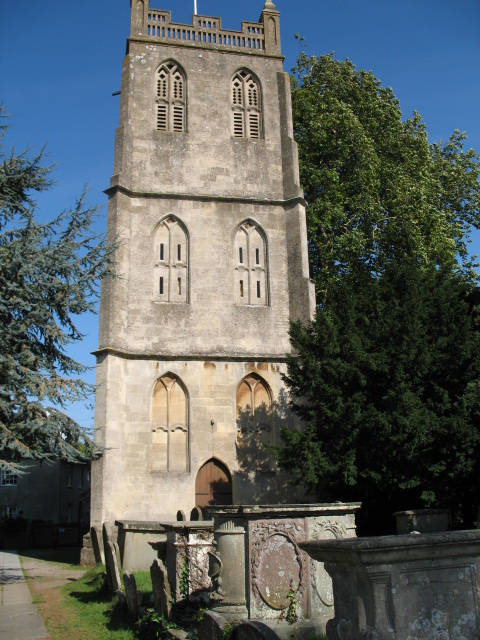
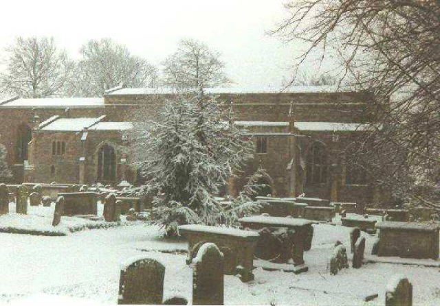
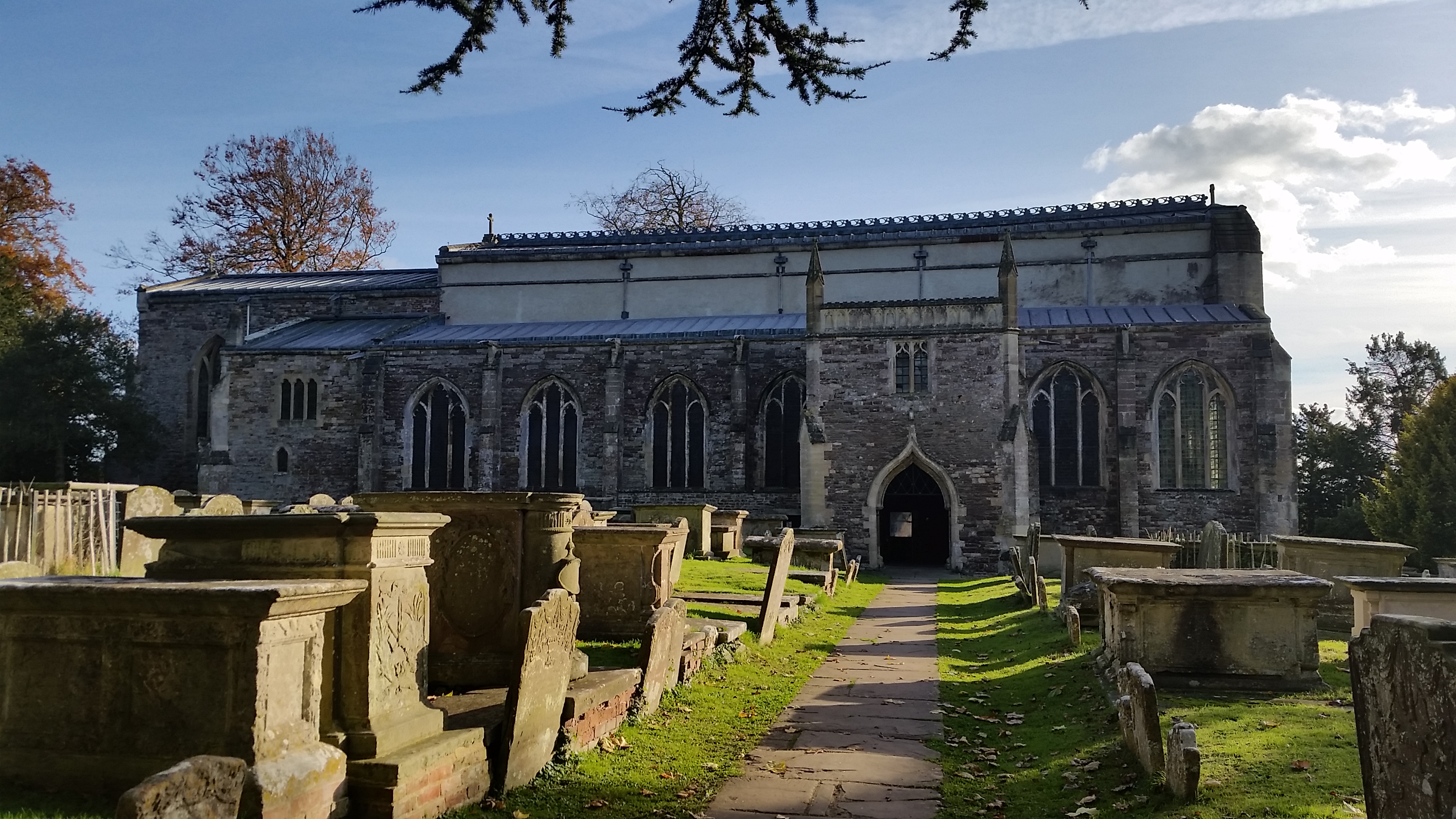
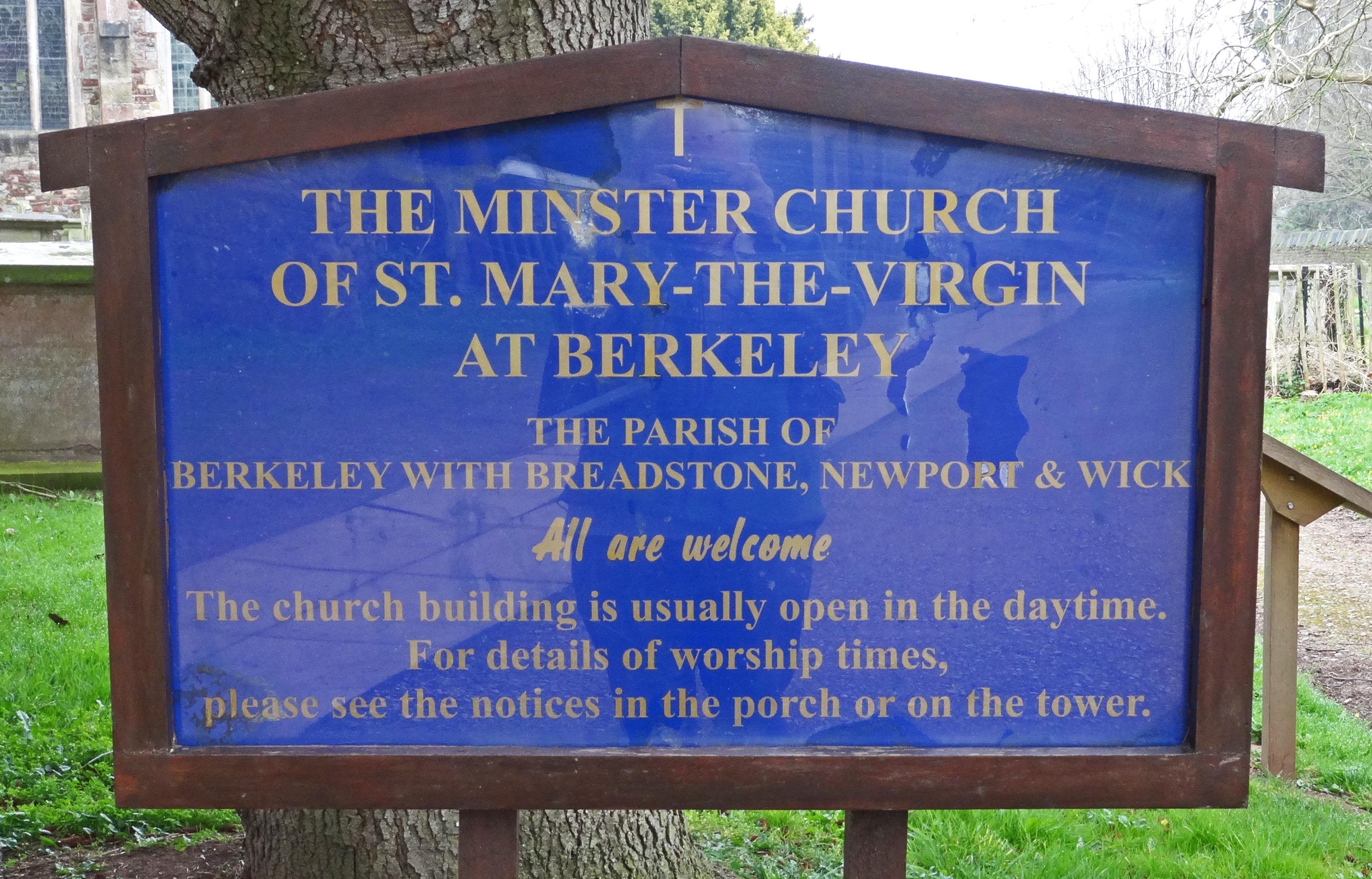
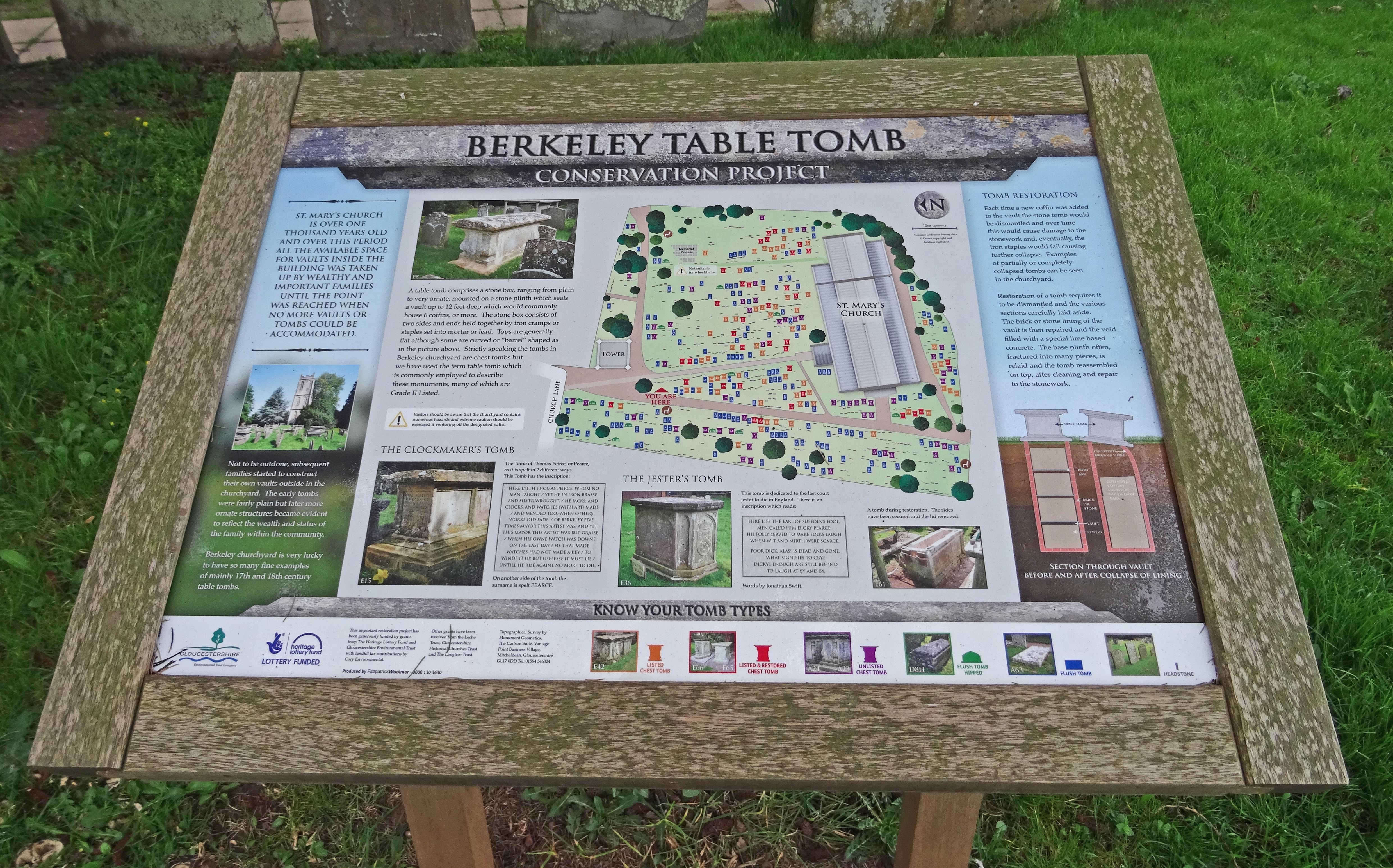
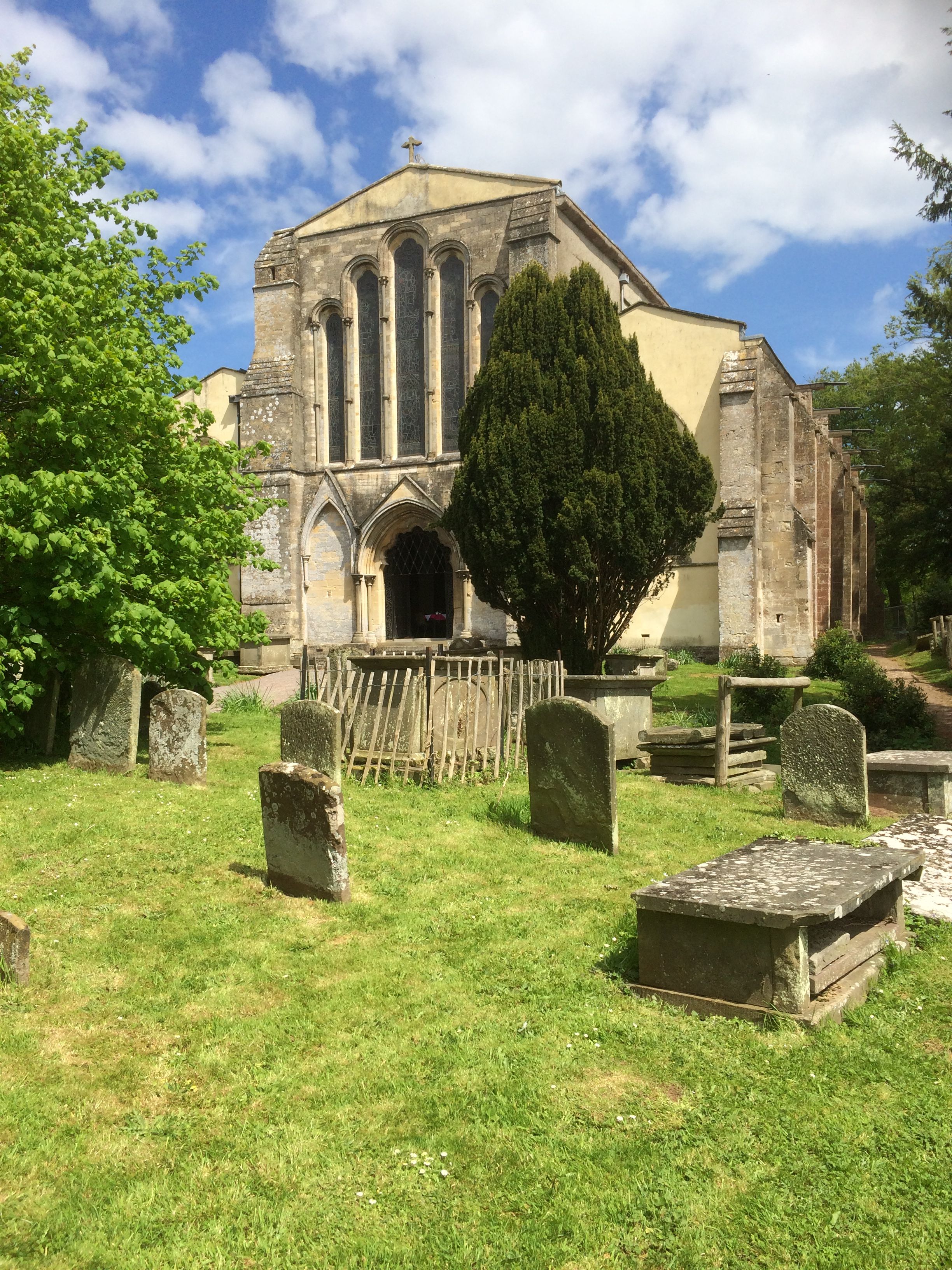
| Description | : | St. Mary’s in Berkeley, Gloucestershire is a large 13th century church with detached 17th century tower situated beside Berkeley Castle. The churchyard contains a great many table tombs including that of Dickie Pearce, probably the last ‘Court Jester’ in England. |
frequently asked questions (FAQ):
-
Where is St. Mary the Virgin Churchyard?
St. Mary the Virgin Churchyard is located at Berkeley, Stroud District ,Gloucestershire , GL13 9BNEngland.
-
St. Mary the Virgin Churchyard cemetery's updated grave count on graveviews.com?
192 memorials
-
Where are the coordinates of the St. Mary the Virgin Churchyard?
Latitude: 51.6890940
Longitude: -2.4576150
Nearby Cemetories:
1. Berkeley Cemetery
Berkeley, Stroud District, England
Coordinate: 51.6946845, -2.4601617
2. All Saints Churchyard
Stone, Stroud District, England
Coordinate: 51.6566800, -2.4575600
3. St. Cyr's Churchyard
Stinchcombe, Stroud District, England
Coordinate: 51.6881090, -2.3927490
4. The Quarry United Reformed Church
Cam, Stroud District, England
Coordinate: 51.6968858, -2.3789270
5. St Martin Churchyard
North Nibley, Stroud District, England
Coordinate: 51.6629860, -2.3836650
6. St Leonard Churchyard
Tortworth, Stroud District, England
Coordinate: 51.6379440, -2.4286650
7. Lydney Cemetery
Lydney, Forest of Dean District, England
Coordinate: 51.7189747, -2.5338209
8. St. Mary the Virgin Churchyard
Lydney, Forest of Dean District, England
Coordinate: 51.7202430, -2.5326060
9. Mount Pleasant Chapel
Wotton-under-Edge, Stroud District, England
Coordinate: 51.6331000, -2.4610000
10. St Oswald Churchyard
Rockhampton, South Gloucestershire Unitary Authority, England
Coordinate: 51.6374200, -2.5003500
11. St. Bartholomew's Churchyard
Dursley, Stroud District, England
Coordinate: 51.7012900, -2.3653000
12. North Nibley Cemetery
North Nibley, Stroud District, England
Coordinate: 51.6584100, -2.3768600
13. Dursley Town Cemetery
Dursley, Stroud District, England
Coordinate: 51.6893700, -2.3623400
14. Dursley Tabernacle URC
Dursley, Stroud District, England
Coordinate: 51.6823727, -2.3571669
15. St. John the Evangelist Churchyard
Slimbridge, Stroud District, England
Coordinate: 51.7302510, -2.3773070
16. Cam Congregational Church
Cam, Stroud District, England
Coordinate: 51.6914518, -2.3530424
17. St. George Churchyard
Cam, Stroud District, England
Coordinate: 51.6923120, -2.3524570
18. St James the Great Church
Dursley, Stroud District, England
Coordinate: 51.6812840, -2.3530000
19. St Marks Churchyard
Dursley, Stroud District, England
Coordinate: 51.6777900, -2.3499800
20. All Saints Churchyard
Viney Hill, Forest of Dean District, England
Coordinate: 51.7569980, -2.5017310
21. All Saints Churchyard
Blakeney, Forest of Dean District, England
Coordinate: 51.7615380, -2.4765280
22. St. Andrew's Churchyard
Alvington, Forest of Dean District, England
Coordinate: 51.7033900, -2.5754460
23. St Andrew Churchyard
Cromhall, South Gloucestershire Unitary Authority, England
Coordinate: 51.6121930, -2.4456930
24. Wotton Baptist Churchyard
Wotton-under-Edge, Stroud District, England
Coordinate: 51.6371850, -2.3531940