
| Memorials | : | 162 |
| Location | : | Tortworth, Stroud District, England |
| Coordinate | : | 51.6379440, -2.4286650 |
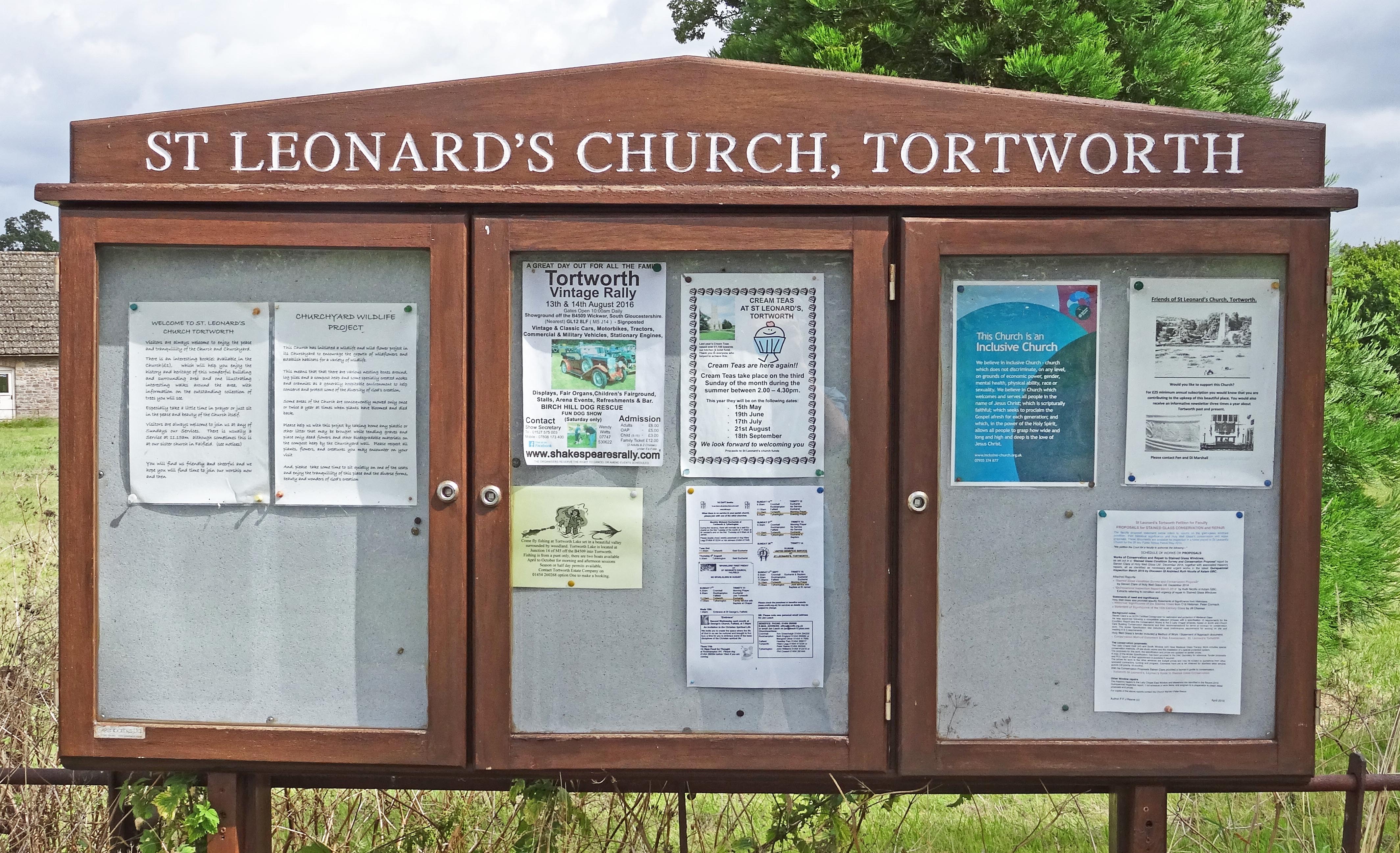
| Description | : | =================================== Many thanks to Andrew Plaster for writing this article: The south Gloucestershire parish of Tortworth is bounded by the old parishes of Berkeley (Alkington tithing), Charfield, Cromhall and Thornbury. Unlike most parishes, which have their main village, dwelling and public buildings are distantly spread out all over the rural parish. Avening Green, the small hamlet is in the north east, and the landscaped Tortworth Park with its arboretum in the south west. The manor of Tortworth (then Torteword) was mentioned in Domesday Book of 1086. The name means ‘Tortha's homestead', but no records appear to exist before the Norman Conquest. The manor... Read More |
frequently asked questions (FAQ):
-
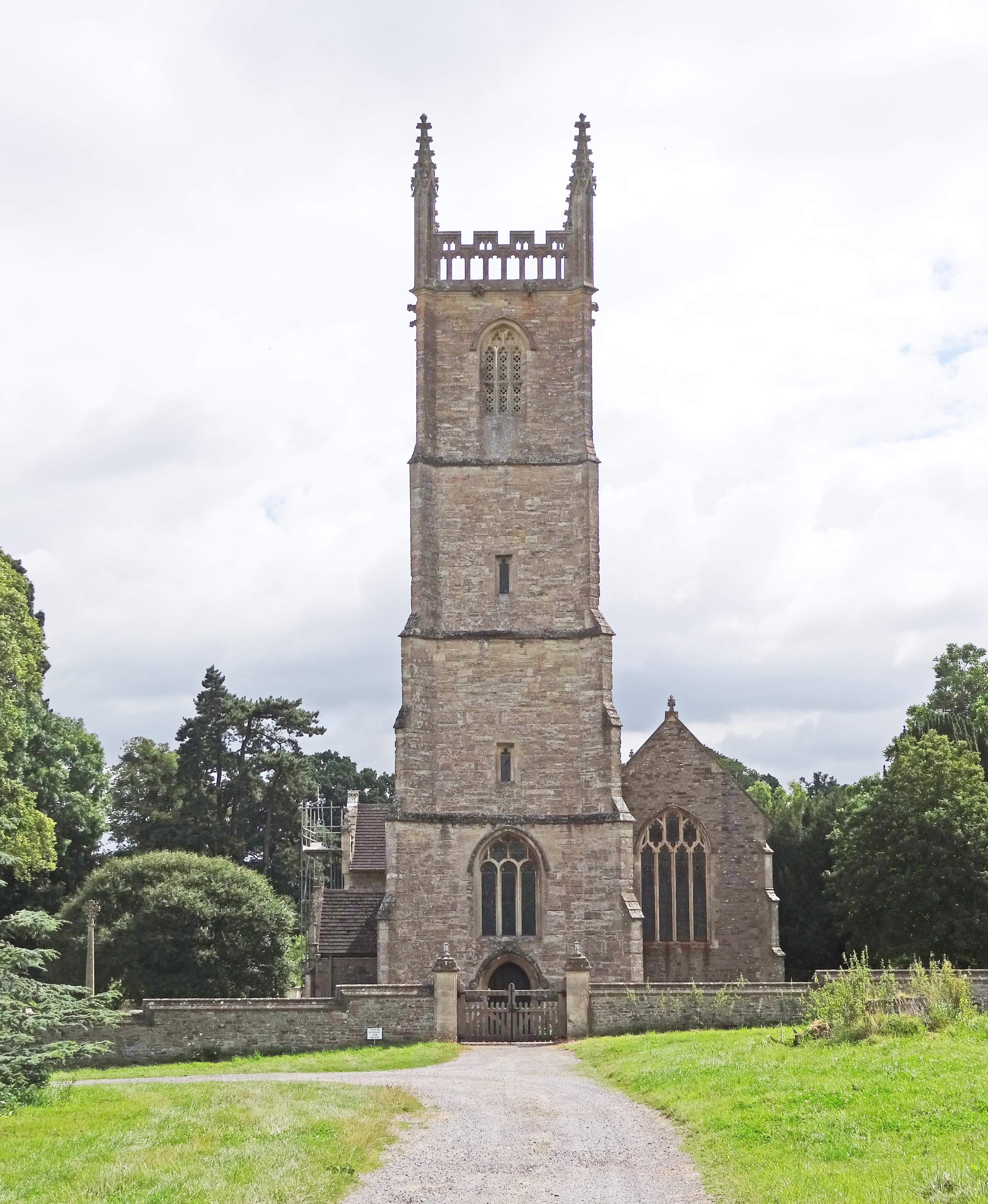
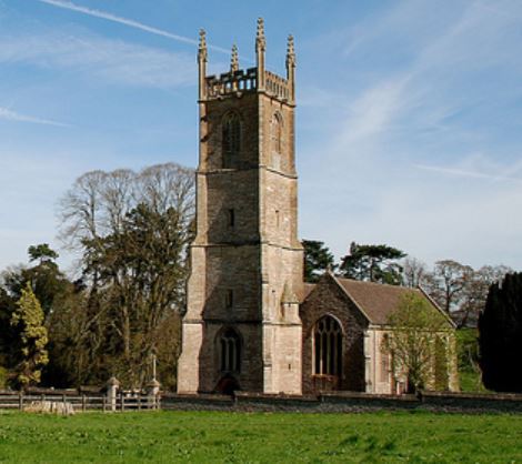
Where is St Leonard Churchyard?
St Leonard Churchyard is located at Tortworth, Stroud District ,Gloucestershire ,England.
-
St Leonard Churchyard cemetery's updated grave count on graveviews.com?
162 memorials
-
Where are the coordinates of the St Leonard Churchyard?
Latitude: 51.6379440
Longitude: -2.4286650
Nearby Cemetories:
1. Mount Pleasant Chapel
Wotton-under-Edge, Stroud District, England
Coordinate: 51.6331000, -2.4610000
2. All Saints Churchyard
Stone, Stroud District, England
Coordinate: 51.6566800, -2.4575600
3. St Andrew Churchyard
Cromhall, South Gloucestershire Unitary Authority, England
Coordinate: 51.6121930, -2.4456930
4. St Martin Churchyard
North Nibley, Stroud District, England
Coordinate: 51.6629860, -2.3836650
5. North Nibley Cemetery
North Nibley, Stroud District, England
Coordinate: 51.6584100, -2.3768600
6. Kingswood Abbey
Kingswood, Stroud District, England
Coordinate: 51.6264381, -2.3667738
7. Holy Trinity Churchyard
Wickwar, South Gloucestershire Unitary Authority, England
Coordinate: 51.5985120, -2.4006930
8. St Oswald Churchyard
Rockhampton, South Gloucestershire Unitary Authority, England
Coordinate: 51.6374200, -2.5003500
9. Wotton Baptist Churchyard
Wotton-under-Edge, Stroud District, England
Coordinate: 51.6371850, -2.3531940
10. St. Mary the Virgin Churchyard
Wotton-under-Edge, Stroud District, England
Coordinate: 51.6390390, -2.3480250
11. St. Mary the Virgin Churchyard
Berkeley, Stroud District, England
Coordinate: 51.6890940, -2.4576150
12. St. Cyr's Churchyard
Stinchcombe, Stroud District, England
Coordinate: 51.6881090, -2.3927490
13. St James Parish Churchyard
Tytherington, South Gloucestershire Unitary Authority, England
Coordinate: 51.5932110, -2.4799250
14. Berkeley Cemetery
Berkeley, Stroud District, England
Coordinate: 51.6946845, -2.4601617
15. St Kenelm Churchyard
Alderley, Stroud District, England
Coordinate: 51.6155170, -2.3357530
16. Dursley Tabernacle URC
Dursley, Stroud District, England
Coordinate: 51.6823727, -2.3571669
17. St Marks Churchyard
Dursley, Stroud District, England
Coordinate: 51.6777900, -2.3499800
18. St James the Great Church
Dursley, Stroud District, England
Coordinate: 51.6812840, -2.3530000
19. Church of the Holy Trinity
Rangeworthy, South Gloucestershire Unitary Authority, England
Coordinate: 51.5742000, -2.4536000
20. Dursley Town Cemetery
Dursley, Stroud District, England
Coordinate: 51.6893700, -2.3623400
21. The Quarry United Reformed Church
Cam, Stroud District, England
Coordinate: 51.6968858, -2.3789270
22. St Mary the Virgin Parish Churchyard
Thornbury, South Gloucestershire Unitary Authority, England
Coordinate: 51.6132330, -2.5300090
23. Hillesley Baptist Churchyard
Hillesley, Stroud District, England
Coordinate: 51.6054787, -2.3318073
24. Thornbury Cemetery
Thornbury, South Gloucestershire Unitary Authority, England
Coordinate: 51.6099460, -2.5323000