
| Memorials | : | 0 |
| Location | : | Bishopstone, Swindon Unitary Authority, England |
| Coordinate | : | 51.5519060, -1.6499760 |
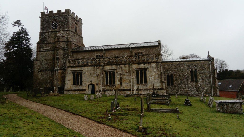
| Description | : | The Parish Church of Saint Mary the Virgin in Bishopstone in a Grade I listed building dating from the Norman period with extensive restorations in 1868 and 1883. There is an associated churchyard burial ground. |
frequently asked questions (FAQ):
-
Where is St. Mary the Virgin Churchyard?
St. Mary the Virgin Churchyard is located at Church Walk Bishopstone, Swindon Unitary Authority ,Wiltshire , SN6 8PHEngland.
-
St. Mary the Virgin Churchyard cemetery's updated grave count on graveviews.com?
0 memorials
-
Where are the coordinates of the St. Mary the Virgin Churchyard?
Latitude: 51.5519060
Longitude: -1.6499760
Nearby Cemetories:
1. St Swithun Churchyard Hinton Prava
Swindon Unitary Authority, England
Coordinate: 51.5481447, -1.6669194
2. St Swithun Churchyard Hinton Prava
Swindon Unitary Authority, England
Coordinate: 51.5481447, -1.6669194
3. St Mary the Virgin Church
Ashbury, Vale of White Horse District, England
Coordinate: 51.5626390, -1.6183810
4. St. James Churchyard
Bourton, Cherwell District, England
Coordinate: 51.5794090, -1.6638890
5. Saint Andrew's Church
Wanborough, Swindon Unitary Authority, England
Coordinate: 51.5415040, -1.7018220
6. All Saints Churchyard
Liddington, Swindon Unitary Authority, England
Coordinate: 51.5298160, -1.7038690
7. Shrivenham Parish Cemetery
Shrivenham, Vale of White Horse District, England
Coordinate: 51.5942061, -1.6517227
8. St Swithun
Compton Beauchamp, Vale of White Horse District, England
Coordinate: 51.5814163, -1.5981875
9. St. Andrew's Churchyard
Shrivenham, Vale of White Horse District, England
Coordinate: 51.6000270, -1.6537370
10. All Saints
Woolstone, Vale of White Horse District, England
Coordinate: 51.5870310, -1.5765330
11. Saint Mary Magdalene Church Cemetery
South Marston, Swindon Unitary Authority, England
Coordinate: 51.5903900, -1.7195100
12. St. Thomas Churchyard
Watchfield, Vale of White Horse District, England
Coordinate: 51.6107409, -1.6468265
13. Watchfield Cemetery
Watchfield, Vale of White Horse District, England
Coordinate: 51.6109220, -1.6467980
14. Watchfield Military Cemetery
Watchfield, Vale of White Horse District, England
Coordinate: 51.6110800, -1.6469400
15. St Nicholas Church
Baydon, Wiltshire Unitary Authority, England
Coordinate: 51.5008798, -1.5961523
16. St Margaret Churchyard
Stratton St Margaret, Swindon Unitary Authority, England
Coordinate: 51.5824430, -1.7422550
17. St. James' Churchyard
Sevenhampton, Swindon Unitary Authority, England
Coordinate: 51.6119590, -1.6984440
18. St Mary the Virgin Parish Churchyard
Longcot, Vale of White Horse District, England
Coordinate: 51.6146420, -1.6056320
19. Upper Lambourn Cemetery
Upper Lambourn, West Berkshire Unitary Authority, England
Coordinate: 51.5206400, -1.5499370
20. St. Luke's Churchyard
West Berkshire Unitary Authority, England
Coordinate: 51.5209870, -1.5492870
21. St Michael Churchyard
Aldbourne, Wiltshire Unitary Authority, England
Coordinate: 51.4835694, -1.6209028
22. St Mary Churchyard
Uffington, Vale of White Horse District, England
Coordinate: 51.6018480, -1.5649000
23. Christ Church Burial Ground
Swindon, Swindon Unitary Authority, England
Coordinate: 51.5537243, -1.7744208
24. Kingsdown Crematorium
Swindon, Swindon Unitary Authority, England
Coordinate: 51.5968450, -1.7513770